![Metro bridge cast box section [concrete]](https://files.structurae.net/files/photos/2011/byker_metro_bridge.jpg)
Dimensions
| main span | 69 m | |
| width | 8.2 m | |
| total length | 815 m | |
| clearance | max. 30 m | |
| number of spans | 18 | |
| number of tracks | 2 | |
| track gauge | 1 435 mm |
 International Database and Gallery of Structures
| Structure: |
Box girder bridge |
|---|---|
| Function / usage: |
Tramway, light or metro rail bridge |
| Construction method: |
for registered users |
| Material: |
Prestressed concrete bridge |
| Plan view: |
Structurae Plus/Pro - Subscribe Now! |
| Material: |
Structurae Plus/Pro - Subscribe Now! |
| 1980 |
for registered users |
|---|
| Location: |
Newcastle upon Tyne, Tyne and Wear, North East England, England, United Kingdom |
|---|---|
| Part of: | |
| Location description: |
Crosses Ouseburn Valley |
| Coordinates: | 54° 58' 34.20" N 1° 35' 34.16" W |
| main span | 69 m | |
| width | 8.2 m | |
| total length | 815 m | |
| clearance | max. 30 m | |
| number of spans | 18 | |
| number of tracks | 2 | |
| track gauge | 1 435 mm |
| 11 November 1982 | Opened as part of official opening of St. James to Tynemouth section of the Metro. |
|---|
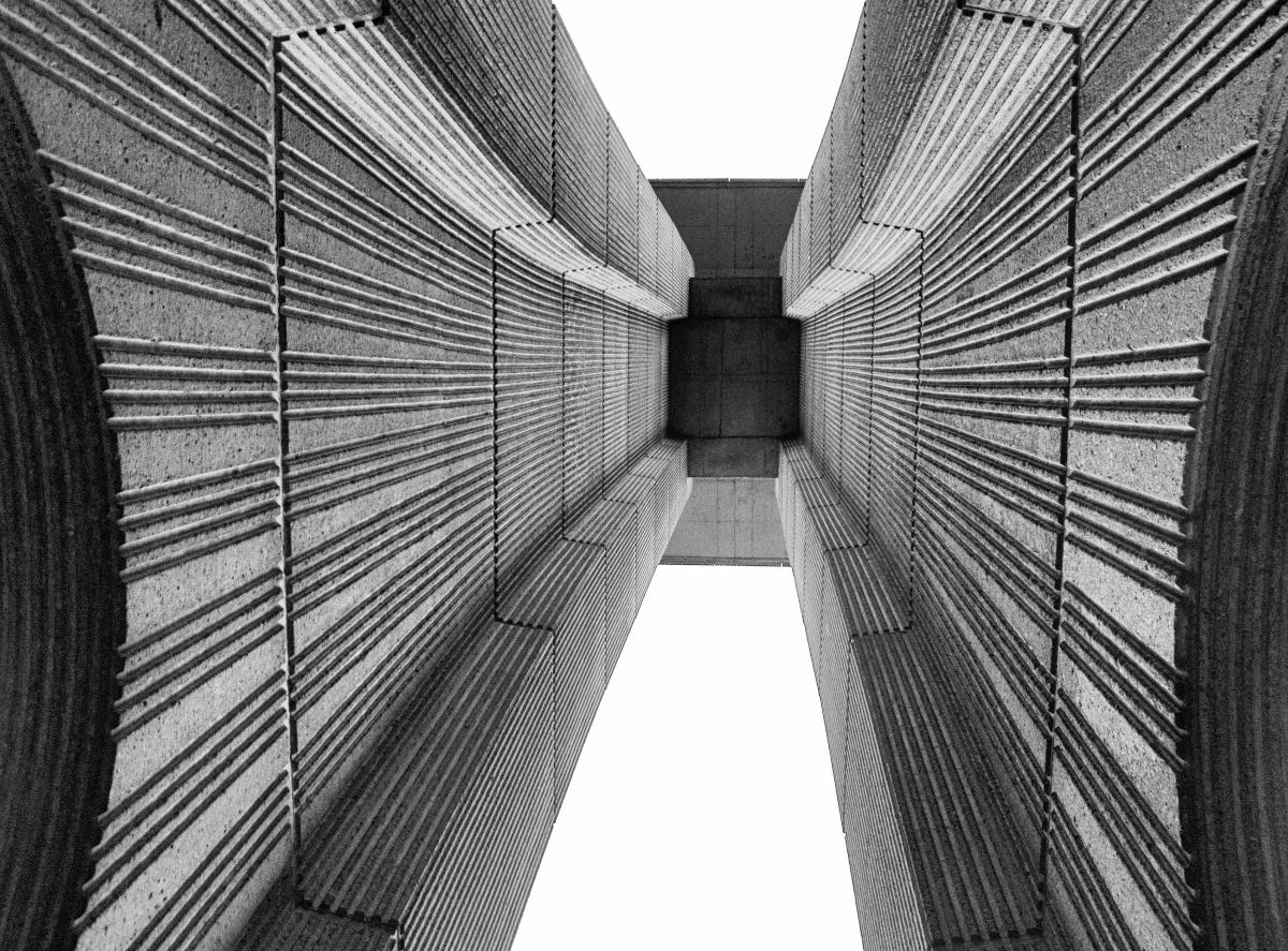
Segmental construction by balanced cantilever method. Joints counter cast and glued.
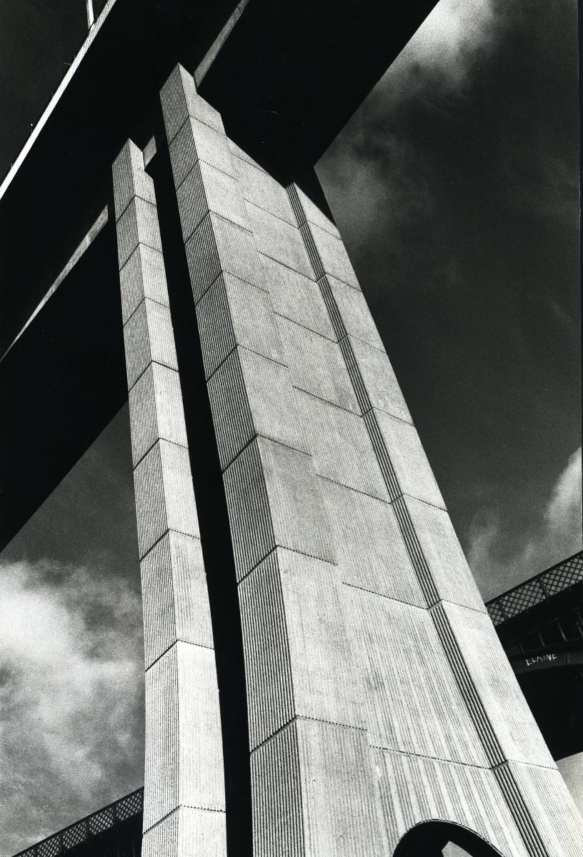
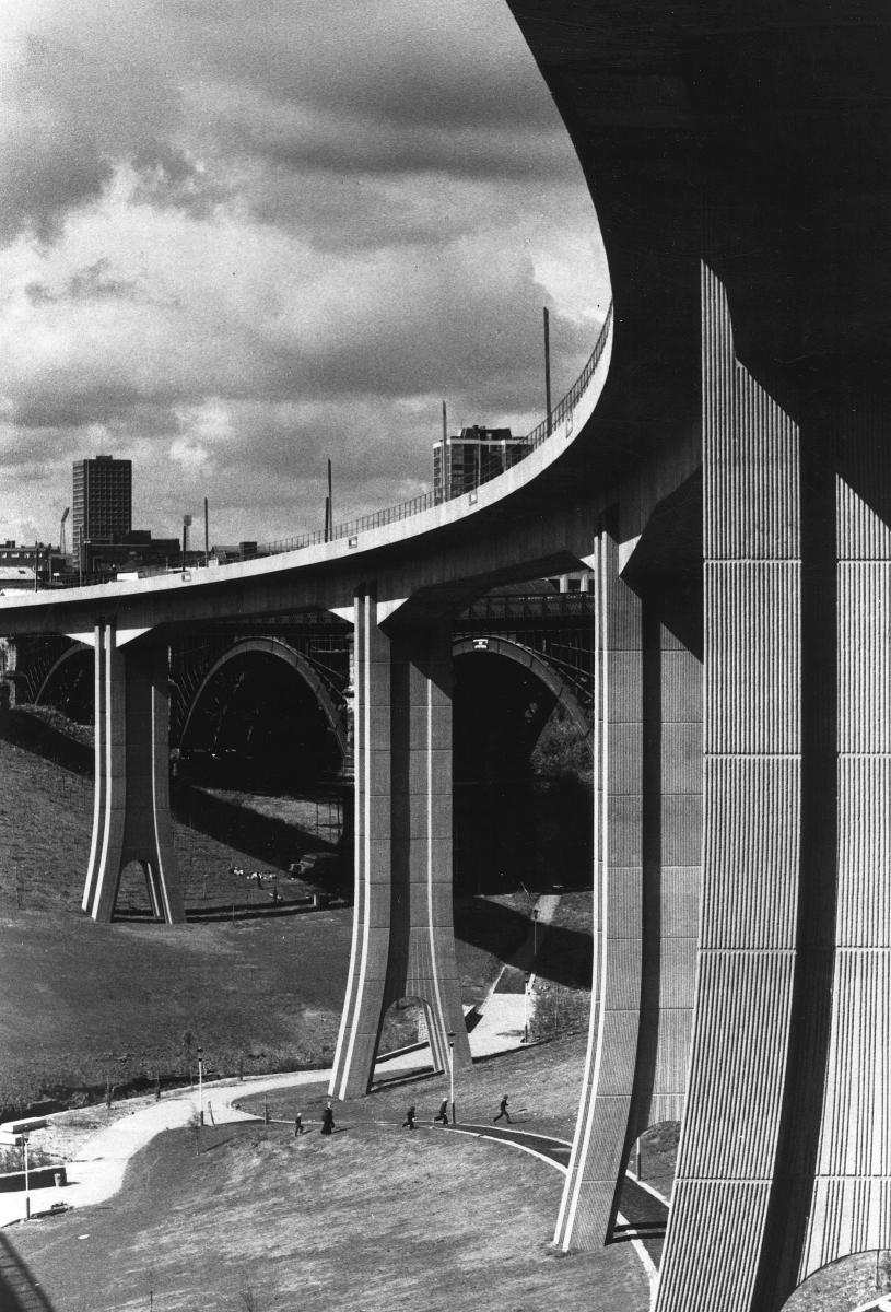
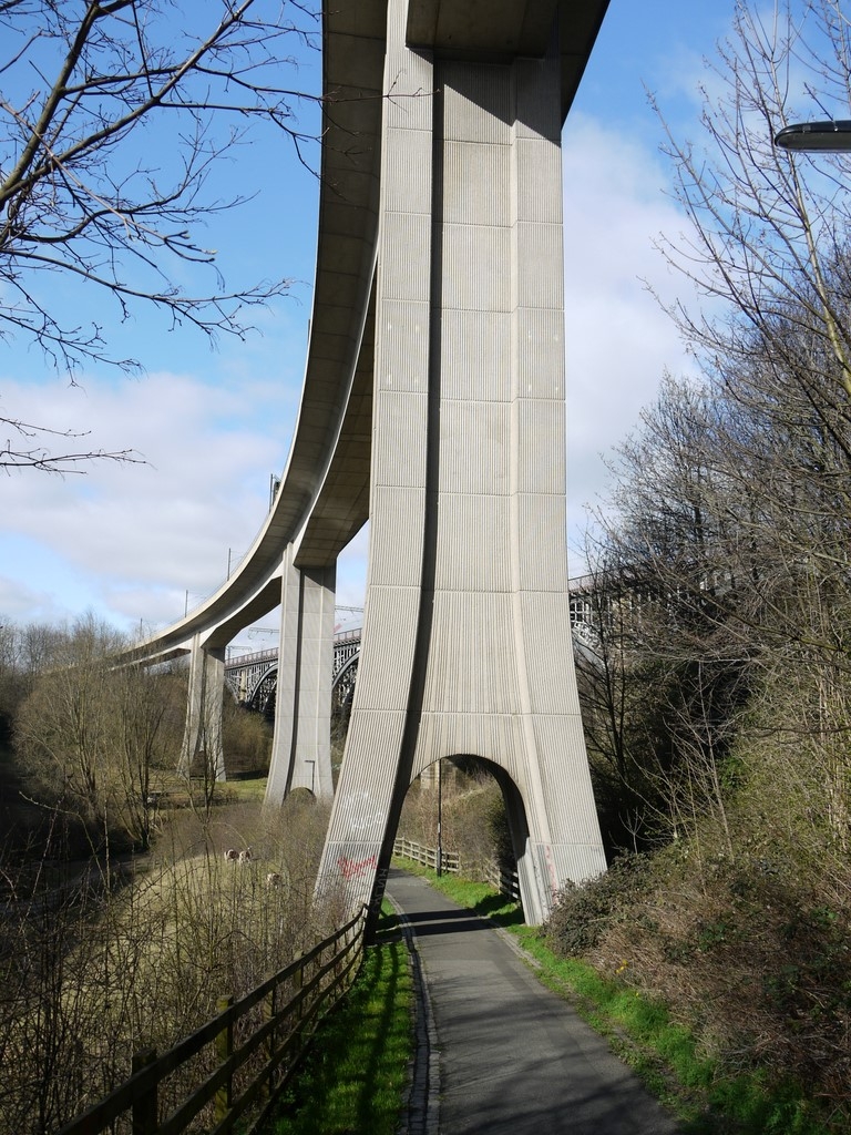
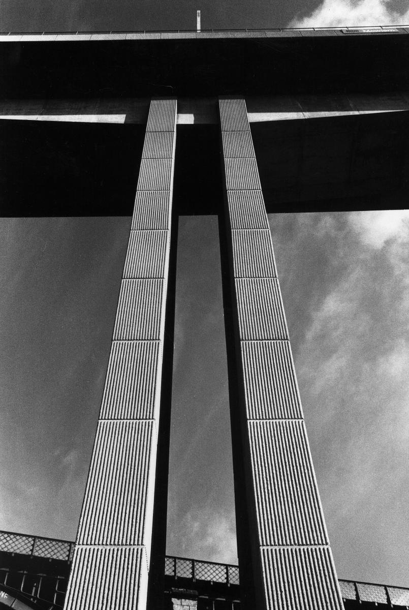
The Byker Viaduct (also known as the Byker Metro Bridge) is a 2,674 ft (815 m) curved 'S' shaped light railway bridge, which carries the Tyne and Wear Metro over the River Ouseburn in Newcastle upon Tyne. It carries the line from Manors Metro station in the city centre to the west, to Byker Metro station in the area of Byker to the east, over the lower Ouseburn valley, with the river emptying into the north side of the River Tyne, to the south.
Designed by Ove Arup and Partners, and built by Mowlem, construction began in 1976 and was completed in 1979, it was opened on 11 November 1982 as part of the St James to Tynemouth section of the Metro. It is 27 ft (8.2 m) wide, and carries standard gauge double tracks up to 30 m (98 ft) above the ground, with 18 spans up to 226 ft (69 m) long; six of the spans are over the river valley, with the remainder continuing on the east side of the valley as a lower elevated section. It was notable, in being the first such structure in Britain to be built using cantilevered concrete sections with joints glued with epoxy resin.
It was one of two major bridges built specifically for the Tyne and Wear Metro, the other being the Queen Elizabeth II Bridge crossing the River Tyne.
It is one of three high level bridges in close proximity making the same crossing, with the Ouseburn railway viaduct to the north and the Byker road bridge to the south. The bridge and elevated section form an S-curve, which takes the track over the Byker road bridge at its east end.
Text imported from Wikipedia article "Byker Viaduct" and modified on January 11, 2024 according to the CC-BY-SA 4.0 International license.


