


General Information
| Name in local language: | Pont de Saint-Nazaire |
|---|---|
| Beginning of works: | 1972 |
| Completion: | 18 October 1975 |
| Status: | in use |
Project Type
| Function / usage: |
Road bridge |
|---|---|
| Support conditions: |
for registered users |
| Structure: |
main bridge: Cable-stayed bridge with fan system main bridge: Three-span cable-stayed bridge |
| Material: |
main bridge: Steel bridge Structurae Plus/Pro - Subscribe Now! |
| Structure: |
approach viaducts: Girder bridge |
| Material: |
approach viaducts: Prestressed concrete bridge |
| Secondary structure(s): |
Structurae Plus/Pro - Subscribe Now! |
| Material: |
Structurae Plus/Pro - Subscribe Now! |
| Secondary structure(s): |
Structurae Plus/Pro - Subscribe Now! |
Location
| Location: |
Saint-Nazaire, Loire-Atlantique (44), Pays de la Loire, France Saint-Brévin-les-Pins, Loire-Atlantique (44), Pays de la Loire, France Montoir-de-Bretagne, Loire-Atlantique (44), Pays de la Loire, France |
|---|---|
| Crosses: |
|
| Carries: |
|
| Coordinates: | 47° 17' 48.31" N 2° 10' 40.78" W |
| Coordinates: | 47° 16' 8.77" N 2° 9' 43.41" W |
Technical Information
Dimensions
| total length | 3 356 m | |
| main bridge | ||
|---|---|---|
| main span | 404.00 m | |
| total length | 720 m | |
| span lengths | 158.00 m - 404.00 m - 158.00 m | |
| deck | deck depth | 3.20 m |
| deck width | 15.00 m | |
| pylons | pylon height (above deck) | 68.00 m |
| northern approach viaduct | ||
| total length | 1 115 m | |
| number of spans | 22 | |
| standard span lengths | 50.70 m | |
| southern approach viaduct | ||
| total length | 1 521 m | |
| number of spans | 30 | |
| on-center distance between girders | 3.50 m | |
| standard span lengths | 50.70 m | |
| roadway / carriageway width | 12.00 m | |
Materials
| cables |
steel
|
|---|---|
| piers |
reinforced concrete
|
| pylons |
steel
|
| deck of main bridge |
steel
|
| deck of approach viaducts |
prestressed concrete
|
Chronology
| 18 October 1975 | Opened to traffic. |
|---|---|
| 1998 | Replacement of one cable-stay by Baudin-Chateauneuf. |
| 2002 | Replacement of three cable-stays by Baudin-Chateauneuf. |
Excerpt from Wikipedia
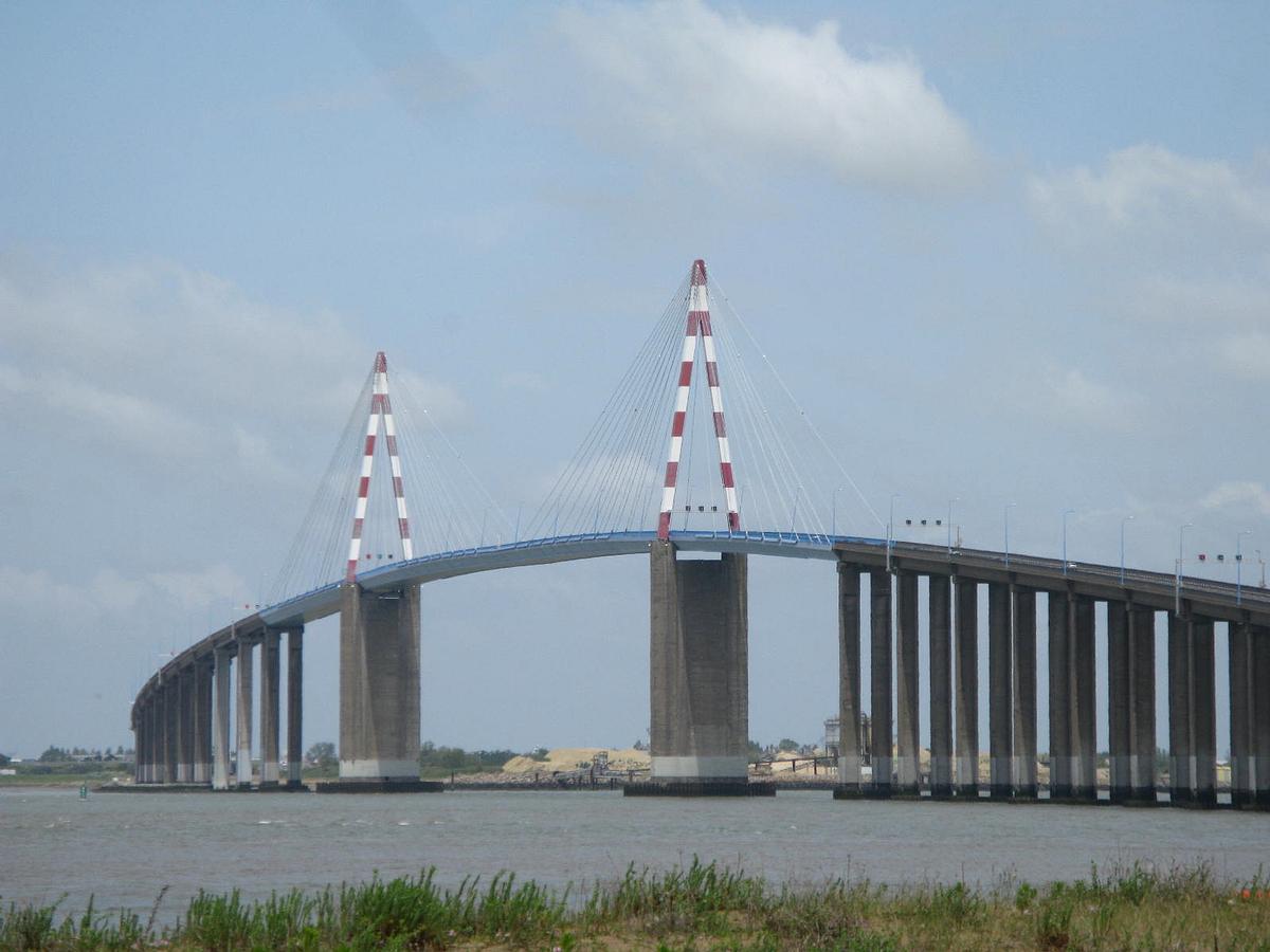
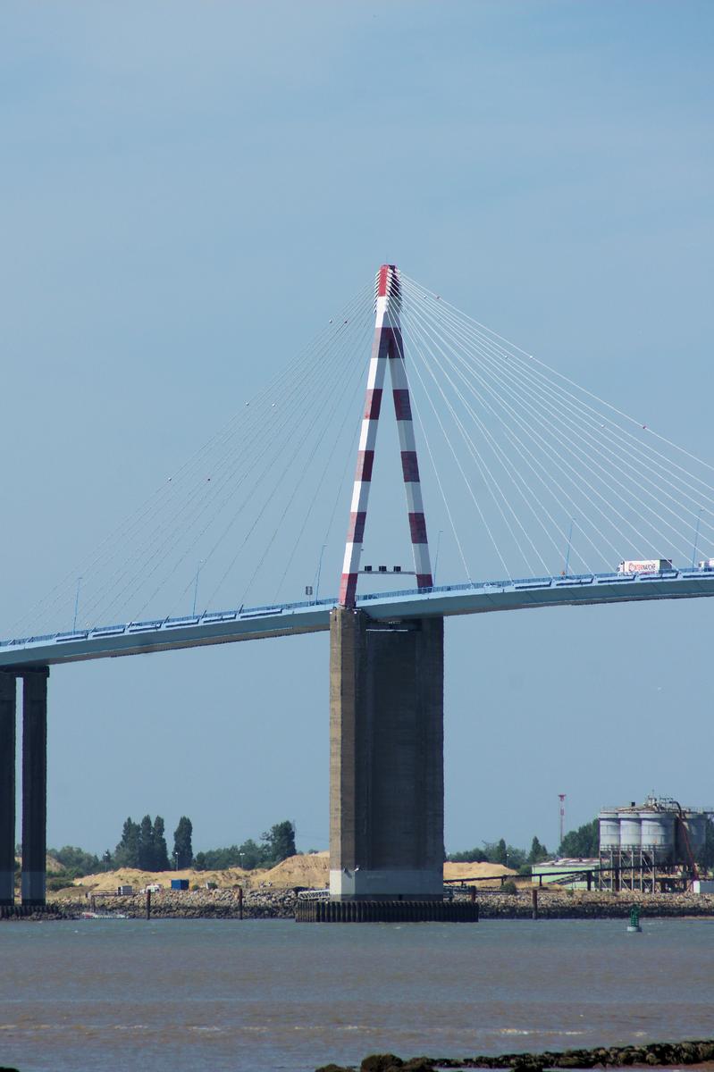
The Saint-Nazaire Bridge (French:Le pont de Saint-Nazaire) is a cable-stayed bridge spanning the Loire River and linking Saint-Nazaire on the north bank and Saint-Brevin-les-Pins on the south bank, in the department of Loire-Atlantique, Pays de la Loire, France. The bridge is crossed by the " Route bleue" (RD213).
The cable-stayed metallic structure measures 720 m and, including the access viaducts, represents a total length of 3 356 m.
History
The bridge was commissioned on October 18, 1975, after three years of construction. Including its 404 m central span, the 720 m metal structure held, at its construction, the world record length for a cable-stayed metallic bridge.
In 1992, the Loire-Atlantique general council took over the Saint-Nazaire SAEM, the contractor for the creation and operation of the bridge. Access to the bridge became toll-free on October 1, 1994.
The building was returned to the department's general council road heritage organization, which has been responsible for its management and maintenance since August 1, 1995. It has improved trading between the north and the south shores of the estuary considerably.
In 1975, the bridge was the longest one ever built in France. Moreover, it held the world record for the longest cable-stayed bridge for eight years.
Construction and specifications
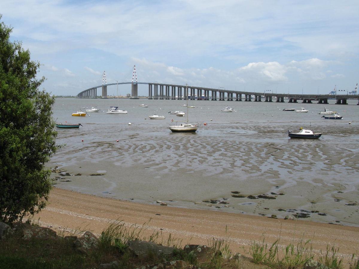
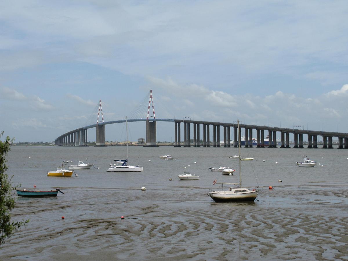
The bridge consists of two access viaducts made out of prestressed concrete: the northern viaduct is 1 115 m long, and the southern one is 1521 m long. The main structure is composed of a 720 m long cable-stayed metallic frame. It is crossed by the department road RD 2132.
The construction of the bridge was entrusted to a consortium of companies:
- Metallic construction: Compagnie Française d’Entreprises Métalliques (CFEM) ;
- Concrete structures: Société Générale d’Entreprises (SGE) (the foundations were subcontracted to Morillon-Corvol, Courbot and Dodin).
Traffic rules and regulations
The speed limit is 70 km/h. Certain or even all vehicles may restricted during strong winds (starting at 80 km/h for cyclists).
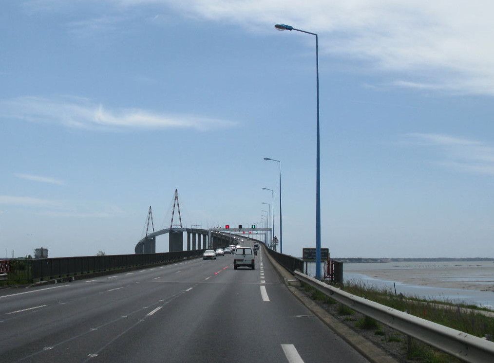
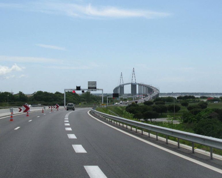
The general council has implemented a lane management system for the bridge. The reversible lanes allow, during the day or special events, for a second lane to be dedicated to the busier way. The system has folding barriers, with illuminated red studs that are embedded in the asphalt, and road sign frames that allow for illuminated road signs (green arrow/orange or red cross) to indicate the way that is assigned to each of the three lanes.
Unique in France, the system went live on August 25, 2010 and is regarded as "experimental". In fact, it is a requirement from the state since the traffic code mandates white markings on the ground. The Loire-Atlantique general council has, therefore, received a one-year permit that has renewed every year since then.
However, the illuminated beacons have become too fragile because of the LEDs.
Also, the increased traffic during the summer causes numerous traffic jams despite the system.
To offer an alternative way of crossing the river for pedestrians and cyclists during the summer (May to September), in June 2010 the general council considered a river shuttle service between Saint-Nazaire and Mindin. Because of its prohibitive cost, the idea was abandoned in December 2011.
The only regular coach lines using the bridge and providing intercity connections between Saint-Nazaire and the Pays de Retz region are those of the Lila network (routes 15, 16 and 17). Route 17 vehicles are fitted with eight bicycle-only spaces.
Text imported from Wikipedia article "Saint-Nazaire Bridge" and modified on July 22, 2019 according to the CC-BY-SA 4.0 International license.
Participants

Relevant Web Sites


Relevant Publications
- (1997): L'architecture et les ingénieurs. Deux siècles de réalisations. Moniteur, Paris (France), pp. 145.
- (1998): Die Ästhetik moderner Schrägseilbrücken. In: Baukultur, n. 3 ( 1998), pp. 12-16.
- (2003): Bridge engineering. A global perspective. Thomas Telford, London (United Kingdom), ISBN 9780727732156, pp. 627.
- (1977): Brücke über die Mündung der Loire zwischen Saint-Nazaire und Saint-Brevin als Schrägseilbrücke mit 404 m Spannweite der Schiffahrtsöffnung. In: Stahlbau, v. 46, n. 4 (April 1977), pp. 120-126.
- (2013): Cable-Stayed Bridges. 40 Years of Experience Worldwide. Wilhelm Ernst & Sohn Verlag für Architektur und technische Wissenschaften GmbH, Berlin (Germany), ISBN 978-3-433-02992-3, pp. 77.
- About this
data sheet - Structure-ID
20000046 - Published on:
28/10/1998 - Last updated on:
08/01/2024


