
General Information
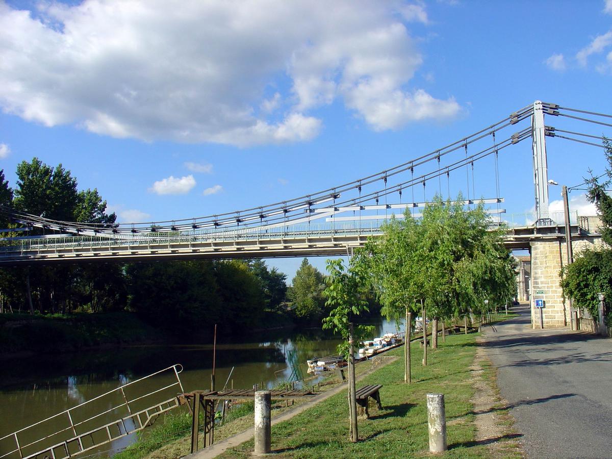
| Other name(s): | Pont de Saint-Denis-de-Pile |
|---|---|
| Completion: | 1931 |
| Status: | in use |
Project Type
| Structure: |
Single-span two-tower suspension bridge |
|---|---|
| Function / usage: |
Road bridge |
| Material: |
Steel bridge |
| Plan view: |
Structurae Plus/Pro - Subscribe Now! |
| Support conditions: |
for registered users |
| Material: |
Structurae Plus/Pro - Subscribe Now! |
| Secondary structure(s): |
Structurae Plus/Pro - Subscribe Now! |
Location
| Location: |
Saint-Denis-de-Pile, Gironde (33), Nouvelle-Aquitaine, France |
|---|---|
| Crosses: |
|
| Coordinates: | 44° 59' 35.51" N 0° 12' 26.09" W |
Technical Information
Dimensions
| span | 62.32 m | |
| number of lanes | 2 x 1 | |
| deck | deck width | 6.20 m |
Materials
| cables |
steel
|
|---|---|
| suspenders |
steel
|
| pylons |
steel
|
Chronology
| 3 June 1931 | 16 trucks are used for load testing with a total load of 120 t. The vertical hangers suddenly give way resulting in a catastrophic collapse of the deck. 10 persons perish including Leinekugel-Lecoq's son. |
|---|---|
| 1943 | In a second expert report, Willemain, Grelot, Godard and Mothe incriminate the lack of calculation and testing of the hanger connections, giving 40% of the fault to Leinekugel's firm, but also 60% to the municipal governments for failing to recognize the problem. |
Participants
Design
- Gaston Leinekugel-Lecocq (designer)
Expertise
- Augustin Mesnager (expert)
- Godard (expert)
- Cellerier (expert)
- Louis Grelot (expert)
- Mothe (expert)
- Willemain (expert)
Construction
Relevant Web Sites
There currently are no relevant websites listed.
Relevant Publications
- (2010): Ingénieur des ponts. L'histoire de l'entreprise Arnodin - Leinekugel Le Cocq. La Vie du Rail, Paris (France), ISBN 978-2-918758-09-9, pp. 290-294.
- (1995): Les ponts modernes - vingtième siècle. Picard Éditeur, Paris (France), pp. 108-109.
- About this
data sheet - Structure-ID
20003016 - Published on:
13/02/2002 - Last updated on:
27/03/2016
Structurae cooperates with


