General Information
| Completion: | 1839 |
|---|---|
| Status: | destroyed (1850) |
Project Type
| Structure: |
Suspension bridge |
|---|---|
| Function / usage: |
Road bridge |
Location
| Location: |
Angers, Maine-et-Loire (49), Pays de la Loire, France |
|---|---|
| Crossed: |
|
| Replaced by: |
Pont de la Basse-Chaîne (1960)
|
| Coordinates: | 47° 28' 14" N 0° 33' 49" W |
Technical Information
Dimensions
| main span | 102 m |
Chronology
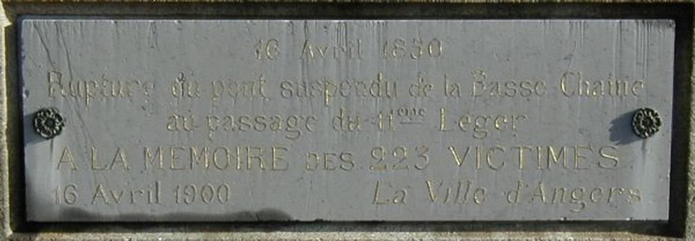
| 16 April 1850 | An army troupe crosses the bridge though not in step as ordered by the lieutnant colonel in charge. However, strong winds cause the bridge to oscillate which is exacerbated by the soldiers trying to balance on the tilting bridge. The bridge collapses due to overloading and oxidated cables, killing 226 soldiers. |
|---|
Participants
Design
- Joseph Chaley (designer)
Relevant Web Sites
Relevant Publications
- (1986): L'architecture du fer. France: XIXe siècle. Editions Champ Vallon, Seyssel (France), ISBN 9782903528713, pp. 124.
- (2001): Les plus beaux ponts de France. Bonneton, Paris (France), pp. 149.
- (1998): Les ponts d'Angers. Editions du Patrimoine, Paris (France), pp. 268.
- (1984): Ponts de France. Presses Ponts et chaussées, Paris (France), pp. 180.
- (1988): Ponts et viaducs au XIXème siècle. Poitiers (France), pp. 118-119.
- About this
data sheet - Structure-ID
20004743 - Published on:
30/08/2002 - Last updated on:
24/06/2022


