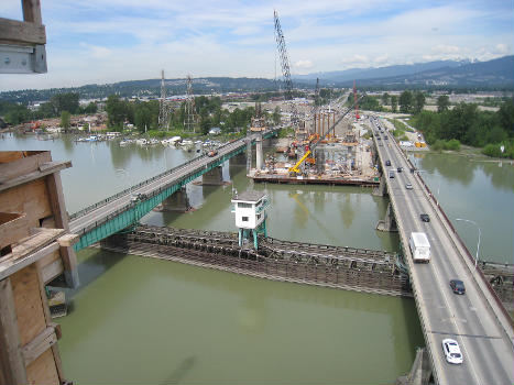
General Information
| Completion: | 1 August 1978 |
|---|---|
| Status: | demolished (22 November 2010) |
Project Type
| Structure: |
Swing bridge |
|---|---|
| Function / usage: |
Road bridge |
Location
| Location: |
Port Coquitlam, British Columbia, Canada Pitt Meadows, British Columbia, Canada |
|---|---|
| Address: | Highway 7 / Lougheed Highway |
| Replaced by: |
Pitt River Bridge (2009)
|
| Coordinates: | 49° 14' 54.50" N 122° 43' 46.11" W |
Technical Information
Dimensions
| total length | 360.9 m | |
| number of lanes | 2 |
Cost
| cost of construction | Canadian dollar 2 800 000 |
Participants
Currently there is no information available about persons or companies having participated in this project.
Relevant Web Sites
Relevant Publications
- (2009): Pitt progress. In: Bridge Design & Engineering, v. 15, n. 54 (1st Quarter 2009), pp. 32-34.
- About this
data sheet - Structure-ID
20049453 - Published on:
06/12/2009 - Last updated on:
05/11/2024


