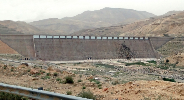
General Information
Project Type
| Structure: |
Gravity dam |
|---|---|
| Function / usage: |
Irrigation & industrial water dam |
| Material: |
Roller-compacted concrete dam |
| Function / usage: |
Fresh water dam |
Location
| Location: |
Jordan |
|---|---|
| Coordinates: | 31° 26' 40.77" N 35° 49' 4.73" E |
Technical Information
Dimensions
| height | 67 m | |
| crest length | 764 m |
Quantities
| dam-fill volume | 1 800 000 m³ | |
| roller-compacted concrete volume | 720 000 m³ |
Materials
| dam structure |
roller-compacted concrete
|
|---|
Chronology
| 12 April 2004 | Inaugurated by the King of Jordan. |
|---|
Excerpt from Wikipedia
Mujib Dam (Arabic: سد الموجب) is located in Wadi Mujib, between the cities of Madaba and Kerak, in the Madaba Governorate of Jordan. It is a rolled concrete dam with abutments of clay-core rockfill completed in 2004, after six years of construction. Highway 35, part of the historic King's Highway, crosses the crest. The water it impounds is combined with desalinated water piped from brackish wells along the Dead Sea to the west in a reservoir holding 35 million m³ (1 billion US gallons) which primarily supplies Amman, 100 kilometres (62 mi) to the north helping to ease a very stressed national water supply.
Text imported from Wikipedia article "Mujib Dam" and modified on July 23, 2019 according to the CC-BY-SA 4.0 International license.
Participants
Relevant Web Sites
Relevant Publications
- (2022): Practical methods to identify seepage paths in dam abutments in semi-arid areas: The Mujib dam in Jordan. In: Frontiers in Built Environment, v. 8 (February 2022).
- About this
data sheet - Structure-ID
20009049 - Published on:
16/04/2003 - Last updated on:
01/10/2018


