General Information
| Name in local language: | Van Brienenoordbrug |
|---|---|
| Beginning of works: | 1986 |
| Completion: | 1 May 1990 |
| Status: | in use |
Project Type
| Structure: |
Tied-arch bridge with inclined hangers |
|---|---|
| Function / usage: |
Road bridge |
| Material: |
Steel bridge |
| Structure: |
Bascule bridge |
| Support conditions: |
for registered users |
| Material: |
Structurae Plus/Pro - Subscribe Now! |
Location
| Location: |
Rotterdam, South Holland, Netherlands |
|---|---|
| Crosses: |
|
| Next to: |
Van Brienenoord Bridge (1965)
|
| Coordinates: | 51° 54' 12" N 4° 32' 34" E |
Technical Information
Dimensions
| total length | 1 320 m | |
| deck width | 28.50 m | |
| arch span | 300 m | |
| horizontal navigation clearance | 280.00 m |
Materials
| piers |
reinforced concrete
|
|---|---|
| arches |
steel
|
Excerpt from Wikipedia
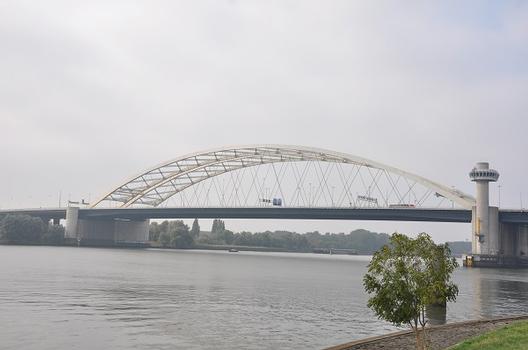
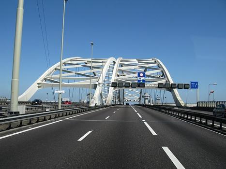
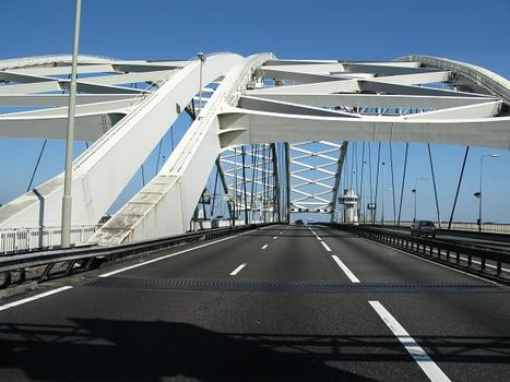
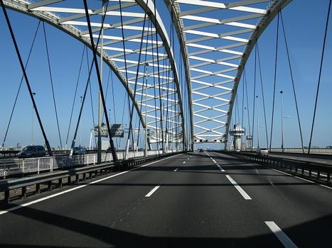
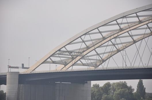
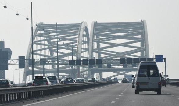
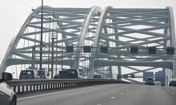
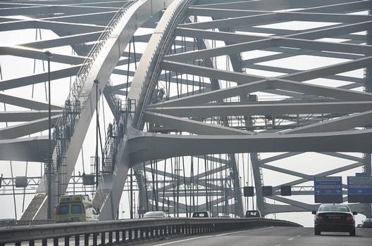
The Van Brienenoord Bridge (Dutch: Van Brienenoordbrug) is a large twin tied-arch motorway bridge in the Netherlands. Located at the east side of Rotterdam, it crosses the New Meuse (Nieuwe Maas), a major distributary of the river Rhine. The bridge actually consists of two separate, parallel, and almost identical arch-bridges, as well as a set of three parallel bascule bridges on the north end. The bridge carries 12 lanes of traffic of the A16 motorway, the busiest highway in the Netherlands. Additionally, on the outside of the east arch, a two-way segregated cycling bridge has been mounted. Including lead-up ramps, the Van Brienenoord Bridge is 1320 metres long and vessels with up to 24 metres air draft can pass under the closed bridge. With a span of 300 m, the west arch is the longest span road bridge in the Netherlands.
Traffic exceeds 235,000 vehicles crossing the bridge daily, using four 3-lane carriageways, in an express versus local / distributor arrangement.
Looking at the twin bridge from the south, it's hard to tell that one of the twins is 25 years older than the other. Each bridge arch carries tworoadways – the inner with three lanes of express traffic; and an outer with another three local / distributor lanes.
History
The east arch (287.5 m long) was built in 1965, constituting the original Van Brienenoord Bridge. In 1990 the bridge received a major upgrade, by the addition of a second, almost identical arch (305 m long and slightly broader) right next to ist west flank, doubling ist traffic capacity. The bridge is named after the Eiland van Brienenoord (Isle of Brienenoord) in the river, on which some of ist pillars are built. The little island was named after ist former owner, baron Arnoud Willem van Brienen van de Groote Lindt in 1847. The Dutch suffix oord means a place.
An average of 150.000 ships pass the bridge every year. Approximately 500 of these ships require the bridge to be opened, a process which takes 18 minutes total. Suspending road traffic and opening the bridge takes 4 minutes, letting the ship pass takes 10 minutes, and closing the bridge requires another 4 minutes. During this time, road traffic is blocked by boom barriers. As of November 2005, the bridge is no longer controlled locally but from the nearby city of Rhoon, where the region's Road Traffic Control is located. A request to open the bridge for shipping needs to be made at the harbor authorities at least three hours in advance.
An electro-mechanical failure on 17 March 2006 left the bridge open for about an hour, on the middle of day, causing traffic jams up to 7 kilometres in length. The western bridge was closed first, restoring traffic to Breda. The eastern bridge was closed at approximately 1 AM, restoring traffic to The Hague and Utrecht. On 5 November 2006 it failed to close again, this time due to an electrical failure, forcing engineers to close the bridge manually.
Text imported from Wikipedia article "Van Brienenoordbrug" and modified on April 11, 2020 according to the CC-BY-SA 4.0 International license.
Participants
Relevant Web Sites
Relevant Publications
- (2002): Bridges - Ponts - Brücken. Atrium, Mexico City (Mexico), pp. 46-53.
- (2023): Renovation of the Van Brienenoord Bridge, The Netherlands. In: Bridge Structures, v. 19, n. 3 (27 July 2023), pp. 121-132.
- About this
data sheet - Structure-ID
20005629 - Published on:
29/09/2002 - Last updated on:
03/09/2023

