General Information
| Name in local language: | Stad skipstunnel |
|---|---|
| Beginning of works: | 2023 |
| Completion: | 2026 |
| Status: | project phase |
Project Type
| Structure: |
Tunnel |
|---|---|
| Function / usage: |
Canal tunnel |
Location
| Location: |
Stad, Vestland, Norway |
|---|---|
| Coordinates: | 62° 0' 35.28" N 5° 27' 44.71" E |
| Coordinates: | 62° 0' 56.80" N 5° 25' 25.12" E |
Technical Information
Dimensions
| length | 1 800 m | |
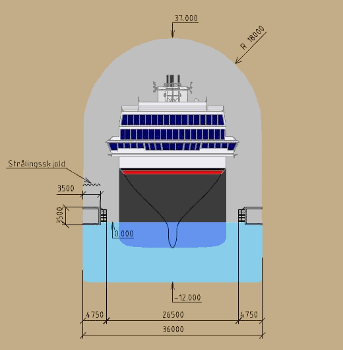
| interior width | 37 m | |
| interior height | 49 m |
Excerpt from Wikipedia
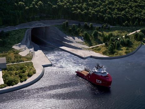
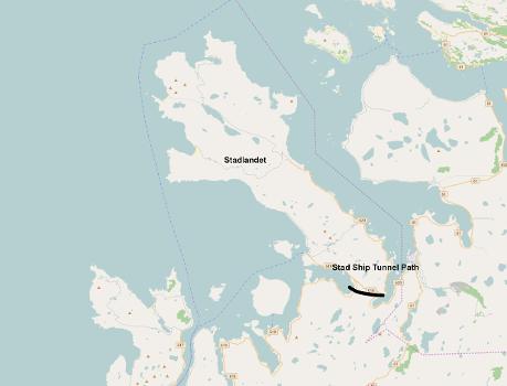
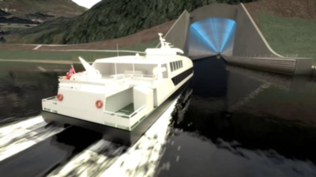
The Stad Ship Tunnel (Norwegian: Stad skipstunnel) is a planned canal and tunnel to bypass the Stad peninsula in Stad Municipality in Vestland county, Norway. The peninsula is one of the most exposed areas on the coast, without any outlying islands to protect it from the weather. The section has traditionally been one of the most dangerous along the coast of Norway. When built it will be the first full-size ship tunnel in the world.
Location
The surrounding waters, known as the Stadhavet Sea, is the most windswept part of the nation's coastline and is stormy around 100 days of the year, leading to ships often waiting days to pass through. Currents, created by the area marking the meeting point of the North Sea and the Norwegian Sea further complicate navigation: Since World War Two ended, 33 deaths have occurred in maritime accidents within the Stadhavet Sea. The official Visit Norway website has claimed Vikings would drag their boats over the peninsula to avoid crossing the dangerous patch of sea.
Planning
The first proposal was in an article in Nordre Bergenhus Amtstidende newspaper in 1874 (148 years ago) (1874), and shortly afterwards an article in the same newspaper proposed a railway tunnel across the peninsula. The latter would have allowed the boats to be raised onto wagons and to be hauled across, and would cost only half as much.
In 2011, a report by Det Norske Veritas and the Institute for Research in Economics and Business Administration for the Norwegian Coastal Administration concluded that a tunnel would not be economical. It looked at two sizes, small and large, which would cost 1,264 million and 2,027 million kr respectively. The report concluded that the utility, including saved waiting costs, for shippers have a present value of 304 million and 314 million kr, respectively, and 67 million and 76 million kr in saved accident costs. A similar report from 2007 concluded that the tunnel would be economical. The Coastal Administration stated that the differences were because of new and better data.
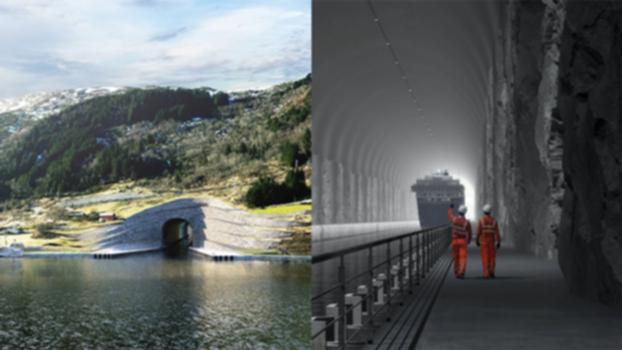
In 2013, the tunnel was included for the first time in the National Transport Plan. 1 billion kr was set aside for it in the budget. The tunnel will be 49 metres (161 ft) high and 36 metres (118 ft) wide, able to handle ships of up to 16,000 tonnes (16,000 long tons; 18,000 short tons), large enough for the Hurtigruten coastal express ships. The water will be 12 metres (39 ft) deep in the tunnel. The tunnel will reduce journey lengths by 35 miles (56 km).
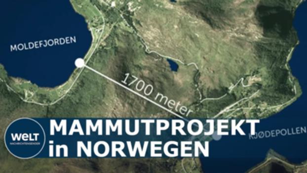
Two routes were proposed: one 1,800 meters (5,900 ft) long from the Eide farm at the inner part of the Moldefjorden through the Mannseidet isthmus to the Kjødspollen (the inner part of the Vanylvsfjorden), the narrowest but innermost place of the peninsula. The other option is a slightly longer tunnel from the Skårbø farm to the Fløde farm through the central part of the peninsula. The second option has been selected for construction.
Knut Samset, a project management professor with at the Norwegian University of Science and Technology, criticised the decision to go ahead, claiming modern vessels could navigate the seas safely and that "cost-benefit analysis is negative".
Construction
In March 2021, the Norwegian Ministry of Transport and Communications gave approval for preparations to begin, with the Norwegian Coastal Administration expecting construction to begin in 2022 (0 years ago) (2022). Terje Andreassen, temporary project manager, states that construction is expected to start in 2023 with an estimated completion in 2025 or 2026. The tunnel may be open by 2025 (3 years' time) (2025).
Owing to the thick gneiss requiring tunnelled through, a "drill and blast" process is proposed by Andreassen, with materials delivered by sea owing to inadequacy of local roads, and a rock wall or possibly cofferdams being used to keep the tunnel free of water during construction. Approximately three million cubic metres of rock require removal. The tunnel's entrances have been designed by Norwegian firm Snøhetta with rock walls left rough to blend into its surrounding landscape. Snøhetta's designs include walkways and the construction of a new road bridge to enhance views of ships passing in and out of the tunnel.
Negotiations for requisite purchases of land and identification of a principal contractor began in April 2021. Several Norwegian and international companies are reviewing information on the project.
Text imported from Wikipedia article "Stad Ship Tunnel" and modified on June 16, 2022 according to the CC-BY-SA 4.0 International license.
Participants
Currently there is no information available about persons or companies having participated in this project.
Relevant Web Sites
Relevant Publications
- (2017): In Numbers - Stad Ship Tunnel. In: Engineering & Technology, v. 12, n. 5 (1 June 2017), pp. 12-13.
- About this
data sheet - Structure-ID
20082982 - Published on:
29/05/2022 - Last updated on:
04/05/2024

