
General Information
Project Type
| Structure: |
Vaulted arch bridge |
|---|---|
| Function / usage: |
Road bridge |
| Material: |
Masonry bridge Structurae Plus/Pro - Subscribe Now! |
Location
| Location: |
Blois, Loir-et-Cher (41), Centre-Val de Loire, France |
|---|---|
| Crosses: |
|
| Coordinates: | 47° 35' 5.55" N 1° 20' 16.41" E |
Technical Information
Dimensions
| total length | 283 m | |
| span lengths | 16.55 m - 18.20 m - 19.80 m - 21.92 m - 24.20 m - 26.30 m - 24.20 m - 21.92 m - 19.80 m - 18.20 m - 16.55 m | |
| number of spans | 11 | |
| deck | deck width | 15 m |
| piers | width | 3 x 4.85 m - 6.82 m - 2 × 5.20 m - 6.82 m - 3 × 4.85 m |
Materials
| piers |
stone
|
|---|---|
| arches |
stone
|
Chronology
| 11 November 1793 | Third arch is quasi completely destroyed. |
|---|---|
| 1804 | Third arch is rebuilt. |
| 10 December 1870 | Seventh arch is destroyed in the attempt to slow the advance of the German troops. |
| 1872 | Seventh arch is rebuilt. |
| 18 June 1940 | Ninth and tenth arches are destroyed again to slow a German invasion. |
| 1941 — 1942 | Reconstruction of the ninth and tenth arches. |
| 16 August 1944 | The three central arches are destroyed by the retreating German army. |
| 1946 | Three central arches rebuilt. |
| 1978 | Eighth arch repaired. |
Excerpt from Wikipedia
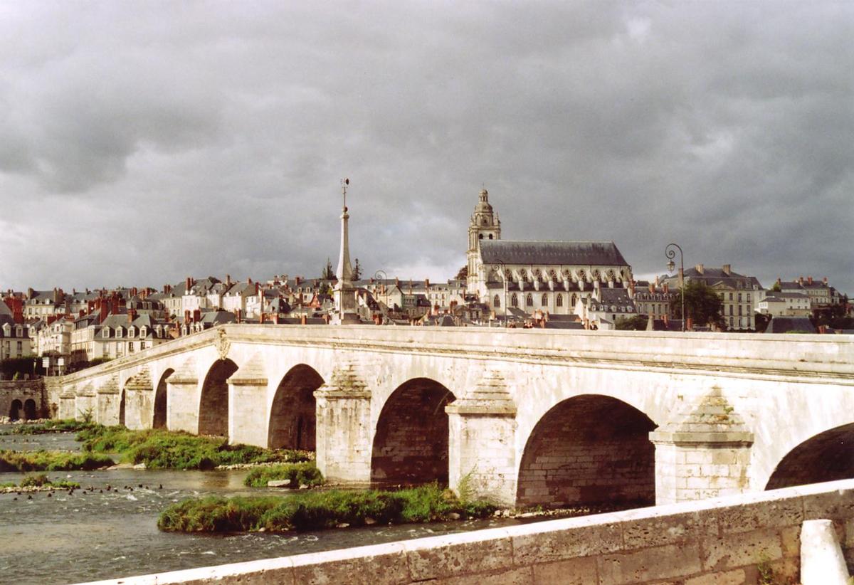
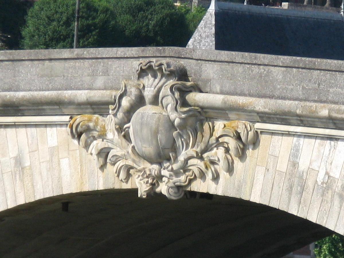
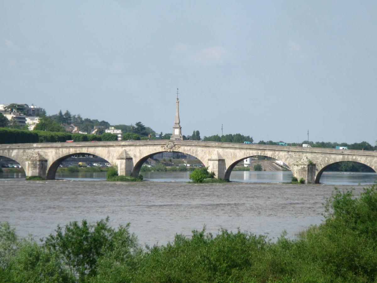
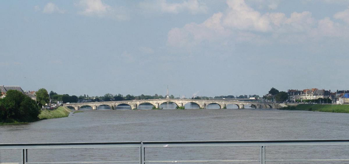
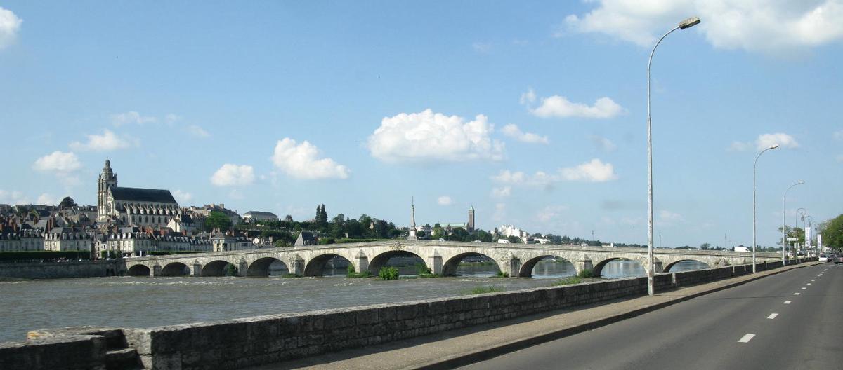
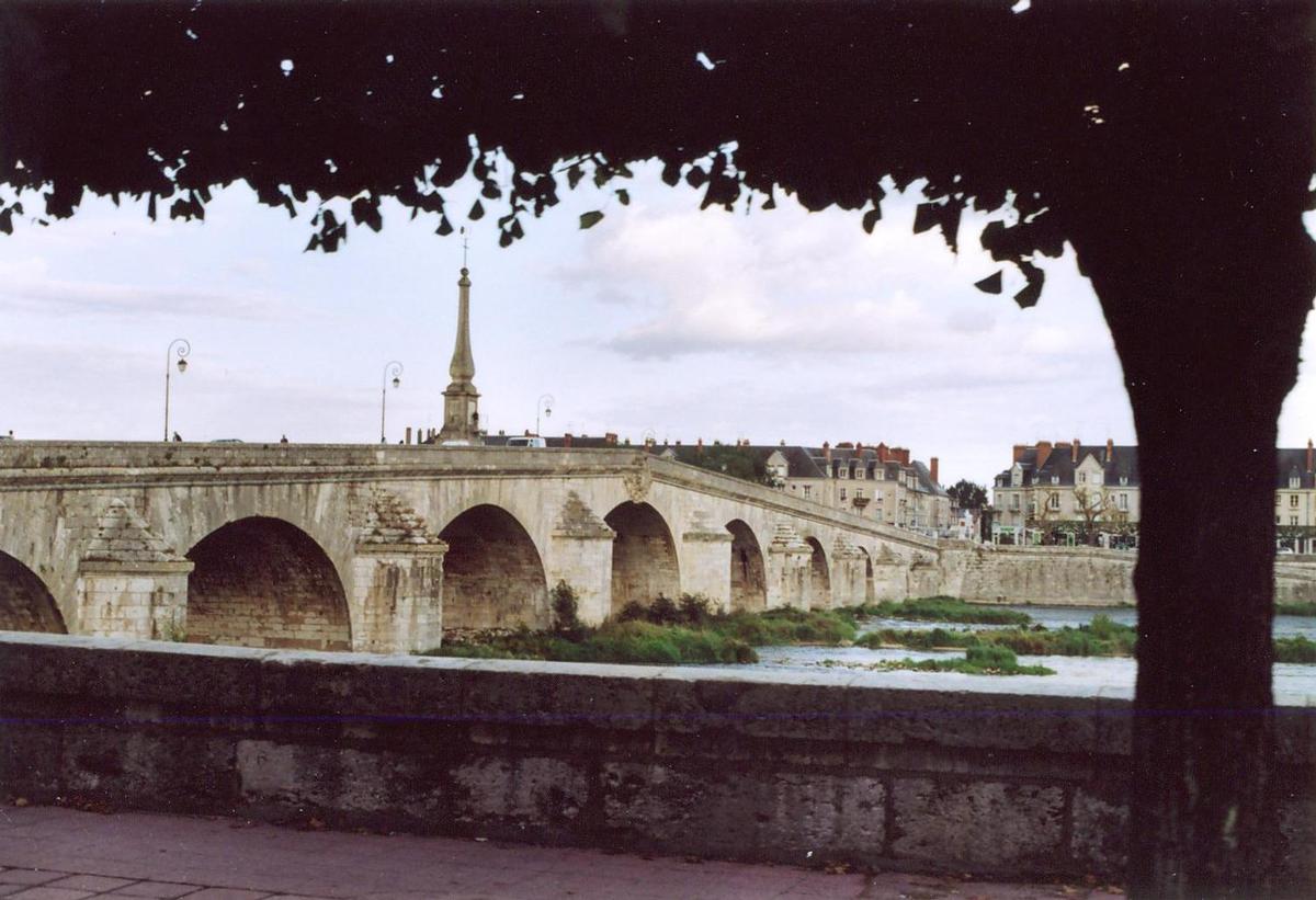
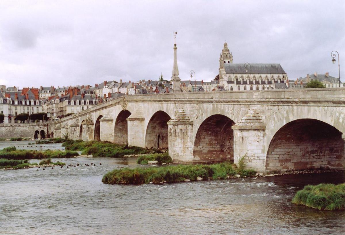
The Jacques-Gabriel Bridge (named pont Jacques-Gabriel in French) spans the Loire river in Blois, France, since the beginning of the 18th century. With a total length of 283m, it is made up of 11 arches, and is the last arch bridge on the river that is pointed. Since its construction, the edifice holds the name of the architect who designed it, Jacques Gabriel. The bridge was partially destroyed three times: in 1870 (Franco-Prussian War), 1940 and 1944 (World War II). It is now crossed by the Route Nationale 156.
The bridge was listed as a historical monument by order of 22 April 1937.
Location
The bridge spans the Loire river in the middle of Blois, between the downtown (from the same axis of the Denis Papin staircase) and Vienne on the left bank (aligned to Wilson Avenue).
History
Construction of a new Bloisian bridge
Since the 11st century, a stone bridge was used to link both banks. In the night between 6 and 7 February 1716, this medieval bridge collapsed.
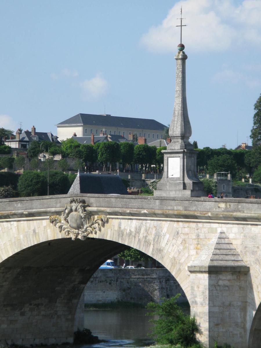
The construction of a new bridge is decided by August 1716. The project management is given by Duke Philippe of Orléans to Jacques Gabriel, yet King Louis XVI's official architect. As early as the end of that year, a regiment from Piedmont is called to build the bridge. The infrastructure is inaugurated on 4 May 1724, with an 14.6m-high obelisk standing in its middle.
Text imported from Wikipedia article "Jacques-Gabriel Bridge" and modified on December 7, 2023 according to the CC-BY-SA 4.0 International license.
Participants

Relevant Web Sites

Relevant Publications
- (1956): Brücken. Karl Robert Langewiesche Verlag, Königstein im Taunus (Germany), pp. 51.
- D'une Rive à l'Autre. Musée de la Marine de la Loire, Châteauneuf-sur-Loire (France), 2001, pp. 37.
- (1907): Etudes sur les ponts de pierre remarquables par leur décoration au XIXe siècle (Volume 2). Ponts français du XVIIIe siècle. Centre de la France. Librairie polytechnique Ch. Béranger, Paris (France), pp. 91.
- (1988): Le guide du Patrimoine: Centre. Val de Loire. Ministère de la Culture, Hachette, Paris (France), pp. 184.
- (2001): Les plus beaux ponts de France. Bonneton, Paris (France), pp. 53.
- About this
data sheet - Structure-ID
20000854 - Published on:
08/08/2000 - Last updated on:
16/02/2020


