
General Information
| Completion: | March 2013 |
|---|---|
| Status: | in use |
Project Type
| Function / usage: |
Pedestrian bridge (footbridge) |
|---|---|
| Structure: |
Pony truss bridge Vierendeel truss bridge |
| Material: |
Steel bridge Structurae Plus/Pro - Subscribe Now! |
Awards and Distinctions
| 2015 |
entry
for registered users |
|---|
Location
| Location: |
Hamburg-Wilhelmsburg, Hamburg, Germany |
|---|---|
| Address: | Fiskalische Straße 2 |
| Coordinates: | 53° 30' 35.12" N 10° 1' 47.59" E |
Technical Information
Dimensions
| total length | ca. 920 m | |
| span lengths | 14 - 16 m | |
| deck width | 3 - 6 m |
Materials
| piers |
steel
|
|---|---|
| foundations |
reinforced concrete
|
| deck truss |
steel
|
| abutments |
reinforced concrete
|
Horizontweg Georgswerder in Hamburg
History
After World War 2, a garbage mountain of rubble debris develops on the meadows of the Elbe island Wilhelmsburg. Later, the dumping of domestic and especially industrial waste leads to a dangerous accumulation of dioxin, which contaminates the groundwater through the rain that falls. Since 1986, the landfill has been sealed, and the toxic waste is still there, but enclosed in the waste mountain by elaborate technical measures. The continuous movements of the landfill have also been carefully measured for years.
Draft
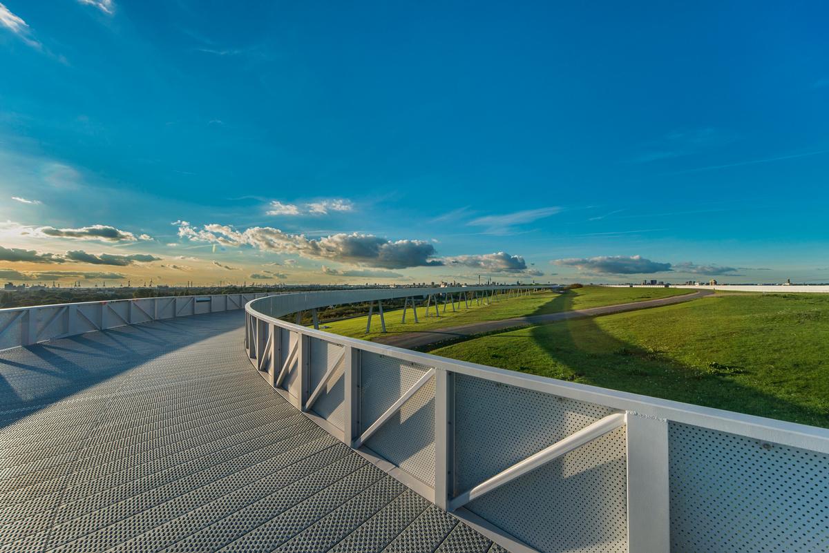
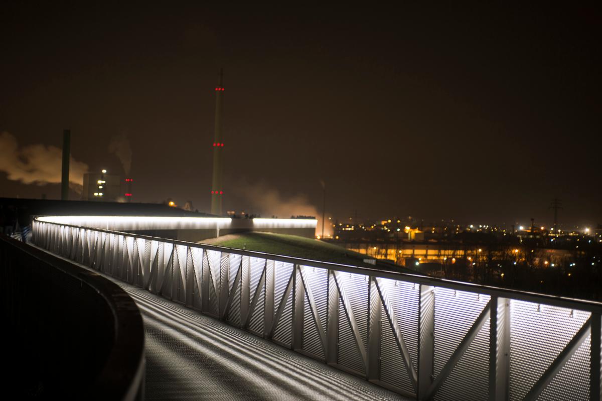
The horizon walkway evolves from the topography, in parts hugging the mountain, in parts swinging out on steel supports, but always running exactly at a level slightly below the highest point. The outside of the railing of the horizon walk is illuminated with LEDs at night, transforming the mountain into a landmark visible from afar. The construction and supporting structure were developed by an interdisciplinary team consisting of a landscape architect, an architect and a structural engineer in collaboration with environmental experts from the Georgswerder landfill.
Construction
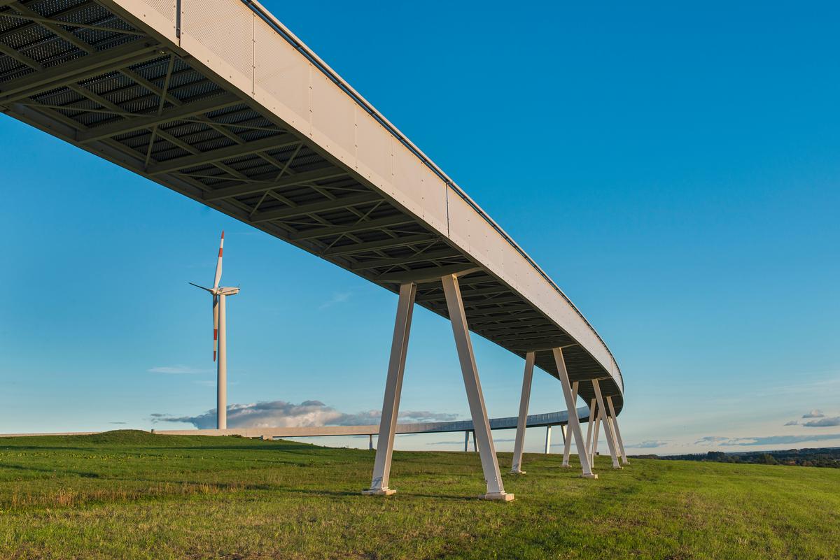
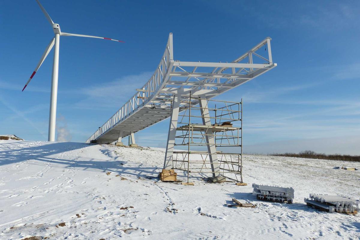
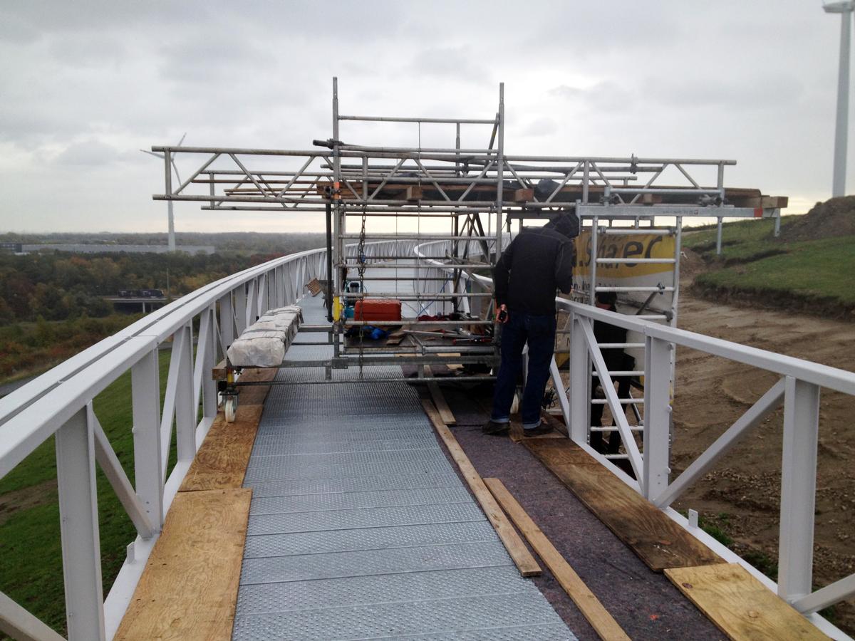
The Promenade is an approximately 920m long pathway and footbridge that was erected on the hill-like Georgswerder landfill and can be walked on. The footbridge runs in a winding form with several curves exactly horizontally at +37.10m a.s.l.. (OK pavement). The footbridge is 3m wide in the normal areas, in the curved areas it is widened to 6m. The steel structure is divided into two sections with a total length of approximately 480m.
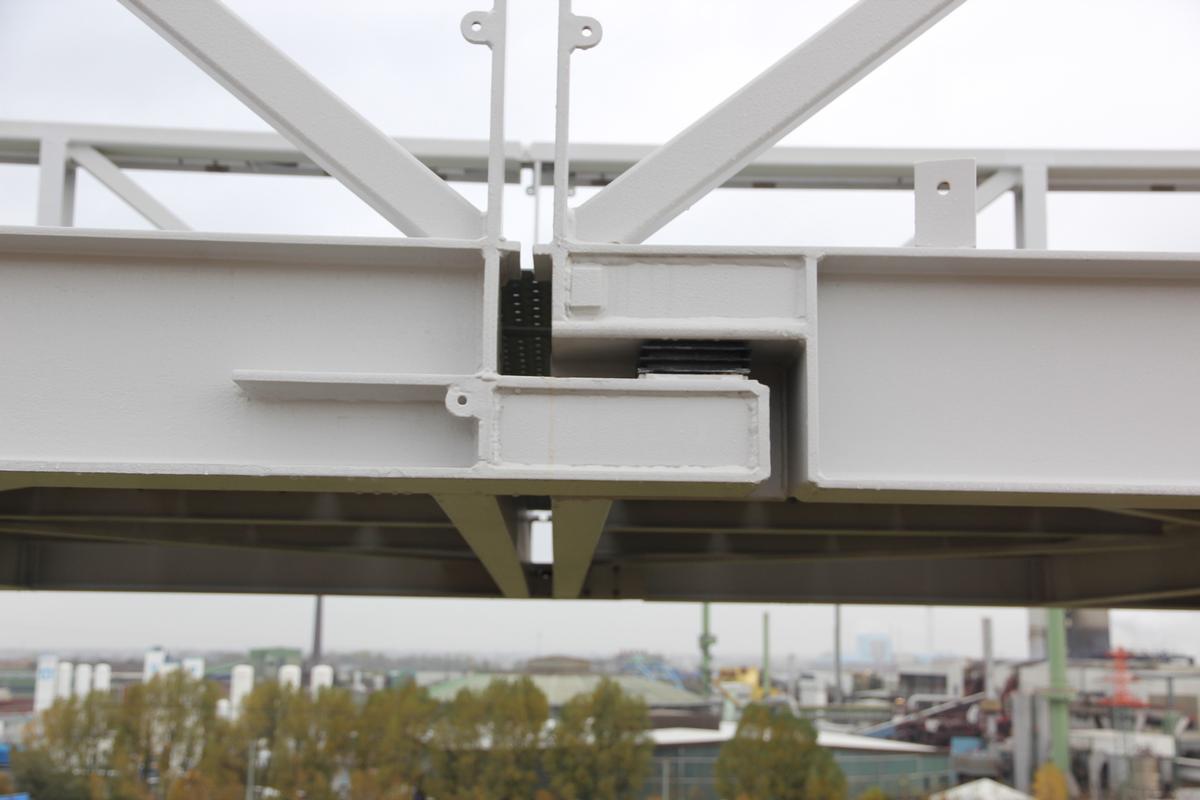
The main structure of the steel web construction is formed by railing-integrated hybrid girders - partly truss girders, partly Vierendeel girders - which are supported in the column axes by main cross girders. The girders have a span of 14 - 16 m. The lattice girders are connected to the main cross girders, each of which is supported by A - shaped column trestles, which also provide bracing in the transverse and longitudinal directions. The walkway decking consists of transversely supporting profiled sheet metal planks resting on longitudinal girders. The railing is clad on the outside with perforated metal sheets.
The walkway is planned as a tanner system. In every second bay, the trusses support as a single-span system with cantilevers (frames) on both sides, and shorter single-span girders are hinged in between. The statically determined support is necessary because of the large continuous settlement movements measured at the landfill. In addition, the joints are designed as expansion joints with elastomeric bearings for reasons of temperature expansion.
The double supports will each receive a common foundation as a shallow foundation in order not to destroy the geomembrane of the landfill. The connection of the columns to the foundation components was made in such a way that the different vertical settlements can be compensated. The foundations have a construction height of 40-50 cm, are founded at least 80 cm below the top edge of the ground and receive a frost-proof gravel pad at least 20 cm thick. The foundations do not interfere with the existing surface drainage above the landfill seal and are dimensioned in your size so that, on the one hand, the permissible increase in the stress on the seal of the landfill by 50 kN/m² is observed and, on the other hand, a sufficient sliding safety is guaranteed.
The geotechnical report for the foundation provided specifications for the expected settlements. It specifies maximum settlement differences for two adjacent foundations at a distance of about 14m of 5cm. For geometric reasons, it is unrealistic to accommodate such a large settlement difference in the supporting structure. Therefore, in the design of the overall structure, only a settlement difference of adjacent foundation bodies in the longitudinal web direction of Δez = 2cm was considered. In the transverse direction of the web, a skewing of the foundation bodies of Δα = 0.2° was provided. In case of larger settlement differences of adjacent foundation bodies, the web can be vertically readjusted. For this purpose, suitable compensation facilities have been planned in the footings of the columns to be able to compensate for different vertical settlements.
According to the available geotechnical report, horizontal deformations in the north-south direction of approx. 2mm/a and in the east-west direction of approx. 7mm/a are to be expected in each outward direction with an east-west and north-south extension of approx. 400m. Assuming a service life of approx. 25 years, a movement possibility of Δex = 1mm/m construction length is provided for. For this purpose, the corresponding support details in the area of the expansion joints are designed in such a way that they can be readjusted if necessary. The settlements of the jetty - as well as the entire landfill - will be checked by regular measurements by the Hamburg Office of Geoinformation.
Explanatory report by ifb frohloff staffa kühl ecker (Berlin) for submission to the Ulrich Finsterwalder Ingenieurbaupreis 2015
Participants
- Bernd von Seht (checking engineer)

Relevant Web Sites
There currently are no relevant websites listed.
- About this
data sheet - Structure-ID
20066613 - Published on:
11/11/2014 - Last updated on:
21/04/2016


