
General Information
Project Type
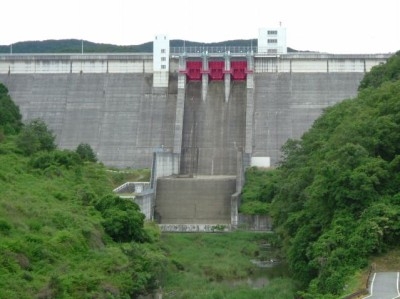
| Structure: |
Gravity dam |
|---|---|
| Function / usage: |
Irrigation & industrial water dam Fresh water dam |
| Material: |
Concrete dam |
Location
Technical Information
Dimensions
| height | 71.5 m | |
| retained water volume | 18 860 000 m³ | |
| crest length | 260 m | |
| dam volume | 370 000 m³ |
Excerpt from Wikipedia
Dondo Dam (呑吐ダム) is a dam in Miki, Hyōgo Prefecture, Japan. Catching the waters of the Sijimi and Yamada rivers, the catchment becomes known as Tsukuhara Lake.
Uses
Other than just creating hydro electricity the catchment area of 328.8km² provides drinking water supply and industrial supply to nearby Kobe; as well as irrigation, flood control, removal of melting snow and recreational uses.
Text imported from Wikipedia article "Dondo Dam" and modified on July 23, 2019 according to the CC-BY-SA 4.0 International license.
Participants
Currently there is no information available about persons or companies having participated in this project.
Relevant Web Sites

- About this
data sheet - Structure-ID
20041426 - Published on:
18/12/2008 - Last updated on:
04/06/2023
Structurae cooperates with


