
General Information
Project Type
| Structure: |
Embankment dam |
|---|---|
| Function / usage: |
Irrigation & industrial water dam Flood-control dam Lock |
| Structure: |
Mobile barrage |
Location
| Location: |
Mauritania Senegal |
|---|---|
| Impounds: |
|
| Coordinates: | 16° 13' 1.52" N 16° 24' 53.16" W |
Technical Information
Dimensions
| height | 18 m | |
| retained water volume | 250 000 000 m³ | |
| crest length | 610 m | |
| spillway capacity | 6 500 m³/s | |
| water surface area | 235 km² |
Excerpt from Wikipedia
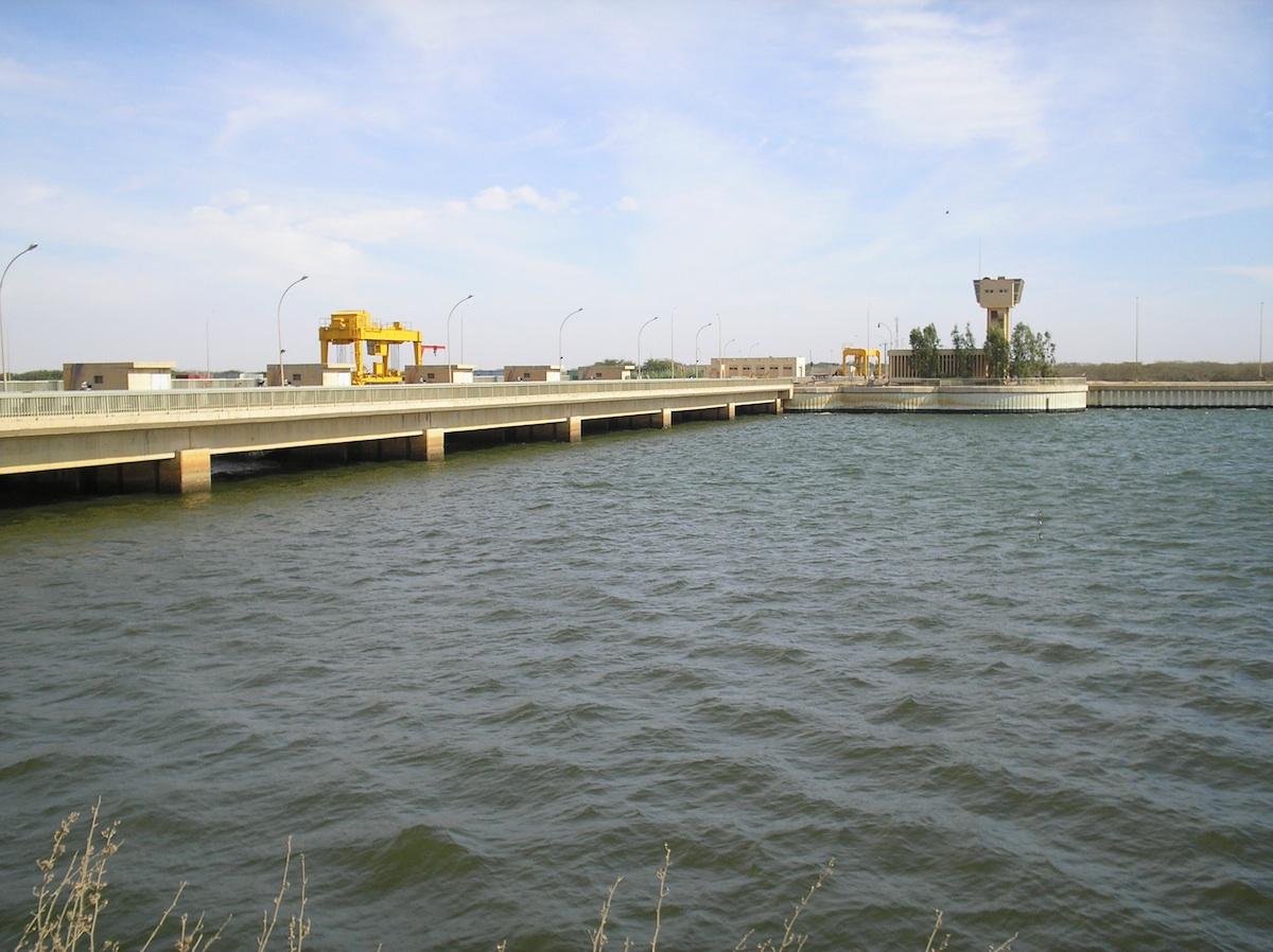
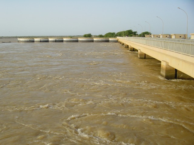
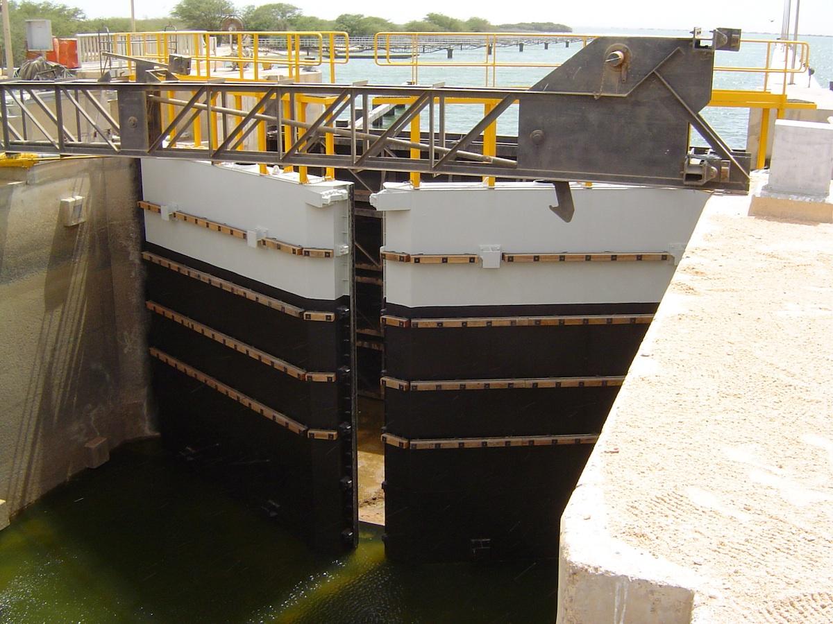
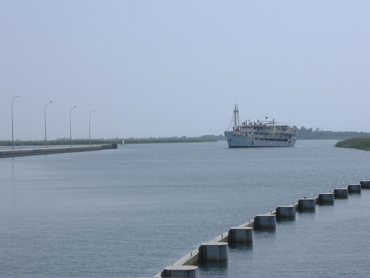
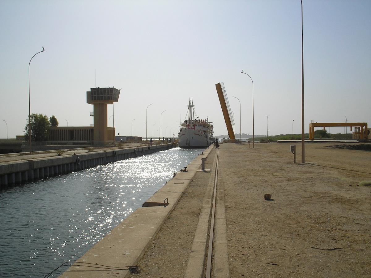
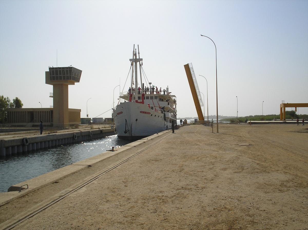
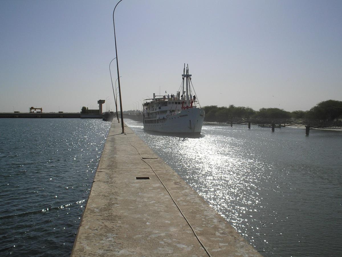
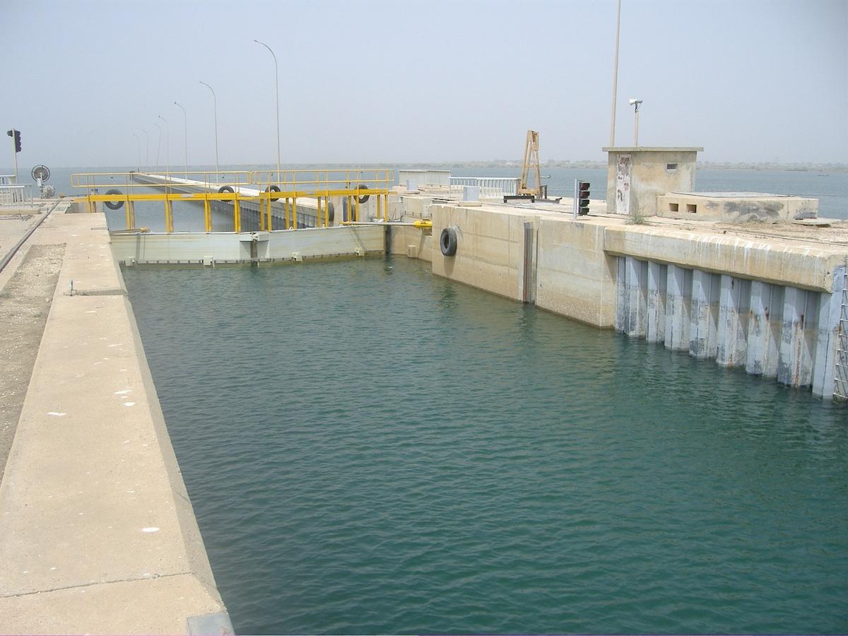
The Diama Dam, sometimes referred to as the Maka–Diama Dam, is a gravity dam on the Senegal River, spanning the border of Senegal and Mauritania. It is located next to the town of Diama, Senegal and about 22 km (14 mi) north of Saint-Louis, Senegal. The purpose of the dam is to prevent saltwater intrusion upstream, supply water for the irrigation of about 45,000 ha (110,000 acres) of crops and create a road crossing for the road between St. Louis and Nouakchott in Mauritania. Additionally, a ship lock built within the dam provides for navigation upstream. Plans for the dam were first drawn in 1970 when the riparian states within the Senegal River Basin Development Authority agreed to develop the Senegal River. The Diama Dam was to be constructed in conjunction with the Manantali Dam which was to be located further upstream in Mali. Construction on the Diama Dam began on 15 September 1981 and was completed on 12 August 1986. The Manantali Dam was completed in 1988. The Diama project was funded by a US$149.5 million loan from the African Development Bank. The main section of the dam with ship lock and spillway is 170 m (560 ft) long while a 440 m (1,440 ft) long embankment dam section extends north to the edge of the river. A dike further extends the dam to the north. The dam is 18 m (59 ft) tall and it is spillway has a maximum discharge of 6,500 m³/s (230,000 cu ft/s).
The small town of Diama is known as a border crossing to and from Mauritania, as the dam is the only land bridge between the two countries.
Text imported from Wikipedia article "Diama Dam" and modified on July 23, 2019 according to the CC-BY-SA 4.0 International license.
Participants
- Claude Bourdon (designer)
Relevant Web Sites

Relevant Publications
- (1987): Barrage de Diama (Sénégal). Essais in situ et battage des palplanches. In: Travaux, n. 622 (June 1987), pp. 34-40.
- (1984): Le barrage de Diama au Sénégal. In: Travaux, n. 593 (November 1984), pp. 38-42.
- (1986): Le barrage de Diama sur le fleuve Sénégal. Maîtrise de la rivière. In: Travaux, n. 607 (February 1986), pp. 17-19.
- About this
data sheet - Structure-ID
20009267 - Published on:
13/05/2003 - Last updated on:
02/01/2018


