General Information
Project Type
| Structure: |
Cable-stayed bridge with fan system |
|---|---|
| Function / usage: |
Road bridge |
| Material: |
Steel bridge |
| Structure: |
Two-span cable-stayed bridge |
| Support conditions: |
for registered users |
| Secondary structure(s): |
Structurae Plus/Pro - Subscribe Now! Structurae Plus/Pro - Subscribe Now! |
| Material: |
Structurae Plus/Pro - Subscribe Now! |
| Material: |
Structurae Plus/Pro - Subscribe Now! |
| Secondary structure(s): |
Structurae Plus/Pro - Subscribe Now! |
Location
| Location: |
Sidmouth, Tasmania, Australia Hillwood, Tasmania, Australia |
|---|---|
| Crosses: |
|
| Coordinates: | 41° 13' 1.56" S 146° 54' 53.13" E |
Technical Information
Dimensions
| span lengths | 54.88 m - 205.74 m - 48.02 m - 3 x 41.16 m | |
| number of spans | 6 | |
| deck | deck depth | 4.50 m |
| deck width | 10.30 m | |
| stay anchor spacing | ca. 48 m | |
| piles | length | 18.3 m |
| pylon | pylon height | 91.00 m |
Materials
| cables |
steel
|
|---|---|
| pylon |
steel
|
| piers |
steel
|
| deck truss |
steel
|
| piles |
steel
|
Excerpt from Wikipedia
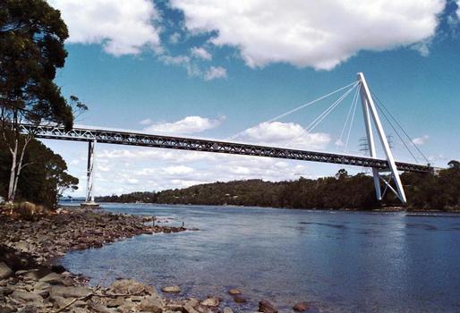
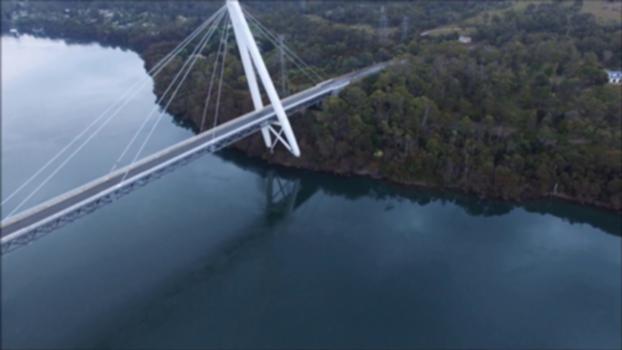
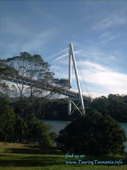
The Batman Bridge is a modern road bridge that carries the Batman Highway across the Tamar River, between Whirlpool Reach, Hillwood at its eastern end and Sidmouth / Deviot midpoint at its western end, in north Tasmania, Australia. The bridge connects the Batman Highway with the West Tamar Highway (state route A7) and the East Tamar Highway (state route A8). The bridge overlooks the Deviot Sailing Club and is named in honour of John Batman, a Launceston businessman and co-founder of Melbourne.
Design features
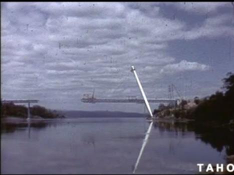
Built between 1966 and 1968, it was the first cable-stayed bridge in Australia and among the first such bridges in the world. The main span is 206 metres (676 ft) long, suspended from a 91-metre-high (299 ft) steel A-frame tower. The deck is 10.3 metres (34 ft) wide. The tower is on the west bank of the Tamar river, on a solid dolerite rock base which carries 78% of the weight of the main span. The length of the bridge is 432 metres (1,417 ft) between abutments. The east bank is soft clay not capable of supporting a bridge. A causeway carries the highway across this softer base, supported by four piers built on piles driven up to 18 metres (59 ft) into the clay. The bridge deck is constructed of steel.
Text imported from Wikipedia article "Batman Bridge" and modified on February 11, 2021 according to the CC-BY-SA 4.0 International license.
Participants
Relevant Web Sites
Relevant Publications
- (1971): Batman bridge. In: La Technique des Travaux, v. 47, n. 3-4 (March 1971), pp. 105-111.
- (1998): The Batman Bridge: Structural Monitoring using GPS. Presented at: Advances in GPS Deformation Monitoring, 24-25 September, 1998, Perth, Western Australia, pp. 8.
- (2003): Bridging the World. Bridge Ink, Wilsonville (USA).
- (1977): Cable-Stayed Bridges. Theory and design. Crosby Lockwood Staples, London (United Kingdom), pp. 386.
- (2019): Global Navigation Satellite System‐based positioning technology for structural health monitoring: a review. In: Structural Control and Health Monitoring, v. 27, n. 1 (19 December 2019).
- About this
data sheet - Structure-ID
20000885 - Published on:
28/08/2000 - Last updated on:
21/01/2021


