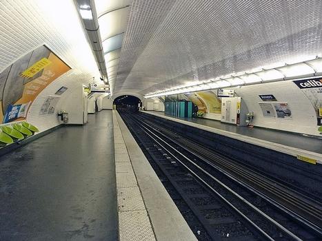
General Information
| Completion: | 7 October 1902 |
|---|---|
| Status: | in use |
Project Type
| Function / usage: |
Below grade metro or light-rail station |
|---|
Location
| Location: |
Paris ( 9th), Paris, Ile-de-France, France Paris (18th), Paris, Ile-de-France, France |
|---|---|
| Part of: | |
| Coordinates: | 48° 52' 58.80" N 2° 20' 41.46" E |
Technical Information
There currently is no technical data available.
Excerpt from Wikipedia
Anvers (Sacré-Cœur) is a station on Paris Métro Line 2, on the border of the 9th and the 18th arrondissements in Montmartre.
The station was opened on 21 October 1902 as part of the extension of line 2 from Étoile. It was the eastern terminus of the line until its extension to Bagnolet (now called Alexandre Dumas) on 31 January 1903. The station is named after the Place d'Anvers and the city of Antwerp (Anvers in French).
The station is located under the Boulevard de Rochechouart, which was built on the route of the Wall of the Farmers-General in order to enforce the collection of taxation between 1784 and 1791 but demolished in the 19th century. Anvers (Sacré-Cœur) is only station on line 2 between the Charles de Gaulle—Étoile and the Nation stations that is not built on the site of a gate (or barrière in French) of the wall, which became important intersections and thus, logical places for stations. Instead, Anvers station was placed as close to the foot of the Montmartre funicular as possible. Nevertheless, the Barrière de Rochechouart was at the east, near the junction of the Boulevard de Rochechouart and the Rue de Rochechouart. Also near are the hill of Montmartre and the Basilica of the Sacré-Cœur
Text imported from Wikipedia article "Anvers (Paris Métro)" and modified on July 23, 2019 according to the CC-BY-SA 4.0 International license.
Participants
Currently there is no information available about persons or companies having participated in this project.
Relevant Web Sites
- About this
data sheet - Structure-ID
20051401 - Published on:
07/01/2010 - Last updated on:
25/01/2022


