

General Information
Project Type
| Structure: |
Gravity dam |
|---|---|
| Material: |
Concrete dam |
| Function / usage: |
Hydroelectric dam / plant Flood-control dam |
Location
| Location: |
Cuenca, Castile-La Mancha, Spain |
|---|---|
| Impounds: |
|
| Coordinates: | 39° 33' 52.15" N 2° 6' 43.98" W |
Technical Information
Dimensions
| height | 67 m | |
| crest length | 317 m | |
| reservoir capacity | 1 112 000 000 m³ | |
| spillway capacity | 1 750 m³/s | |
| dam volume | 229 630 m³ |
Materials
| dam structure |
concrete
|
|---|
Excerpt from Wikipedia
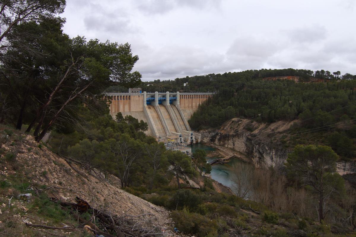
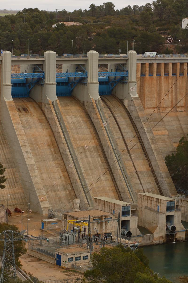
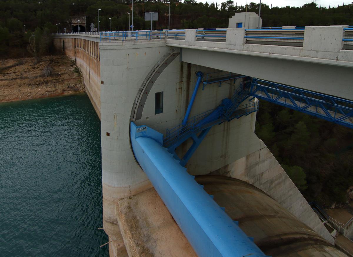
The Alarcón Dam (Spanish: Presa de Alarcón, Pantano de Alarcón, or Embalse de Alarcón) is a gravity dam on the upper course of the Júcar River. It is located 6 kilometers (4 miles) from Alarcón, in the province of Cuenca, in the autonomous community of Castilla-La Mancha, Spain.
The reservoir formed by the dam has a water capacity of 1,112 cubic hectometers3 (901,513 acre-feet) and spans a surface area of 6,840 hectares (26 square miles). All together, its drainage basin measures 3,033 km² (1,171 mi2). The dam houses a hydroelectric power plant with an installed power capacity of 56 MW.
The Tagus-Segura Water Transfer, which links two other major rivers, joins the reservoir briefly on its journey south, entering at the northern tail end and mixing its waters with the Júcar.
Construction of the dam began in 1941 through the efforts of Valencian farmers who wanted to stabilize the flow of the river, as irrigation in the province of Valencia depends on that supply of water. This initiative is unique in Spanish history because rather than the State, it was the farmers who assumed the total cost of the project, having organized under the Unidad Sindical de Usuarios del Júcar (USUJ, Júcar Users' Coalition), an alliance of irrigation communities [es].
Beneath the waters of the Alarcón Reservoir rest the remains of the town of Gascas, which was flooded after the building of the dam. When the water level drops, one can see traces of the streets and walls, as well as a stone wall with an arch.
The reservoir is located within the municipal districts of the following towns (from east to west): Alarcón, Olmedilla de Alarcón, Tébar, Cañada Juncosa, Buenache de Alarcón, Honrubia, Torrubia del Castillo, Hontecillas, Valverde de Júcar, Castillo de Garcimuñoz, Villaverde y Pasaconsol, La Almarcha, Belmontejo, and Olivares de Júcar.
Text imported from Wikipedia article "Alarcón Dam" and modified on July 23, 2019 according to the CC-BY-SA 4.0 International license.
Participants
Currently there is no information available about persons or companies having participated in this project.
Relevant Web Sites

Relevant Publications
- (2013): Refuerzo de los tableros de la N-III sobre los aliviaderos de la presa de Alarcón. In: Hormigón y acero, v. 64, n. 269 (3rd Quarter 2013), pp. 77-98.
- About this
data sheet - Structure-ID
20076015 - Published on:
30/09/2018 - Last updated on:
01/10/2018


