
General Information
| Completion: | 26 August 1960 |
|---|---|
| Status: | in use |
Project Type
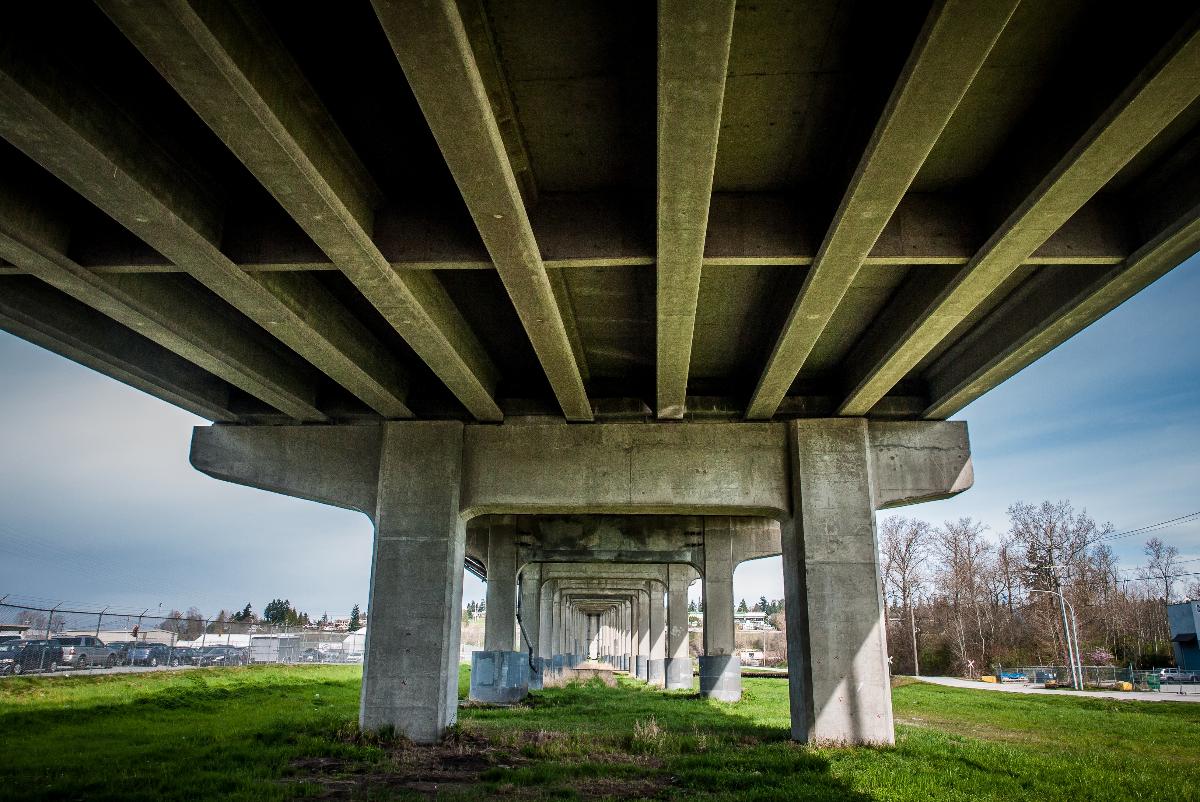
| Structure: |
Haunched girder bridge |
|---|---|
| Support conditions: |
for registered users |
| Secondary structure(s): |
Structurae Plus/Pro - Subscribe Now! Structurae Plus/Pro - Subscribe Now! |
| Function / usage: |
Road bridge |
| Material: |
Steel bridge Structurae Plus/Pro - Subscribe Now! |
Location
| Location: |
New Westminster, British Columbia, Canada |
|---|---|
| Crosses: |
|
| Replaces: |
Queensborough Bridge (1909)
|
| Coordinates: | 49° 11' 46.48" N 122° 56' 49.78" W |
Technical Information
Dimensions
| total length | 924 m | |
| number of spans | 41 |
Cost
| cost of construction | Canadian dollar 4 000 000 |
Materials
| piers |
reinforced concrete
|
|---|---|
| girder |
steel
|
| deck slab |
reinforced concrete
|
Excerpt from Wikipedia
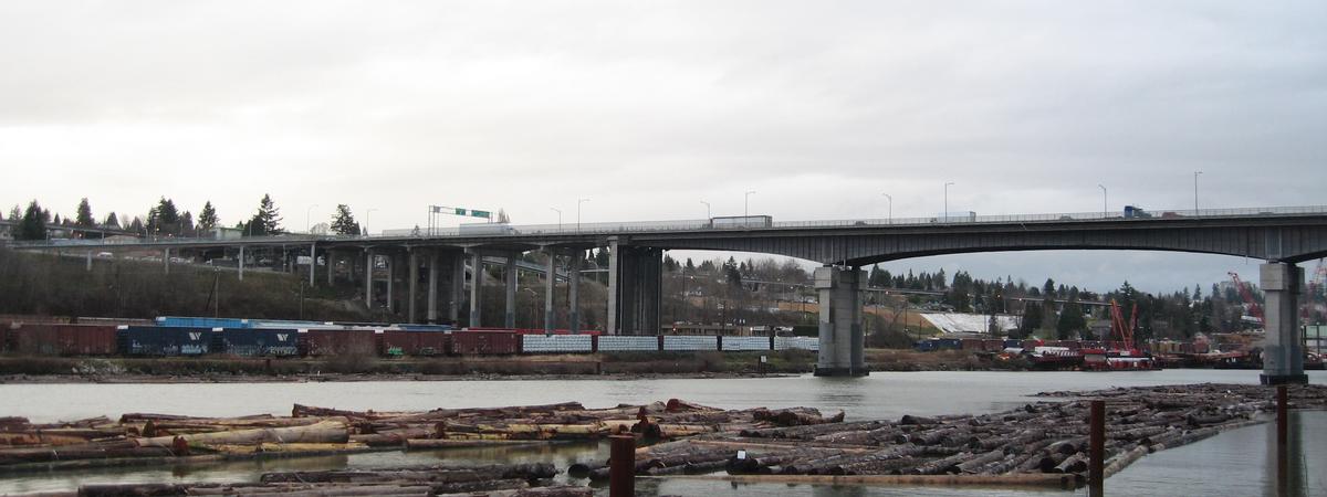
Queensborough Bridge is a highway bridge in New Westminster, British Columbia. It was built in 1960 by the City of New Westminster, costing $4 million. The bridge spans the north arm of the Fraser River for road access from the main part of New Westminster to the suburb of Queensborough at the east end of Lulu Island, giving the bridge its name.
It has since become a part of Highway 91A feeder to Highway 91 to the south. Queensborough was a toll bridge until bought by the provincial government in November 1966. In 2008, the northern exit has been upgraded into a better intersection with Marine Way and Stewardson Way.
Text imported from Wikipedia article "Queensborough Bridge" and modified on July 23, 2019 according to the CC-BY-SA 4.0 International license.
Participants
Currently there is no information available about persons or companies having participated in this project.
Relevant Web Sites

Relevant Publications
- (2017): Condition Assessment and Renewal Options Analysis for the Queensborough Bridge. Presented at: IABSE Symposium: Engineering the Future, Vancouver, Canada, 21-23 September 2017, pp. 2512-2519.
- (1995): Experimental Investigations of Dynamics of Queensborough Bridge. In: Journal of Performance of Constructed Facilities (ASCE), v. 9, n. 2 ( 1995), pp. 146-155.
- (1996): Richmond and its Bridges. Fifteen Crossings of the Fraser River. Richmond (Canada).
- About this
data sheet - Structure-ID
20005898 - Published on:
03/10/2002 - Last updated on:
06/06/2023


