General Information
| Completion: | 1819 |
|---|---|
| Status: | out of service |
Project Type
| Structure: |
Segmental arch bridge |
|---|---|
| Function / usage: |
Road bridge |
| Material: |
Masonry bridge Structurae Plus/Pro - Subscribe Now! |
Location
| Location: |
Hagerstown, Washington County, Maryland, USA |
|---|---|
| Crosses: |
|
| Coordinates: | 39° 39' 28.44" N 77° 50' 52.82" W |
Technical Information
Materials
| arches |
masonry
|
|---|
Excerpt from Wikipedia
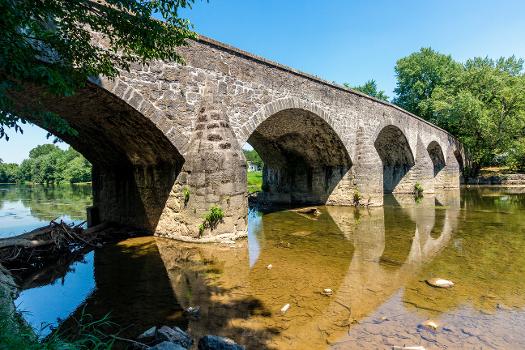
Wilson's Bridge is a bridge near Hagerstown, Washington County, Maryland, United States. It originally carried the Hagerstown and Conococheague Turnpike, the National Road, across Conococheague Creek 7 miles (11 km) west of Hagerstown. The five-arched structure, the longest of the county's stone bridges, is 210 feet (64 m) in length and is constructed of coursed local limestone. The bridge was erected in 1819 by Silas Harry, who had built similar bridges in Pennsylvania. The bridge was closed in June 1972 when it was damaged by floods which occurred during Tropical Storm Agnes.
Wilson's Bridge was listed on the National Register of Historic Places in 1982.
Text imported from Wikipedia article "Wilson''s Bridge" and modified on November 30, 2021 according to the CC-BY-SA 4.0 International license.
Participants
- Silas Harry (builder)
Relevant Web Sites
- About this
data sheet - Structure-ID
20007195 - Published on:
10/12/2002 - Last updated on:
22/12/2021


