
General Information
Project Type
| Function / usage: |
Flood-control dam Irrigation & industrial water dam Hydroelectric dam / plant |
|---|---|
| Material: |
Concrete dam |
| Structure: |
Gravity dam |
Location
Technical Information
Dimensions
| height | 49.50 m | |
| total length | 2 449 m |
Excerpt from Wikipedia
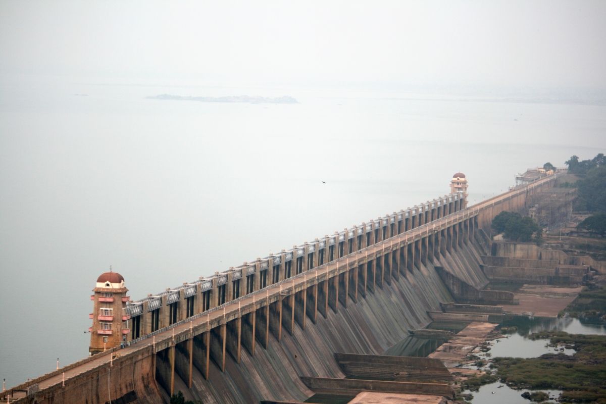
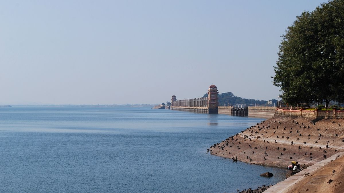
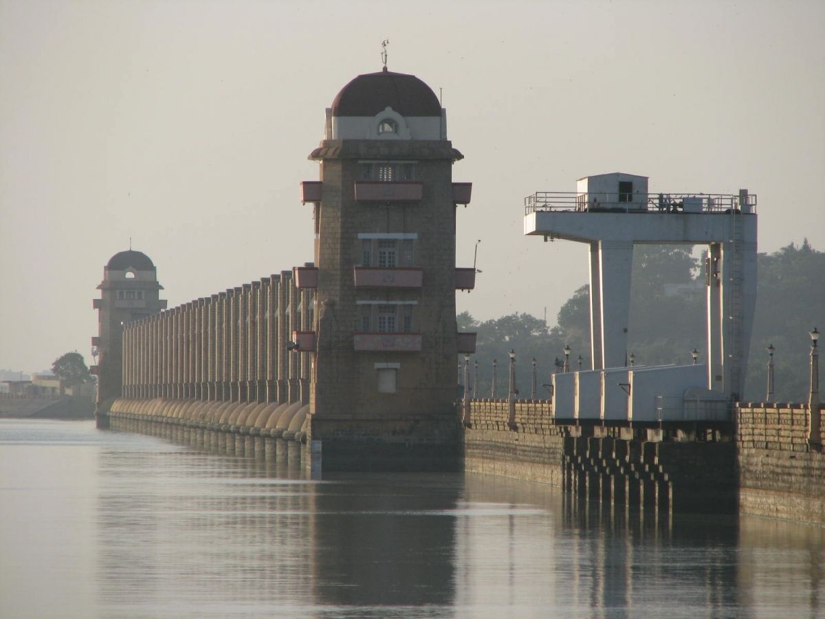
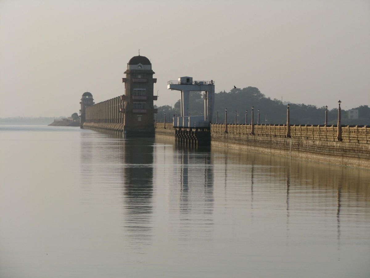
The Tungabhadra Dam also known as Pampa Sagar is constructed across the Tungabhadra River, a tributary of the Krishna River. The dam is in Hosapete, Ballari district of Karnataka. It is a multipurpose dam serving irrigation, electricity generation, flood control, etc. This is a joint project of erstwhile Hyderabad state and erstwhile Madras Presidency when the construction was started; later it became a joint project of Karnataka and Andhra Pradesh after its completion in 1953. The main architect of the dam was Dr Thirumala Iyengar, an engineer from Madras . There is a dispute between Andhra Pradesh,Telangana and Karnataka for the water of Tungabhadra reservoir. The main contractor for the dam was Venkat Reddy Mulamalla, from Konour village, Mahabubnagar, Hyderabad state.
History
The endemic famine region of Rayalseema, comprising the districts of Bellary, Anantapur, Kurnool and Cuddapah attracted the attention of the British Engineers as early as 1860. To relieve the intensity of famine in these districts, proposals were made in 1860 to utilize the waters of Tungabhadra through a storage reservoir and a system of canals to provide irrigation for the lands.
Sir Arthur Cotton originally conceived the Tungabhadra Project in the year 1860. The proposals were further modified and developed subsequently evolving it into a joint scheme with Hyderabad. N. Paramseswaran Pillai accordingly revised the Scheme in 1933. Several agreements were concluded in the past for harvesting and imposing certain restrictions on utilizing the Tungabhadra waters. Protracted negotiations and investigations lasted for about eighty years. The Government of Madras in 1940 ordered for the detailed investigation of the scheme. Based on the agreements concluded and examination of a number of alternatives by L. Venkata Krishna Iyer, the then Superintending Engineer, Bellary, and F. M. Dowley, Chief Engineer, Irrigation, further detailed investigations of the project was done by M. S. Thirumale Iyengar on the Madras side in the year 1942. The Agreement between Madras and Hyderabad of June 1944 enabled the Madras and Hyderabad Governments finally to start the construction of the Tungabhadra project.
The Tungabhadra Project was formally inaugurated by laying foundation stone on 28th February, 1945 by "Prince of Berar" on the left side and by Sir Arthur Hope, Governor of Madras on right side. However, much headway could not be made up to January 1949. Difference of opinion in certain technical matters and settled political situation in Hyderabad were the reasons for the slow progress. The Madras and the Hyderabad engineers were sharply divided on:
- Nature of mortar to be used in the construction of the dam
- Design of spillway
- Design of over flow and non-overflow sections of the dam and
- Contraction joints
These differences were referred to a Board of Engineers under the Chairmanship of M. Visveswaraya, a Statesman-cum-Engineer.
Dam construction
Excavation in the riverbed was started in 1947 and masonry construction on 15 April 1949. With help of a cofferdam constructed earlier, foundation excavation was continued during flood season also. The river bed portion was tackled during the summer of 1950 (1949–50). Masonry in the riverbed blocks was started in the year 1951. Thereafter there was vigorous progress in works. By October 1953 the structures were completed substantially enabling the storage of water in the reservoir up to +1613.00 ft. Acquisition of lands and villages and rehabilitation of persons displaced from the water spread area up to 1630 ft contour were completed by September, 1953 in all respects. About 90 villages and 54,452 people were effected. The balance of the works namely the spillway, bridge road on the top of the dam, construction of utility tower, manufacture of crest grates for storing water up to 1633 level were completed in all respects by the end of June 1958. The cost of dam and appurtenant works was Rs. 16.96 crores. The water was led down into the canal on 1 July 1953 to derive partial benefits.
Timeline of the construction of the dam:
Foundation excavation Completed by June 1952 Masonry Completed by October 1953 Drilling and Grouting Completed by August 1955 Crest Gates, embedded part Completed by February 1955 Spillway shutters Completed by June 1955 Operation bridges Completed by February 1956 Counterweight erection Completed by January 195 Hoists Completed by January 1957 Gate House Completed by June 1957 Utility Tower Completed by June 1958
Power Canal works started in June 1954 and were completed by May 1957.
The project submitted by M. S. Tirumale Iyengar in 1942 for Low Level Canal was accepted by Government of Madras with certain modifications fixing sill level at RL 1550 ft. The Low Level Canal excavation was completed by 1953 up to Mile 173. The balance portion of canal from Mile 173 to 203 that had to be excavated by the GOAP was completed by the end of March 1957.
As major portion of the construction of the dam was over by the middle of 1953, the reservoir circle was entrusted with the construction of canal works in 1956. In 1958 water was let out up to and inclusive of distributory 42 to serve an area of about 1.80 lakh acres.
By 1952, when project sanctioned by both the Government’s for constituting Tungabhadra Reservoir and the canals reached advance and decisive stage of construction, the Government of Madras in GO 382 dated 30-1-1952 ordered investigation of the High Level Canal. On 15-11-1952 detailed estimates were got prepared up to Mile 79/2 covering the reach just before Chinna-Hagari and by 1954 the investigation of the remaining portion of canal from Mile 79/2 to Mile116/0 was completed and project report submitted to Government of India for approval. The proposals were further reviewed and a final project report to the Planning Commission costing Rs.21.90 crores for head discharge of 4000 cusecs for clearance. The CWC advised the participating states to execute the project in two stages. The 1st stage contemplated an unlined canal with a head discharge of 2300 cusecs and the 2nd stage a lined canal with 4000 cusecs head discharge.
The 1st stage scheme was inaugurated by the Governor of Andhra Pradesh on 2 October 1956 under the presidency of the Chief Minister of Mysore. The 1st stage work was almost completed by June 1966 at a cost of Rs. 920 lakhs and canal commissioned by releasing water for Irrigation on 27 July 1966. The 2nd stage works were approved by the Board in June 1967 for Rs.385 lakhs. The works were completed by June 1970 at an estimated cost of Rs.487 lakhs.
The Tungabhadra Hydro Electric Scheme was undertaken in the composite Madras State in the post war period under the first five-year plan in the year 1950. The work on the project was taken up in the year 1951 but no appreciable progress was achieved till the end of the year 1953. During 1957 two units of 9 MW each at Dam Power House were installed and in 1958 two units of 9MW each were installed at Hampi Power House. Thus the first stage of the scheme was completed in 1958 and the second stage under this scheme was taken up in the year 1959. The plant erection was started in the Dam Power House in Nov.1962 and in the Hampi Power House in February `1963. Under stage II the units 3 and 4 of both, Dam Power House and Hampi Power House started functioning by June 1964.
On left side the powerhouse is designed to accommodate 4 units of 9MW each. The stage I power generation commissioned during 1960-61.
Agreements for harnessing Tungabhadra waters
Issue of sharing of waters of river Tungabhadra has its genesis in 1861 when Kurnool-Cuddapah Canal (KC Canal) was proposed by the then Government of Madras. Despite agreement on construction of KC Canal project, there was no general agreement on sharing of Tungabhadra waters between Government of Madras and Government of Mysore. In 1930, Government of Madras proposed a joint project on the Tungabhadra. Subsequently, a number of conferences between the Governments of Madras, Mysore, Hyderabad and Bombay took place, but all were inconclusive. In 1936, there was an agreement between Governments of Madras and Mysore, followed up by an agreement between Governments of Madras and Hyderabad in 1938. However, due to some differences in interpretation of the agreement between Governments of Madras and Hyderabad no substantial progress was made in implementation of the project. It was in a conference between the Governments of Madras and Hyderabad held on 26 June 1944, that a final decision was arrived at on the allocation of waters as well as on taking up the project jointly and sharing the cost equally between the two States.
Tungabhadra River
The river Tungabhadra derives its name from two streams viz., the Tunga, about 147 km (91.6 miles) long and the Bhadra, about 178 km (110.9 miles) long which rise in the Western Ghats. The river after the influence of the two streams near Shimoga, runs for about 531 km (330 miles) till it joins the river Krishna at Sangamaleshwaram in Andhra Pradesh. It runs for 382 km (237 miles) in Karnataka, forms the boundary between Karnataka and Andhra Pradesh for 58 km (36 miles) and further runs for the next 91 km (57 miles) in Andhra Pradesh. The total catchment area of the river is 69,552 km² (26,856 Sq miles) up to its confluence with Krishna and it is 28,177 km² (10,880 Sq miles) up to Tungabhadra Dam. It is influenced chiefly by the South-West monsoon. It is a perennial river but the summer flows dwindle to as low as 2.83 to 1.42 cumec (100 to 50 cusec).
Technical details
The dam creates the biggest reservoir on the Tungabhadra River with 101 tmcft of gross storage capacity at full reservoir level (FRL) 498 m MSL, and a water spread area of 378 square kilometres. The dam is 49.39 meters high above its deepest foundation. The left canals emanating from the reservoir supplies water for irrigation entirely in Karnataka state. Two right bank canals are constructed — one at low level and the other at high level serving irrigation in Karnataka and Rayalaseema region of Andhra Pradesh. Hydropower units are installed on canal drops. The reservoir water is used to supply water to downstream barrages Rajolibanda and Sunkesula located on the Tungabhadra River. The identified water use from the project is 220 tmcft by the Krishna Water Disputes Tribunal. Karnataka and Andhra Pradesh got 151 tmcft and 79 tmcft water use entitlement respectively.
Future potential
On the right side of the dam, tall Sanduru hill ranges extending up to 800 m MSL are close to the periphery of the Tungabhadra reservoir. These hill ranges form the Sanduru valley located above 600 m MSL. This reservoir is an ideal place to install pumped storage hydropower plants and lift irrigation projects. A moderate high level storage reservoir of capacity 20 tmcft at FRL 620 m MSL, can be constructed by damming the Sanduru valley. This reservoir will serve as upper pond and existing Tungabhadra reservoir as tail pond for installing pumped-storage hydroelectricity units. The water pumped during the monsoon months into the upper pond can be diverted by gravity to irrigate an extensive area in the uplands up to 600 m MSL in Rayalaseema and Karnataka. This water can be pumped further to meet the drinking water requirements of Bengaluru city.
However, the available water resources at Tungabhadra dam are over-used, and water shortages are frequent. Water availability in the reservoir could be augmented by transferring water from the Krishna River, if a link canal were constructed from the Almatti reservoir to the Tungabhadra reservoir. Envisaging small balancing reservoirs where this link canal is intercepting the tributaries of Tungabhadra River would facilitate water diversion to Tungabhadra reservoir for augmenting further water availability. Once the Almatti reservoir FRL is raised to 524 m MSL, this canals full supply level (FSL) can also be increased to 516 m MSL from 510 m MSL to reduce its construction cost and serve more area for irrigation in Karnataka.
Flooding Tungabhadra dam
Nearly 180 tmcft out of 230 tmcft water presently supplied from Tungabhadra reservoir to various canals can be replaced by reliable Krishna river water from the Narayanpur reservoir. These are water supply to mid and lower reaches of Tungabhadra left bank canal, water assistance to Rajolibanda canal, water assistance to KC canal and mid and lower reaches of Tungabhadra right bank low level canal. This is achieved with a 20 km long tunnel from Narayanpur reservoir to the Maski nala reservoir / tank situated at 475 m MSL for drawing nearly 250 tmcft Krishna river water. From this tank, north canal would supply Krishna river water by gravity flow to the lower reaches of Tungabhadra left bank canal in addition to bringing substantial uplands under irrigation in Karnataka and Telangana. From this tank, south canal would supply Krishna river water by gravity flow to the middle portion of Tungabhadra left bank canal in addition to bringing substantial uplands under irrigation in Karnataka and also connected to the Tungabhadra right bank low level canal at 425 m MSL near 15°22′09″N 76°32′55″E / 15.36917°N 76.54861°E / 15.36917; 76.54861 (Tungabhadra RB LLC) through a 1.5 km long aqueduct over Tungabhadra main river. Water is also released from the Maski nala in to downstream Tungabhadra main river to meet continuous water needs of downstream Rajolibanda canal and KC canal. 180 tmcft water in addition to the water diverted from the Almatti reservoir to Tunghbadra reservoir can be utilised for uplands irrigation in Tungabhadra basin and Rayalaseema region of Andhra Pradesh. When these joint projects of Karnataka and Andhra Pradesh are constructed, nearly 400 tmcft water additionally will be available for irrigation and drinking purposes in the high drought risk uplands of Rayalaseema and Karnataka.
Text imported from Wikipedia article "Tungabhadra Dam" and modified on August 5, 2019 according to the CC-BY-SA 4.0 International license.
Participants
Currently there is no information available about persons or companies having participated in this project.
Relevant Web Sites

Relevant Publications
- (2011): Electrical Resistivity Survey On The Left Branch Canal Of High Embankment Of Tungabhadra Dam, Miles 69, 77 & 85, Karnataka State. In: ISH Journal of Hydraulic Engineering, v. 17, n. 1 (January 2011), pp. 43-49.
- (1961): La presa de Tungabhadra. In: Informes de la Construcción, v. 14, n. 134 (October 1961).
- About this
data sheet - Structure-ID
20078056 - Published on:
02/08/2019 - Last updated on:
03/08/2019


