
General Information
Project Type
| Structure: |
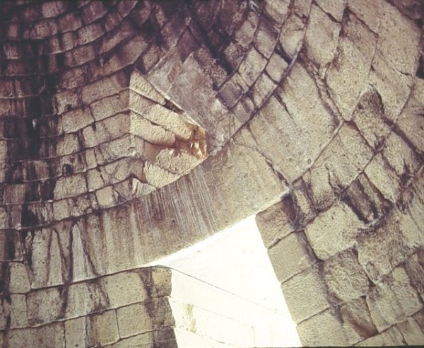
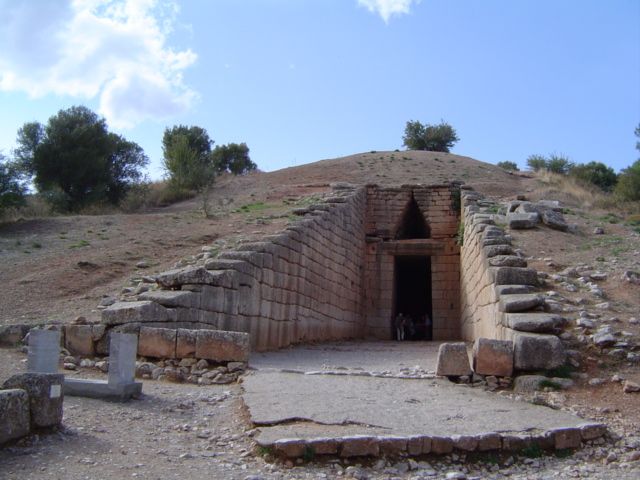
Corbel dome |
|---|---|
| Function / usage: |
Mausoleum / tomb |
| Material: |
Masonry structure |
| Structure: |
Underground structure |
Location
| Location: |
Mycenae, Argolis, Peloponnese, Greece |
|---|---|
| Coordinates: | 37° 43' 36.54" N 22° 45' 13.98" E |
Technical Information
Dimensions
| diameter | 14.50 m | |
| height | 13.20 m |
Materials
| dome |
stone
|
|---|---|
| walls |
stone
|
Participants
Currently there is no information available about persons or companies having participated in this project.
Relevant Web Sites

Relevant Publications
- (2006): Analysis of the Statics of the Mycenaean Tholoi. Presented at: Second International Congress on Construction History, Queens' College, Cambridge University; 29/03-02/04/2006, pp. 777-790.
- (2019): Ancient Aegean Measurement Systems Analysed Through the Treasury of Atreus. In: Nexus Network Journal, v. 22, n. 2 (October 2019), pp. 471-486.
- (1983): Greek Architecture. 4th edition, Yale University Press, New Haven (USA), pp. 80-86.
- (1974): Naissance de l'art grec. Gallimard, Paris (France), pp. 335.
- (2005): Qu'est-ce que l'architecture?. Une histoire de l'Architecture. Editions Gründ, Paris (France), pp. 214-215.
- About this
data sheet - Structure-ID
20003185 - Published on:
02/03/2002 - Last updated on:
28/05/2021
Structurae cooperates with


