
.jpg)

General Information
Project Type
| Structure: |
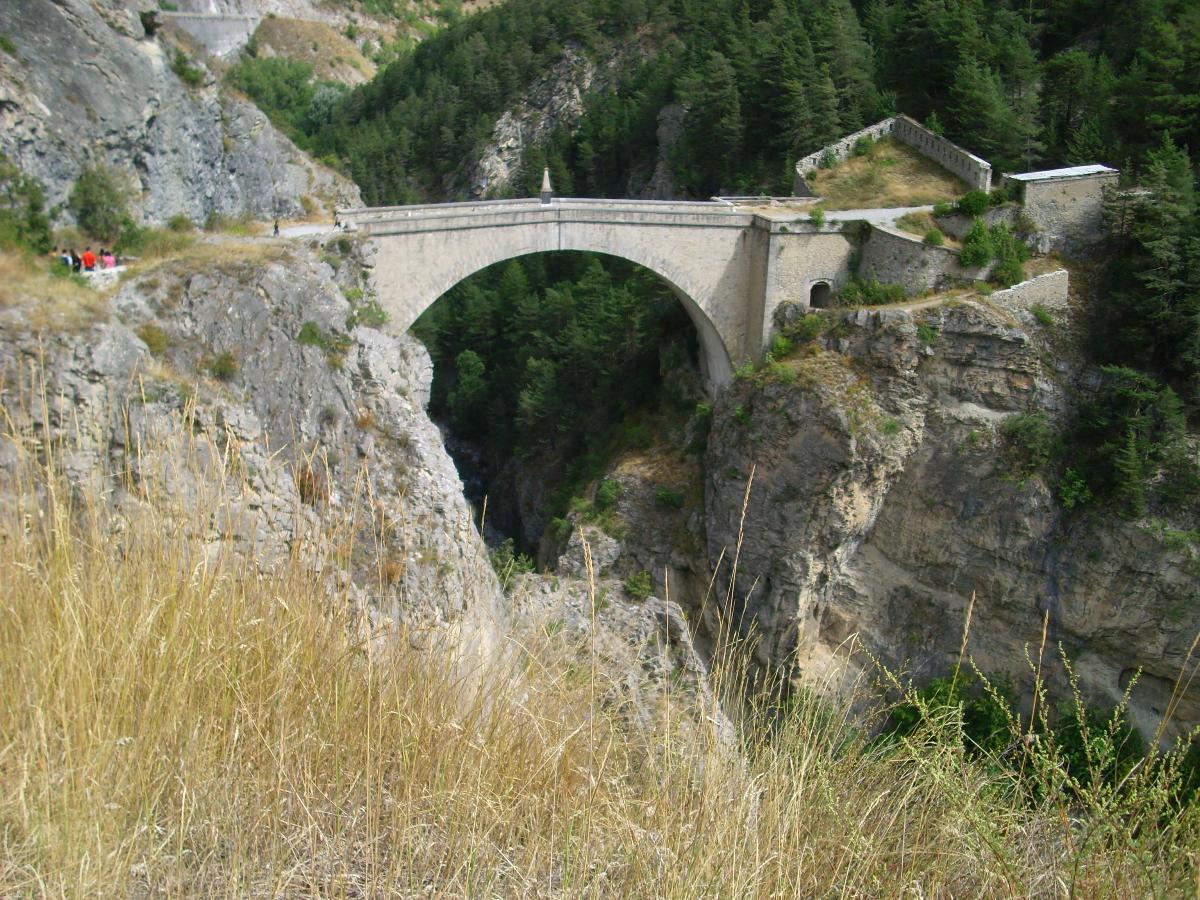
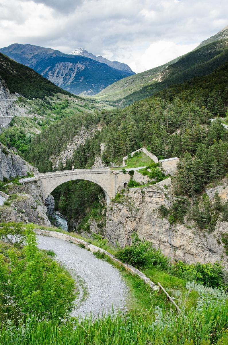
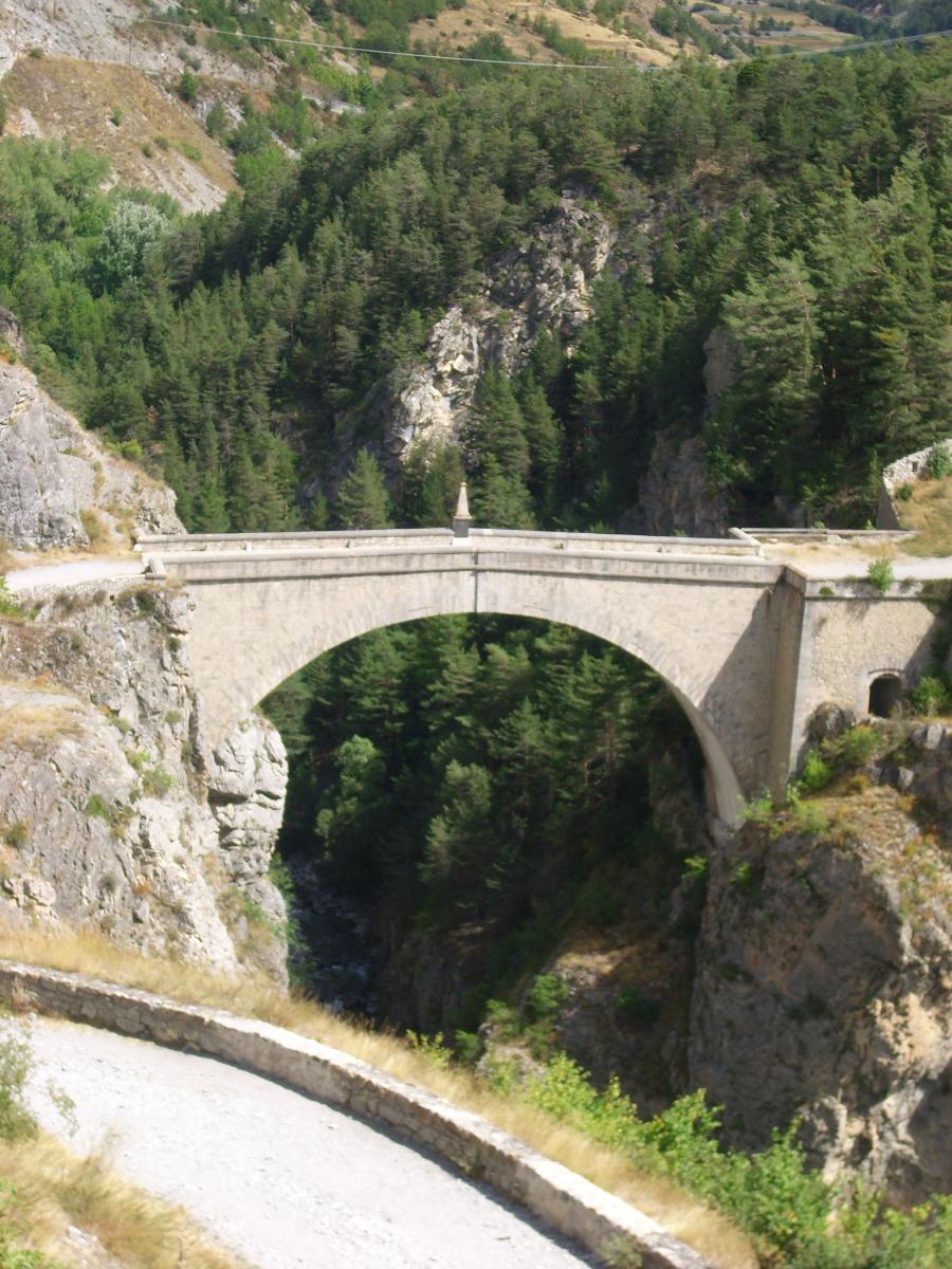
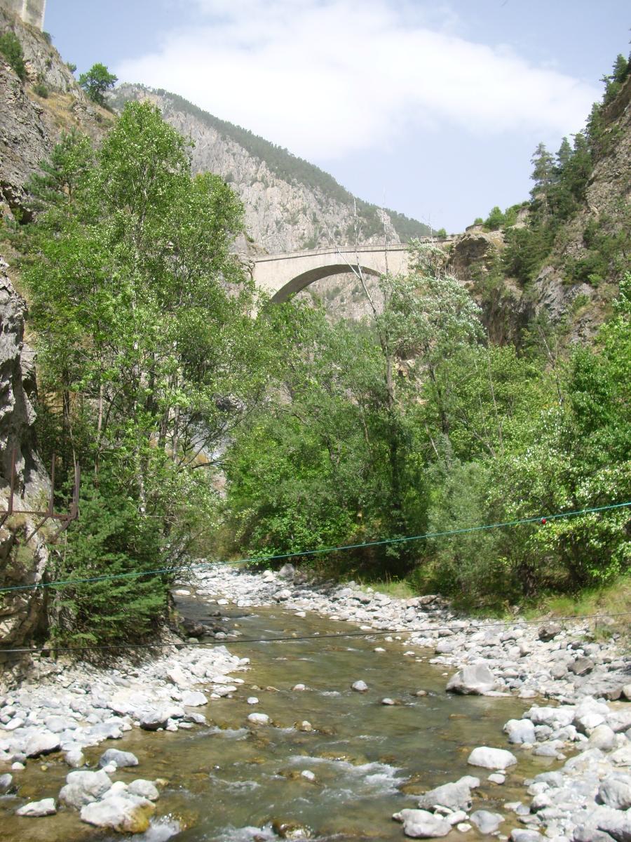
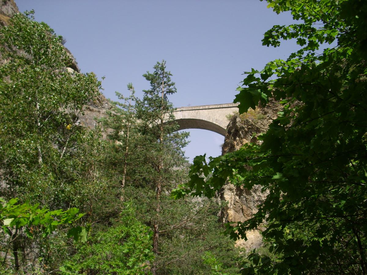
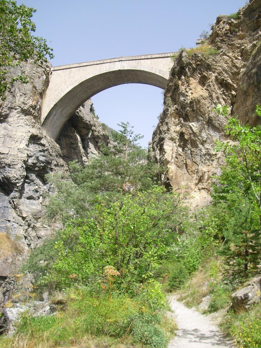
Vaulted arch bridge |
|---|---|
| Function / usage: |
Road bridge |
| Material: |
Masonry bridge |
Location
| Location: |
Briançon, Hautes-Alpes (05), Provence-Alpes-Côte d'Azur, France |
|---|---|
| Crosses: |
|
| Coordinates: | 44° 53' 55.73" N 6° 38' 50.46" E |
Technical Information
Dimensions
| span | 38.60 m | |
| height above valley floor or water | 56 m |
Materials
| arch |
stone
|
|---|
Chronology
| 1734 | Opened to traffic. |
|---|---|
| 1986 | Restored. |
Participants
Currently there is no information available about persons or companies having participated in this project.
Relevant Web Sites
There currently are no relevant websites listed.
Relevant Publications
- (2001): Les plus beaux ponts de France. Bonneton, Paris (France), pp. 49.
- (1972): Le pont d'Asfeld à Briançon. Presented at: Session. Congrès archéologique de France vol. 130 (1972), pp. 30-42.
- (1990): Les ponts modernes - 18e et 19e siècles. 1st edition, Picard Editeur, Paris (France), pp. 30-32.
- (1988): Les ponts monuments historiques. Inventaire - description - histoire. Editions Brissaud, Poitiers (France), pp. 58.
- About this
data sheet - Structure-ID
20000855 - Published on:
08/08/2000 - Last updated on:
01/01/2022
Structurae cooperates with


