
General Information
Project Type
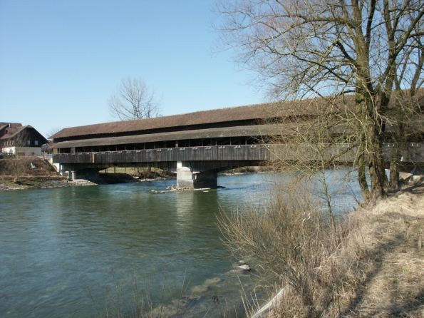
| Structure: |
Covered bridge |
|---|---|
| Material: |
Timber bridge |
| Function / usage: |
original use: Road bridge current use: Bicycle and pedestrian bridge |
Location
| Location: |
Sins, Argovia, Switzerland |
|---|---|
| Crosses: |
|
| Coordinates: | 47° 11' 11.53" N 8° 24' 1.82" E |
Technical Information
Dimensions
| span lengths | 2 x 30.8 m | |
| number of spans | 2 |
Materials
| arches |
wood
|
|---|
Chronology
| 1824 — 1826 | Strengthening. |
|---|---|
| 1847 | One span of the bridge is destroyed in battle. It is later rebuilt by Johann Schacher based on plans by Ferdinand Stadler. |
Participants

Relevant Web Sites
There currently are no relevant websites listed.
Relevant Publications
- (2001): Holzbrücken am Weg. Bruderverlag, Karlsruhe (Germany), pp. 20.
- About this
data sheet - Structure-ID
20005948 - Published on:
04/10/2002 - Last updated on:
28/05/2021
Structurae cooperates with


