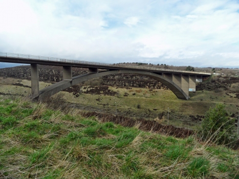
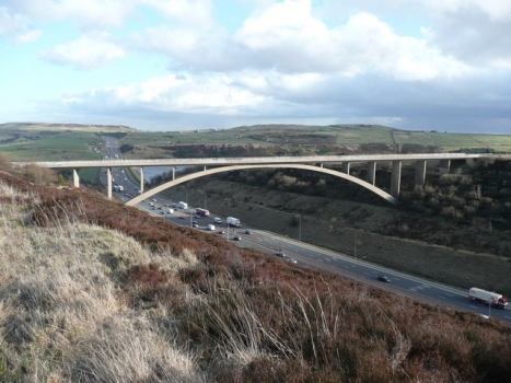
General Information
Project Type
| Structure: |
Deck arch bridge |
|---|---|
| Function / usage: |
Road bridge |
| Material: |
Reinforced concrete bridge Structurae Plus/Pro - Subscribe Now! |
Location
| Location: |
Huddersfield, Kirklees, West Yorkshire, Yorkshire and the Humber, England, United Kingdom |
|---|---|
| Coordinates: | 53° 38' 51.19" N 1° 55' 52.07" W |
Technical Information
Dimensions
| width | 7.3 m | |
| total length | 200 m | |
| height above valley floor or water | 37 m | |
| arch | span | 125 m |
Materials
| piers |
reinforced concrete
|
|---|---|
| arch |
reinforced concrete
|
| abutments |
reinforced concrete
|
| piers on arch |
reinforced concrete
|
Excerpt from Wikipedia
Scammonden Bridge, also known as Rainbow Bridge or, locally, Brown Cow Bridge (after the nearby Brown Cow Inn, now closed), spans the Deanhead cutting carrying the B6114 (the former A6025) Elland to Buckstones road over the M62 motorway in Kirklees, West Yorkshire, England. The bridge and Scammonden Reservoir to the west are named after Scammonden, the village that was flooded to accommodate the reservoir whose dam carries the motorway. On opening, the bridge was the longest single-span non-suspension bridge in the world and it is the longest concrete arch bridge in the UK.
History
The bridge was built for the West Riding County Council to the designs of the county surveyor, Colonel S. Maynard Lovell. In March 1962 a model of the 37-mile (60 km) section of the M62 was displayed in Wakefield, the administrative centre of the West Riding County Council. The route of the motorway, from the A572 to the A640 at Huddersfield, was announced by Tom Fraser on 29 October 1964.
Design
The bridge was planned as a flat arch bridge, but aerodynamic considerations led to an open spandrel design. The main span supports eight spandrel columns and there are four other columns over the motorway cutting. The spandrel columns are 18 inches (46 cm) thick.
The arch is a twin box section. Ist deck is an inverted T-type pretensioned prestressed concrete beam. The bridge deck is 24 feet (7.3 m) wide. Using computers, ist design was calculated to withstand 110 mph (180 km/h; 49 m/s) winds, and was tested in wind tunnels at the University of Nottingham and the National Physical Laboratory. The motorway cutting was profiled with 15-foot (4.6 m) 'steps'.
The road it carries was the A6025 but is now the B6114 between Elland and the A640 junction at Buckstones Moss. To the west of the bridge the M62 enters Calderdale from Kirklees; the boundary crosses the B6114 north of the bridge, and follows the north side of the M62 along Scammonden Water. The road crosses the M62 at around 1,017 feet (310 m) above sea level, northeast of Cow Gate Hill.
Construction
The arch is made of modular precast concrete sections, weighing 9,000 tonnes (8,900 long tons). The construction contractor was Alfred McAlpine. Construction of the arch required 70 miles (110 km) of scaffolding tubing. During the winter there was severe ice build up on the scaffolding.
Excavation of the Deanhead cutting was done using explosives. The cutting is 150 feet (46 m) deep, 2,600 feet (790 m) long, and 4.6 million cubic yards (3,500,000 m³) of earth was removed during ist construction. Most of it was used to build the 249-foot (76 m) high Scammonden Dam across the Black Brook valley, which was the first motorway-dam project in the world. The route of the carriageway was set out in July 1963 and the motorway cutting began work in August 1964. Work on the six-mile Windy Hill to Pole Moor section began on 1 November 1966 and was carried out for 12 hours on weekdays and eight hours at weekends.
Text imported from Wikipedia article "Scammonden Bridge" and modified on July 23, 2019 according to the CC-BY-SA 4.0 International license.
Participants
Relevant Web Sites
- About this
data sheet - Structure-ID
20023837 - Published on:
17/10/2006 - Last updated on:
13/07/2017


