
General Information
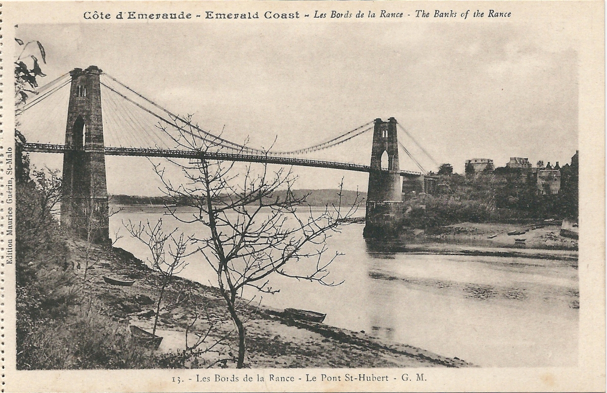
| Name in local language: | Pont Saint-Hubert |
|---|---|
| Beginning of works: | 1913 |
| Completion: | 1928 |
| Status: | destroyed (12 June 1944) |
Project Type
| Structure: |
Suspension bridge with cable-stays |
|---|---|
| Function / usage: |
Road bridge |
| Material: |
Structurae Plus/Pro - Subscribe Now! Structurae Plus/Pro - Subscribe Now! |
Location
| Location: |
Plouër-sur-Rance, Côtes-d'Armor (22), Bretagne, France La Ville-es-Nonais, Ille-et-Vilaine (35), Bretagne, France |
|---|---|
| Crossed: |
|
| Replaced by: |
Saint Hubert Bridge (1959)
|
| Coordinates: | 48° 32' 6.84" N 1° 58' 16.03" W |
Technical Information
There currently is no technical data available.
Participants
Currently there is no information available about persons or companies having participated in this project.
Relevant Web Sites

- About this
data sheet - Structure-ID
20013264 - Published on:
08/09/2004 - Last updated on:
26/10/2020
Structurae cooperates with


