
General Information
| Completion: | 18th century |
|---|---|
| Status: | in use |
Project Type
| Structure: |
Vaulted arch bridge |
|---|---|
| Material: |
Masonry bridge |
| Function / usage: |
original use: Road bridge current use: Pedestrian bridge (footbridge) |
Location
| Location: |
Aberdeenshire, Scotland, United Kingdom |
|---|---|
| Coordinates: | 57° 5' 58.17" N 3° 9' 28.46" W |
Technical Information
There currently is no technical data available.
Notes
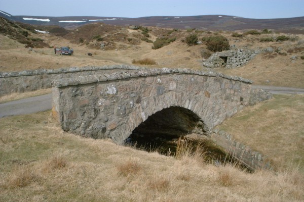
Single-arched, rubble-built road bridge crossing the Allt Coire an t-Slugain. Probably built about 1750, as part of a military road, and still in use as the present A939 road.
Listed: Category C(S), 9301
National Monuments Record of Scotland Number: NJ20SE 42
National Grid Reference: NJ29940154
Participants
Currently there is no information available about persons or companies having participated in this project.
Relevant Web Sites
There currently are no relevant websites listed.
- About this
data sheet - Structure-ID
20010187 - Published on:
04/09/2003 - Last updated on:
28/05/2021
Structurae cooperates with


