
General Information
Project Type
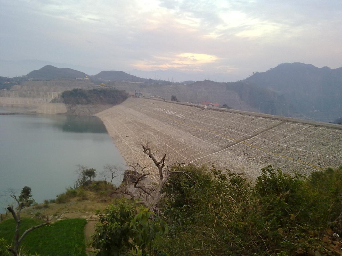
| Structure: |
Zoned embankment dam |
|---|---|
| Function / usage: |
Hydroelectric dam / plant Irrigation & industrial water dam |
Location
| Location: |
Himachal Pradesh, India Jammu and Kashmir, India |
|---|---|
| Coordinates: | 32° 26' 32.99" N 75° 43' 42.71" E |
Technical Information
Dimensions
| height | 160 m | |
| retained water volume | 3 280 000 000 m³ | |
| crest length | 617 m | |
| crest thickness | 14 m | |
| base thickness | 669.2 m | |
| spillway capacity | 24 637 m³/s | |
| dam volume | 21 920 000 m³ | |
| water surface area | 87 km² |
Excerpt from Wikipedia
The Ranjit Sagar Dam, also known as the Thein Dam, is part of a hydroelectric project constructed by the Government of Punjab Punjab Irrigation Department on the Ravi River on the Border of two states of India Jammu and Kashmir and Punjab. 60% of the lake is part of J&K. The project is situated near Pathankot city in Pathankot district of the state of Punjab and Kathua city and Basholi tehsil of Kathua district in J&K. The project is the largest hydroelectric dam of the state of Punjab. The township where the site is located is called Shah pur Kandi Township. Feasibility studies for the project began in 1953 and geotechnical studies continued until 1980. Construction began in 1981, the generators were commissioned in 2000 and the project complete in March 2001.
The project is used for both irrigation purposes and power generation. It has a 600 Megawatt capacity. The dam is one of the highest earth-fill dams in India and has the largest diameter penstock pipes in the country.
Several issues and claims were consistently reported by the govt of J&K to govt of Punjab over the usage of water, electricity, employment and compensation to the locals against the land acquisition. Finally on 12 May 2017 govt of J&K has raised this issue in the Northern Zonal Council Meeting held in Chandigarh on this Ministry of Home Affairs, GOI has decided to construct barrage to allow both states to enjoy equal rights over the dam. Barrages will help J&K in irrigation in Samba and Kathua districts in Jammu division of J&K. Punjab govt has also agreed to share electricity produced through the project. But the previous claims of J&K remained unsettled. In 2017 Govt of J&K has claims worth 8000 crores for the loss against govt of Punjab, on which the Punjab govt has never shown any interest to square them off. It is located upstream of the Madhopur Barrage at Madhopur.
Text imported from Wikipedia article "Ranjit Sagar Dam" and modified on July 23, 2019 according to the CC-BY-SA 4.0 International license.
Participants
Currently there is no information available about persons or companies having participated in this project.
Relevant Web Sites

- About this
data sheet - Structure-ID
20076596 - Published on:
19/01/2019 - Last updated on:
19/01/2019


