
General Information
| Completion: | 1764 |
|---|---|
| Status: | destroyed (6 December 2015) |
Project Type
| Function / usage: |
Road bridge |
|---|---|
| Material: |
Masonry bridge |
| Plan view: |
Structurae Plus/Pro - Subscribe Now! |
| Structure: |
Segmental arch bridge |
| Material: |
Structurae Plus/Pro - Subscribe Now! |
Awards and Distinctions
Location
| Location: |
Pooley Bridge, Cumbria, North West England, England, United Kingdom |
|---|---|
| Replaced by: |
New Pooley Bridge (2020)
|
| Coordinates: | 54° 36' 43.97" N 2° 49' 19.82" W |
Technical Information
Dimensions
| number of spans | 3 | |
| abutments | number | 2 |
| piers | number | 2 |
Materials
| piers |
masonry
|
|---|---|
| arches |
masonry
|
| abutments |
masonry
|
Excerpt from Wikipedia
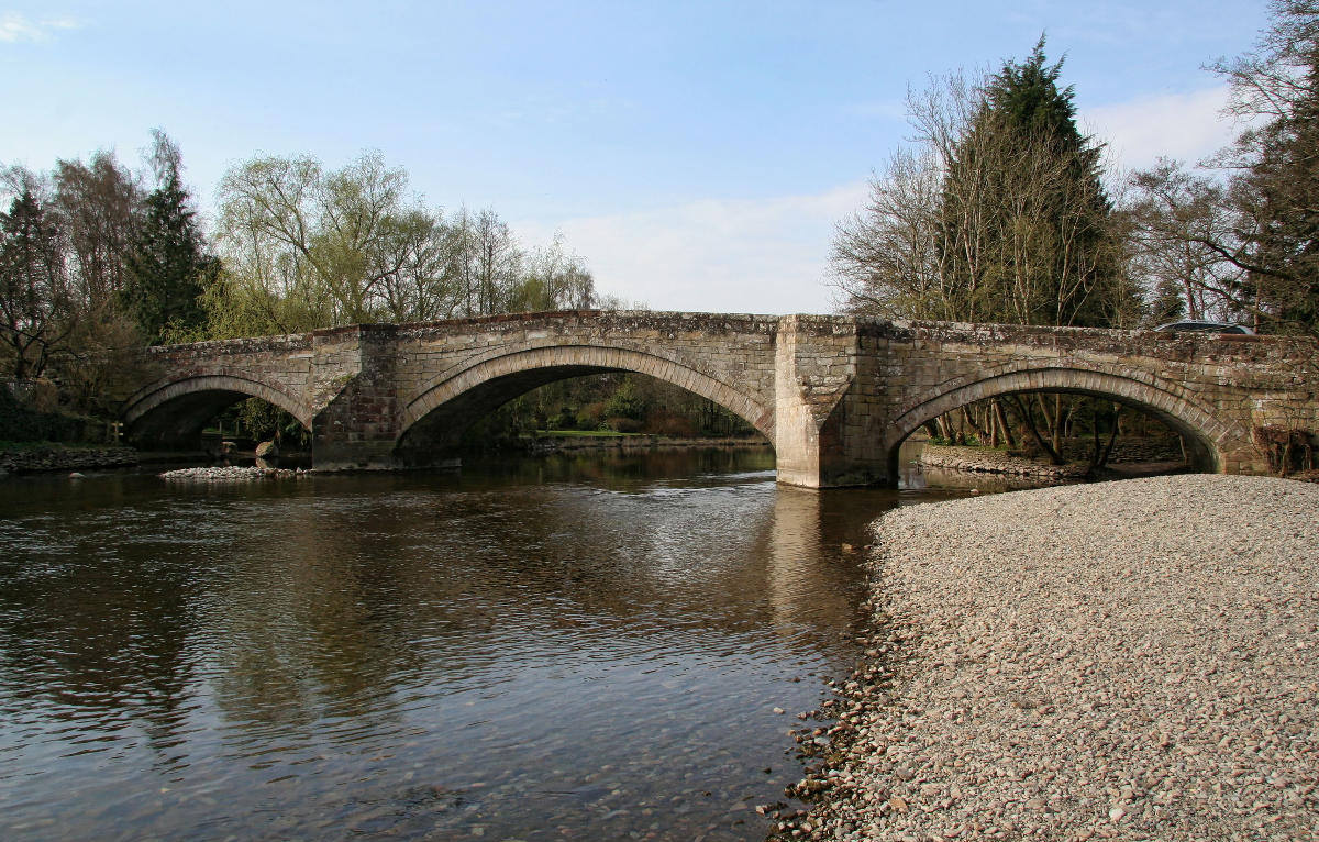
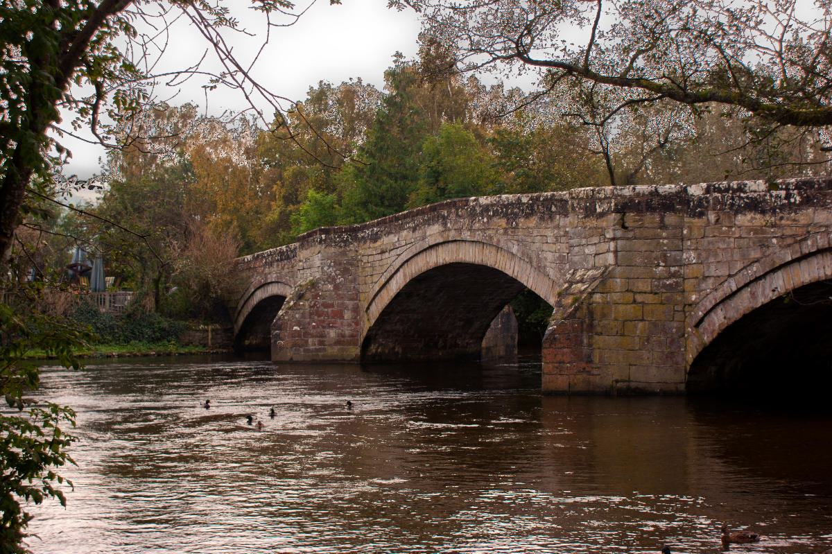
Pooley Bridge was an historic stone road bridge that crossed the River Eamont in the village of Pooley Bridge near the northern end of Ullswater. It connected two civil parishes, Barton and Pooley Bridge and Dacre, and was grade II listed in January 1991.
The bridge, erected in 1764 and replacing an earlier bridge from the 16th century, was washed away on 6 December 2015 when Cumbria was hit by heavy flooding during Storm Desmond, after storm waters eroded the riverbed around the base of the bridge supports.
Text imported from Wikipedia article "Pooley Bridge (structure)" and modified on September 6, 2024 according to the CC-BY-SA 4.0 International license.
Participants
Currently there is no information available about persons or companies having participated in this project.
Relevant Web Sites

Relevant Publications
- (2024): The New Pooley Bridge – Reconnecting a Community. Presented at: IABSE Symposium: Construction’s Role for a World in Emergency, Manchester, United Kingdom, 10-14 April 2024, pp. 235-242.
- About this
data sheet - Structure-ID
20089278 - Published on:
05/09/2024 - Last updated on:
06/09/2024


