
General Information
Project Type
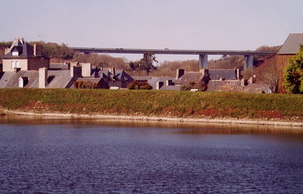
| Structure: |
Girder bridge |
|---|---|
| Function / usage: |
Road bridge |
| Material: |
Prestressed concrete bridge Structurae Plus/Pro - Subscribe Now! |
Location
| Location: |
Jugon-les-Lacs, Côtes-d'Armor (22), Bretagne, France |
|---|---|
| Crosses: |
|
| Carries: |
|
| Coordinates: | 48° 24' 49.80" N 2° 19' 24.64" W |
Technical Information
Dimensions
| total length | 257 m | |
| pier | pier height | max. 45 m |
Materials
| deck |
prestressed concrete
|
|---|---|
| piers |
reinforced concrete
|
Participants
Currently there is no information available about persons or companies having participated in this project.
Relevant Web Sites
There currently are no relevant websites listed.
Relevant Publications
- (1996): Le plan routier breton. Presses de l'Ecole Nationale des Ponts et Chaussées, Paris (France), pp. 160.
- About this
data sheet - Structure-ID
20011527 - Published on:
07/03/2004 - Last updated on:
05/02/2016
Structurae cooperates with


