
General Information
| Name in local language: | Passerelle Nelson-Mandela |
|---|---|
| Beginning of works: | Summer 2013 |
| Completion: | 10 October 2015 |
| Status: | in use |
Project Type
| Structure: |
Single-span single-tower suspension bridge Suspension bridge with diagonal hangers |
|---|---|
| Secondary structure(s): |
Structurae Plus/Pro - Subscribe Now! |
| Function / usage: |
Bicycle and pedestrian bridge |
| Material: |
Concrete bridge Structurae Plus/Pro - Subscribe Now! |
| Plan view: |
Structurae Plus/Pro - Subscribe Now! |
Location
| Location: |
Creil, Oise (60), Hauts-de-France, France |
|---|---|
| Crosses: |
|
| Coordinates: | 49° 15' 32.21" N 2° 28' 1.52" E |
Technical Information
Dimensions
| main span | 80 m | |
| total length | 305 m | |
| deck width | 4.0 m | |
| vertical navigation clearance | 7 m | |
| horizontal navigation clearance | 42 m | |
| anchorages | number | 3 |
| piles | diameter | 0.80 - 1.00 m |
| length | 10 -13 m | |
| number | 13 | |
| pylon | height | 28 m |
Quantities
| anchorages | concrete volume | 150 m³ |
| pylon | structural steel | 49 t |
Cost
| cost of construction | Euro 3 000 000 |
Materials
| pylon |
steel
|
|---|---|
| deck |
precast concrete
|
| deck slab |
precast reinforced concrete
|
Chronology
|
March 2010
— May 2010 |
Launch of a competition for the design of a footbridge over the Oise River, awarded to RFR |
|---|---|
| July 2012 | Construction contract awarded to the joint venture Bouygues TP – Gagne Constructions Métalliques. |
|
March 2013
— June 2013 |
Site clean-up on the right bank |
| June 2013 | Site installation, start of construction for foundations and civil works for ramp on right bank. |
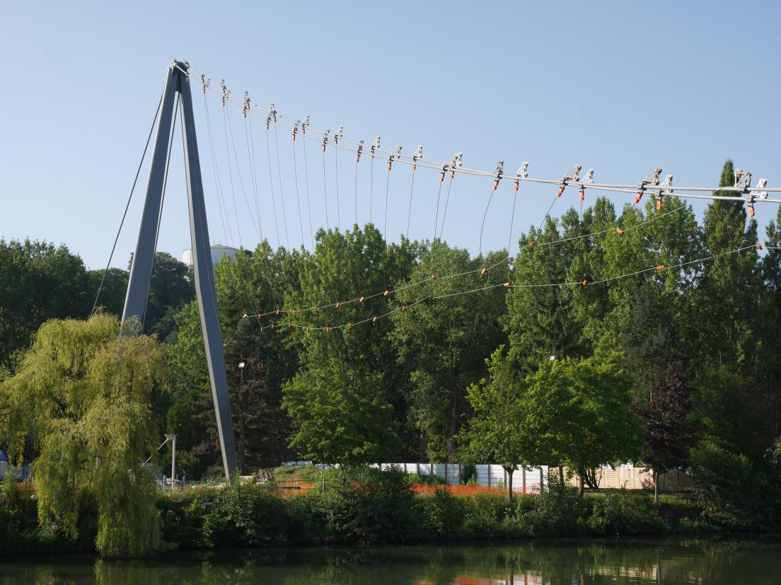
| Fall 2013 | Steel structure fabrication of the mast at GAGNE facilities, and of cables at the PFEIFFER workshop in Germany. |
| January 2014 | Lifting of the steel mast on Saint Maurice Island |
| February 2014 | Installation of cables on the left bank |
| April 2014 | Installation of the gantry on abutment C4. |
| May 2014 | Delivery and installation of metal segments of the deck for island ramp. |
| 19 June 2014 | Installation of the ferry cables during the night for future launching of cables above the Oise |
|
25 June 2014
— 7 July 2014 |
Launching of cables above the Oise River by winching on ferry cables. |
|
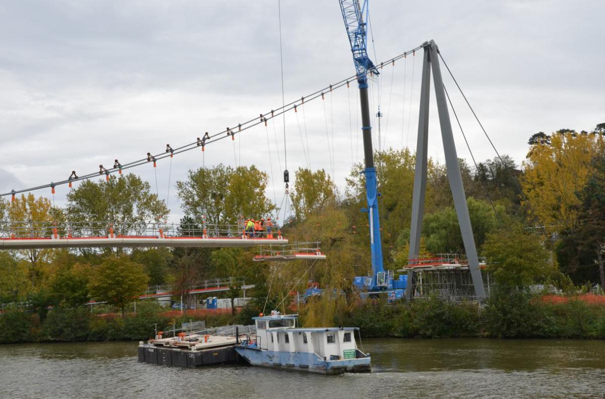
13 October 2014
— 20 October 2014 |
Installation of the 19 prefabricated concrete elements of the deck, suspended to the main cable by temporary hangers |
| November 2014 | Installation and adjustment of final crossed hangers |
| December 2014 | Final joining of concrete deck elements |
|
January 2015
— April 2015 |
Installation of balustrade, lighting equipment, testing and finishing |
| 10 May 2015 | Inauguration of the bridge. |
Description of the Footbridge
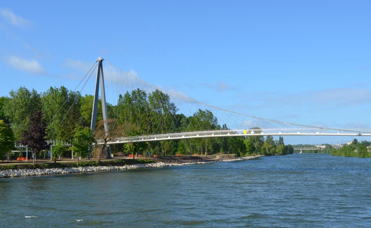
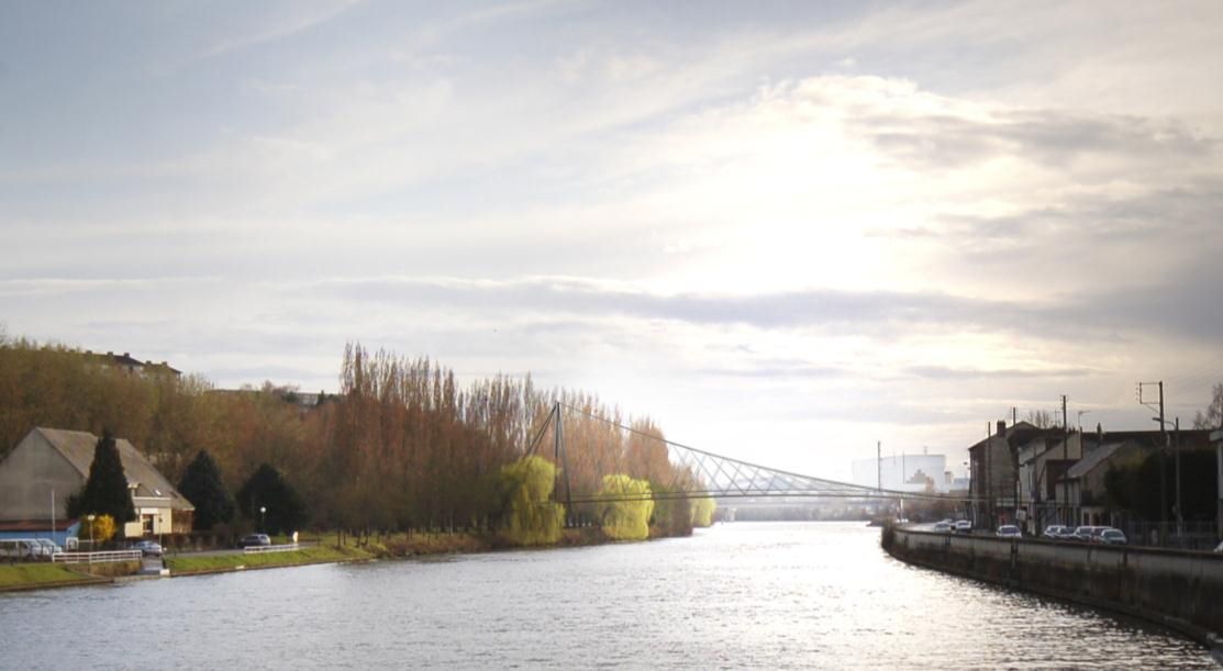
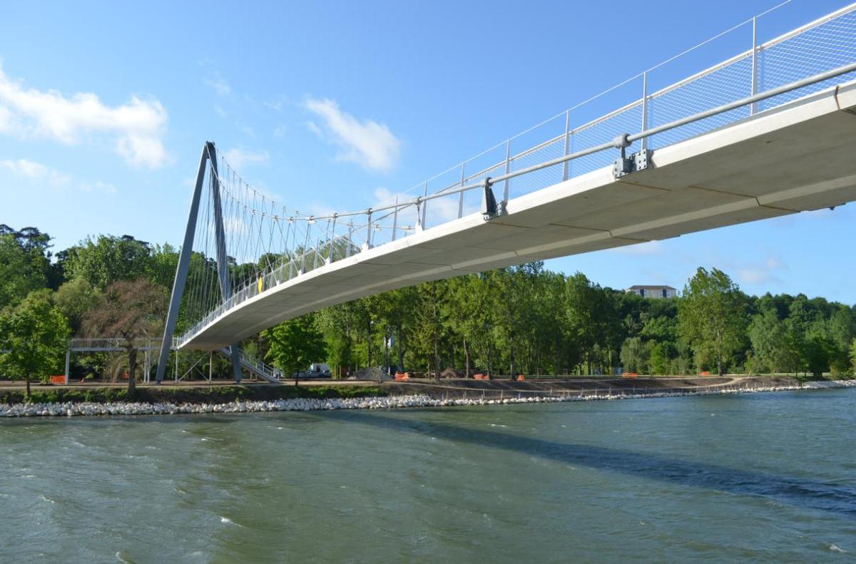
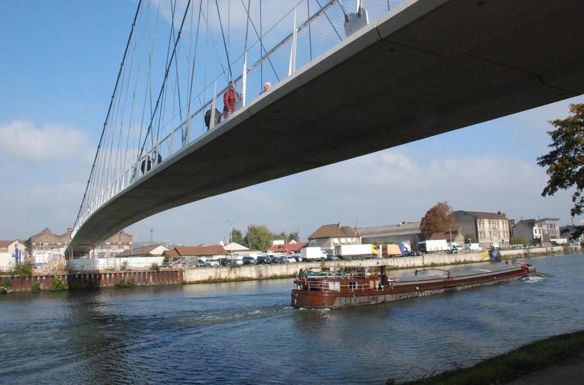
The Nelson Mandela Bridge crosses both the Oise River and the railway lines in Creil. The structure creates a much-needed link between the communities of the Creil municipal association.
The bridge is a key element in the large scale civic development strategy and intends to create an "urban landmark", which connects an uninterrupted pedestrian and cyclist path between the Plateau district on the left bank of the Oise and the Gournay neighborhood on the right bank in active urban renewal. At the core of the crossing is the link with the Park of Saint Maurice Island pathway and the future Fichet Place, making the bridge the unifying element and the symbolic union between the two parts of the city.
The structural of the bridge responds to the architectural and landscape requirements of the site as well as the constraints of a major river crossing. With great slenderness, the suspended structure effectively responds to these requirements by avoiding a pile in the Oise. The design with a single mast on the island reflects the asymmetry of the site with the refined silhouette of the mast integrating with the verticality o the vegetation of the island while creating a strong, elegant signal from the urban bank of the place Fichet.
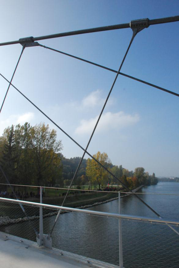
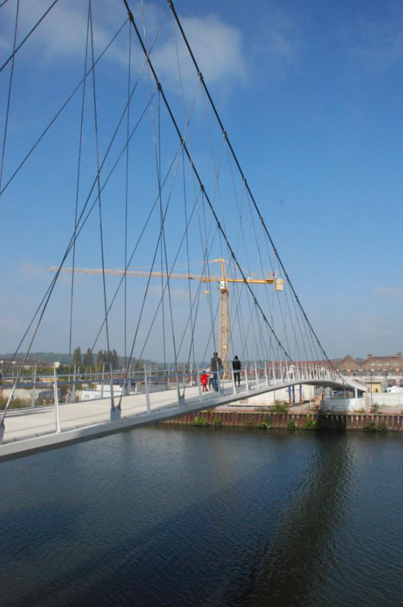
The suspended structure and ist intersecting hanger cables permit the thrilling slenderness of the design: the total length is spanned by a thin concrete deck slab with less than 30cm thickness. The structure scheme also reduced the construction impact on the river traffic: the cables were pulled on a rope and installed in one night, and the deck was crane lifted in small prefabricated elements of 4m in length.
The bridge is 100m long, with a single 80m span over the Oise River. The mast is 28m tall, consisting of structural steel sections welded from curved metal plates, and creates an inverted V on the Island's shore. A pair of cables stays the mast to ist anchorages on the island. A second pair of suspension cables crosses the river connecting the top of the mast with the abutment on the urban riverbank. The concrete deck is suspended to a fine mesh of diagonal tension rods. On the right bank, a 100m concrete ramp supported by tubular columns aligns with the bridge deck, creating a continuous and slender ribbon of 200 m length.
On the island, access to the bridge is provided by a 120 m long light steel ramp aligned with the Oise River, and a staircase, and both covered with wooden decking.
Careful structural analysis has led to a final bridge which is visually consistent with the original project image. The inherently efficient structural system and optimized structural elements highlight the slenderness of the
structure.
Participants
Owner
Design
Structural engineering
Co-contractor
Steel construction

Cables
Relevant Web Sites
There currently are no relevant websites listed.
- About this
data sheet - Structure-ID
20067202 - Published on:
29/06/2015 - Last updated on:
05/02/2016
Structurae cooperates with


