
General Information
| Completion: | 1917 |
|---|---|
| Status: | out of service |
Project Type
| Function / usage: |
Lighthouse |
|---|---|
| Material: |
Concrete tower |
Location
| Location: |
Navassa Island, USA |
|---|---|
| Coordinates: | 18° 23' 50.54" N 75° 0' 46.19" W |
Technical Information
Dimensions
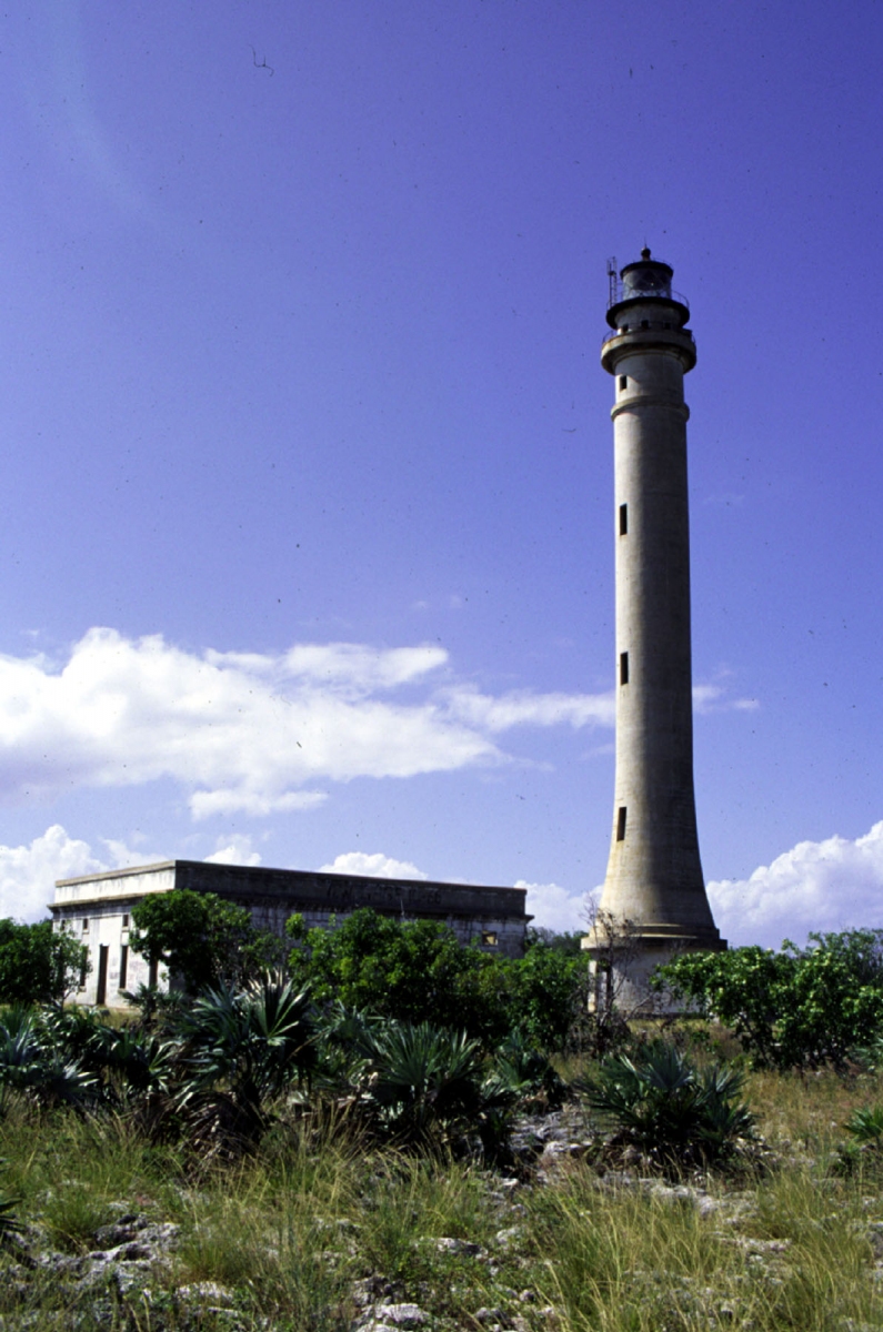
| height | 49 m |
Materials
| tower |
concrete
|
|---|---|
| foundations |
stone
|
Excerpt from Wikipedia
Navassa Island Light is a deactivated lighthouse on Navassa Island, which lies in the Caribbean Sea at the south end of the Windward Passage between the islands of Hispaniola (Haiti and the Dominican Republic) to the east and Cuba and Jamaica to the west. It is on the shortest route between the east coast of the United States and the Panama Canal. The light was built in 1917 and deactivated in 1996. The light is gradually deteriorating from lack of maintenance. The keepers' house is roofless and in ruins.
The importance of the light before the advent of GPS is evident in the fact that it has the twelfth-highest tower and fourth-highest focal plane of all U.S. lights.
Text imported from Wikipedia article "Navassa Island Light" and modified on November 3, 2020 according to the CC-BY-SA 4.0 International license.
Participants
Currently there is no information available about persons or companies having participated in this project.
Relevant Web Sites

- About this
data sheet - Structure-ID
20080292 - Published on:
03/11/2020 - Last updated on:
03/11/2020


