
General Information
| Name in local language: | Most Maslenica; Maslenički most |
|---|---|
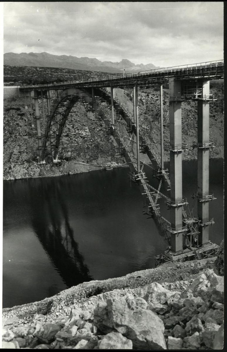
| Beginning of works: | 1955 |
| Completion: | 1960 |
| Status: | destroyed (21 November 1991) |
Project Type
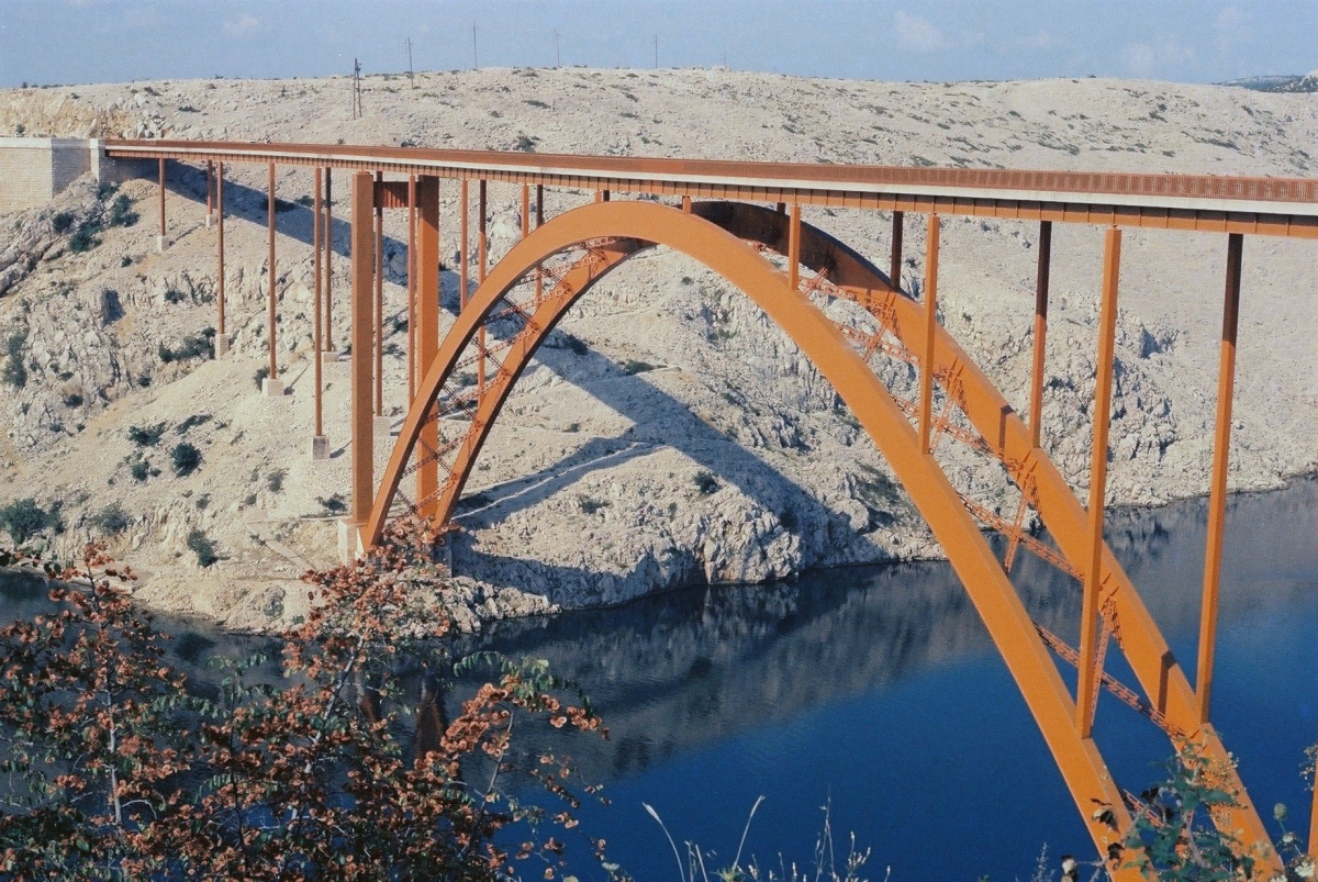
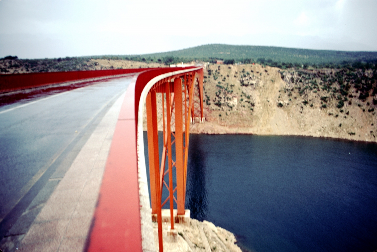
| Structure: |
Deck arch bridge |
|---|---|
| Function / usage: |
Road bridge |
| Material: |
Steel bridge Structurae Plus/Pro - Subscribe Now! |
Location
| Location: |
Maslenica, Zadar, Croatia |
|---|---|
| Address: | D 8 |
| Replaced by: |
Maslenica Bridge (2005)
|
| Coordinates: | 44° 13' 29.10" N 15° 31' 51.46" E |
Technical Information
Dimensions
| height above valley floor or water | 55 m | |
| arch | rise | 41.45 m |
| span | 155 m | |
| deck | width | 9.4 m |
| span lengths | 17.52 m - 2 x 19.71 m - 19.68 m - 7 x 17.52 m - 19.68 m - 4 x 19.71 m - 17.52 m | |
| number of spans | 17 | |
| number of lanes | 2 | |
| roadway / carriageway width | 7 m | |
| walkway width | 2 x 1 m |
Materials
| piers |
steel
|
|---|---|
| arches |
steel
|
| abutments |
reinforced concrete
|
| piers on arch |
steel
|
Chronology
| 21 November 1991 | The bridge is destroyed by explosives during the Croatian War of Independence. |
|---|
Participants

Relevant Web Sites

- About this
data sheet - Structure-ID
20056975 - Published on:
19/07/2010 - Last updated on:
05/08/2020
Structurae cooperates with


