

General Information
| Official designation: | OR 07253B |
|---|---|
| Completion: | 1953 |
| Status: | in use |
Project Type
| Function / usage: |
Road bridge |
|---|---|
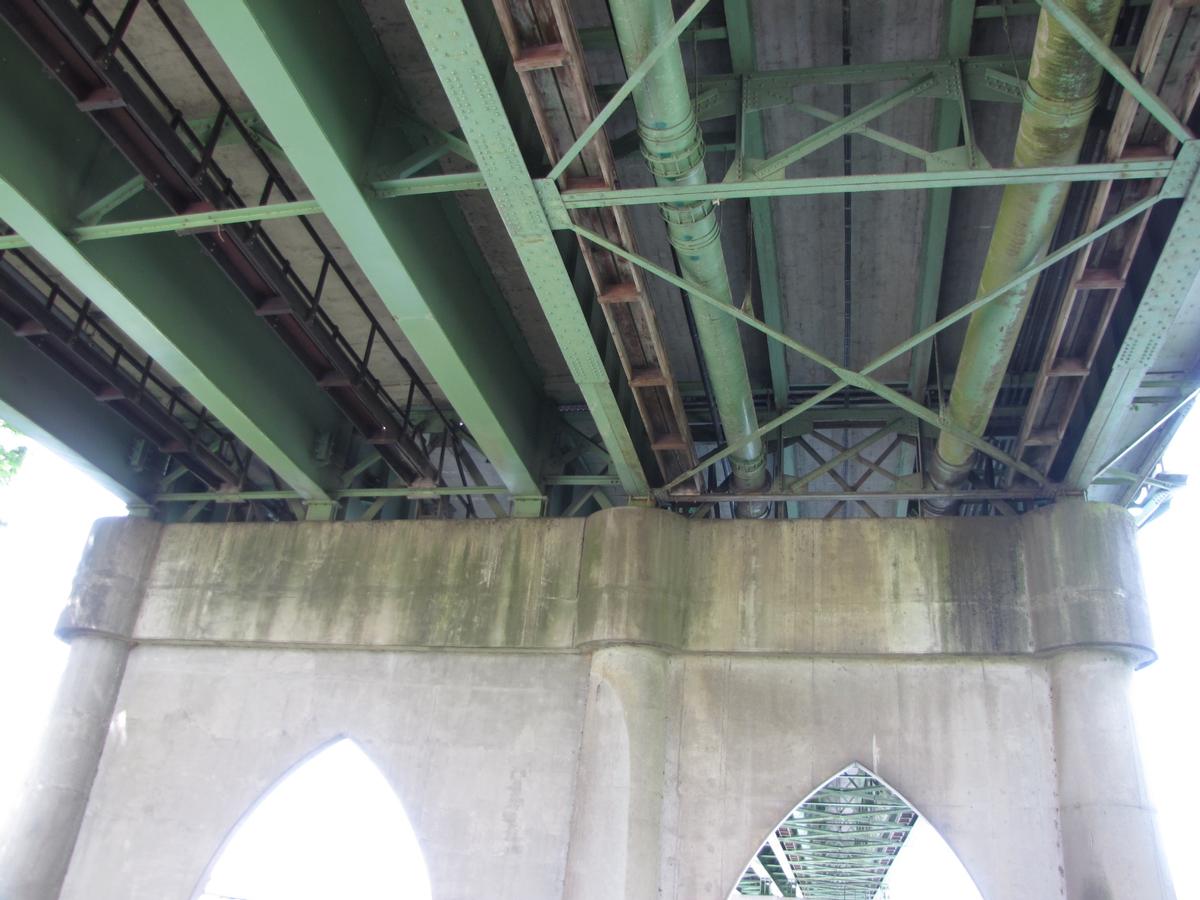
| Structure: |
Steel plate girder bridge |
| Support conditions: |
for registered users |
| Material: |
Steel bridge Structurae Plus/Pro - Subscribe Now! |
Location
| Location: |
Salem, Marion County, Oregon, USA Polk County, Oregon, USA |
|---|---|
| Address: | OR 22 / Marion Street |
| Crosses: |
|
| Next to: |
Black Rock Rail Bridge (1913)
Center Street Bridge |
| Coordinates: | 44° 56' 45.46" N 123° 2' 34.20" W |
Technical Information
Dimensions
| main span | 76.81 m | |
| total length | 729.45 m | |
| deck width | 17.1 m |
Materials
| piers |
reinforced concrete
|
|---|---|
| girders |
steel
|
Excerpt from Wikipedia
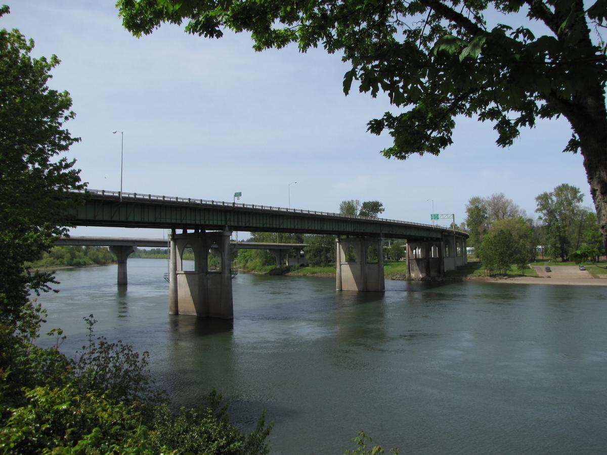
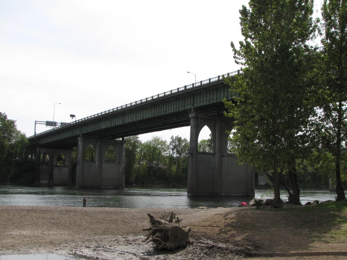
The Marion Street Bridge is an automobile bridge located in Salem, Oregon, United States. It spans the Willamette River to connect Salem and West Salem, and acts as a conduit for Oregon Route 22. The bridge carries vehicular traffic one way westbound. Traffic includes two lanes that flow onto the bridge from Marion Street, vehicles turning right from Commercial Street, and traffic from a quarter-loop on-ramp from Front Street that was added in 1981. Construction began in December 1952 and the bridge opened in 1954, after taking nearly three years to complete. The bridge was built to complement the Center Street Bridge, which switched from two-way traffic to eastbound-only, later expanding to four lanes in 1982. At the time of its opening, the Marion Street Bridge was the longest bridge of its type west of the Mississippi River.
Text imported from Wikipedia article "Marion Street Bridge" and modified on October 19, 2020 according to the CC-BY-SA 4.0 International license.
Participants
- Glen S. Paxson (designer)
Relevant Web Sites

- About this
data sheet - Structure-ID
20031707 - Published on:
17/09/2007 - Last updated on:
11/10/2020


