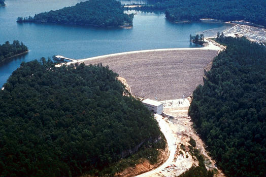
General Information
Project Type
| Function / usage: |
Hydroelectric dam / plant |
|---|---|
| Structure: |
Rockfill dam |
Location
| Location: |
Laurel County, Kentucky, USA |
|---|---|
| Coordinates: | 36° 57' 39.12" N 84° 16' 5.04" W |
Technical Information
Dimensions
| height | 86 m | |
| crest length | 433 m |
Participants
Relevant Web Sites
- About this
data sheet - Structure-ID
20087294 - Published on:
26/10/2023 - Last updated on:
26/10/2023


