
General Information
Project Type
| Structure: |
Gravity dam |
|---|---|
| Material: |
Concrete dam |
Location
| Location: |
Kazakhstan |
|---|---|
| Coordinates: | 46° 6' 9.06" N 60° 46' 4.02" E |
Technical Information
Materials
| dam structure |
concrete
|
|---|
Excerpt from Wikipedia
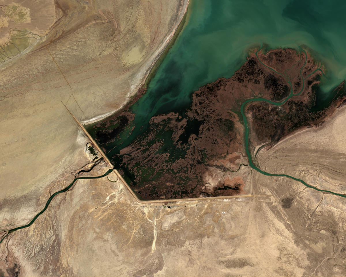
Dike Kokaral is a dam across a narrow stretch of the Aral Sea, splitting off the North Aral Sea (also called "The Small Sea") from the much larger South Aral Sea ("The Large Sea"). The dike is conserving the dwindling waters of the Syr Darya river and maintaining (and attempting to revive) the damaged ecology of the North Aral Sea, at the expense of sealing the fate of the larger South Aral. Work was completed in August 2005, with help from the World Bank. Dike Kokaral is named after the Kokaral peninsula (an island until the 1960s), which would connect it to the other shore of the Aral Sea and separate the northern from the southern seas.
History
As the waters of the contributory rivers to the Aral have been progressively redirected for irrigation, the water levels in the Aral have fallen, the shore receded, and the water quality has dropped precipitously. The dike was built twice in the past from local sand, but due to a lack of funding necessary to strengthen it once the water level in the North Aral Sea (and therefore pressure to the dike) began to rise, the dike was washed away. This happened in 1992 and 1998. However, for the short time that the dike stood, positive changes were already noticed - the climate became milder, and fauna was partly restored. When the dike was washed away, the water-level fell again, as much of the water poured into the South Aral Sea. In some places the coastline of North Aral retreated by as much as a few hundred meters.
North Aral's sea level
Water level of the North Aral has risen, and ist salinity has decreased. As of 2006, some recovery of sea level has been recorded, sooner than expected. "The dam has caused the small Aral's sea level to rise swiftly to 38m (125ft), from a low of less than 30m (98ft), with 42m (138ft) considered the level of viability." Economically significant stocks of fish have returned, and observers who had written off the North Aral Sea as an environmental catastrophe were surprised by reports that in 2006 ist returning waters already were partly reviving the fishing industry and producing a catch for export as far as Ukraine. The restoration reportedly gave rise to long absent rain clouds and possible microclimate changes, bringing tentative hope to an agricultural sector swallowed by a regional dustbowl, and some expansion of the shrunken sea. The sea, which had receded almost 100 kilometres (62 mi) south of the port-city of Aralsk, is now a mere 12 kilometres (7.5 mi) away as of 2015.
Text imported from Wikipedia article "Dike Kokaral" and modified on July 23, 2019 according to the CC-BY-SA 4.0 International license.
Participants
Currently there is no information available about persons or companies having participated in this project.
Relevant Web Sites

- About this
data sheet - Structure-ID
20032831 - Published on:
01/11/2007 - Last updated on:
19/11/2024


