
General Information
Project Type
| Function / usage: |
Road bridge |
|---|---|
| Support conditions: |
for registered users |
| Structure: |
Haunched girder bridge |
| Material: |
Prestressed concrete bridge Structurae Plus/Pro - Subscribe Now! |
Location
| Location: |
Dnipro, Dnipropetrovsk Oblast, Ukraine |
|---|---|
| Crosses: |
|
| Coordinates: | 48° 29' 45.12" N 34° 57' 51.02" E |
| Coordinates: | 48° 30' 11.77" N 34° 58' 18.62" E |
Technical Information
Dimensions
| width | 28 m | |
| total length | 1 732 m |
Materials
| superstructure |
prestressed concrete
|
|---|---|
| piers |
reinforced concrete
|
| abutments |
reinforced concrete
|
Excerpt from Wikipedia
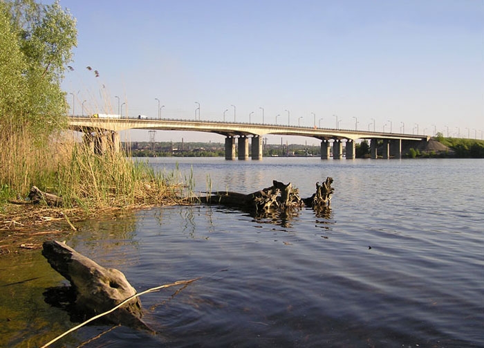
Kaidatsky Bridge (Ukrainian: Кайдацький міст) Kaidaky Bridge is a bridge over Dnieper in the city of Dnipro, Ukraine. The bridge connects right (Novokodatskyi District) and left (Amur-Nyzhnodniprovskyi District) banks of Dnipro and is part of the European route E50.
The bridge is named after an old Zaporizhian Cossack settlement, Novi Kodaky (Kaidaky). The crossing across Dnieper existed since at least the 17th century.
The bridge stretches over an island Namystanka. The island is part of Sukhachivka arboretum (also known as Diyivka Park) and administered by the Dnipro State Forestry.
Text imported from Wikipedia article "Kaidatsky Bridge" and modified on March 15, 2022 according to the CC-BY-SA 4.0 International license.
Participants
Currently there is no information available about persons or companies having participated in this project.
Relevant Web Sites

- About this
data sheet - Structure-ID
20082525 - Published on:
14/03/2022 - Last updated on:
14/03/2022


