General Information
Project Type
| Function / usage: |
Hydroelectric dam / plant |
|---|
Location
| Location: |
Florida, USA Georgia, USA |
|---|---|
| Impounded: |
|
| Coordinates: | 30° 42' 30.96" N 84° 51' 51.12" W |
Technical Information
There currently is no technical data available.
Excerpt from Wikipedia
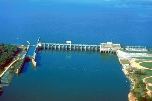
Jim Woodruff Dam is a hydroelectric dam on the Apalachicola River, about 1,000 feet (300 m) south of that river's origin at the confluence of the Flint and Chattahoochee Rivers.
The dam impounds Lake Seminole on the common border of Florida and Georgia. The dam is named in honor of James W. Woodruff, Sr., a Georgia businessman who spearheaded the development of the Apalachicola-Chattahoochee-Flint Project.
Text imported from Wikipedia article "Jim Woodruff Dam" and modified on July 23, 2019 according to the CC-BY-SA 4.0 International license.
Participants
Currently there is no information available about persons or companies having participated in this project.
Relevant Web Sites
- About this
data sheet - Structure-ID
20050857 - Published on:
26/12/2009 - Last updated on:
12/12/2021


