
General Information
Project Type
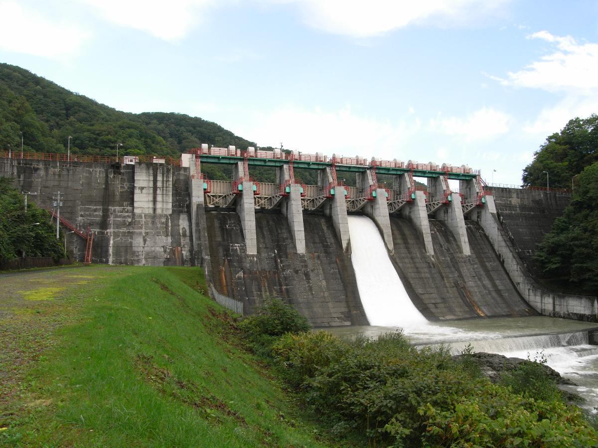
| Structure: |
Gravity dam |
|---|---|
| Function / usage: |
Hydroelectric dam / plant |
| Material: |
Concrete dam |
Location
Technical Information
Dimensions
| height | 37.2 m | |
| length | 190.5 m | |
| retained water volume | 9 026 000 m³ | |
| dam volume | 78 000 m³ |
Excerpt from Wikipedia
The Iwamatsu Dam (岩松ダム) is a dam situated in Hokkaidō, Japan. Work began on the dam's construction in 1939. The construction was completed in 1941.
Location
The Iwamatsu Dam is located at latitude N 43°111' 49 and longitude E 142°56' 11.
Dam Details
Iwamatsu Dam is Concrete Gravity dam 37.2 meters high. Its crest is 190.5 meters long. The dam's volume is 78 thousand m³. The total catchment area of the dam is 788km². The dam has a total water surface area of 102ha. The dam's reservoir can hold a maximum of 9026 thousand m³ of water.
Purpose
The dam was a constructed to serve a variety of purposes. Among its main functions are agricultural irrigation, flood control, water supply for industry, river flow maintenance, hydropower generation, recreation and water supply. The dam can generate up to 12,000 kW of Hydroelectric power.
Text imported from Wikipedia article "Iwamatsu Dam" and modified on July 23, 2019 according to the CC-BY-SA 4.0 International license.
Participants
Currently there is no information available about persons or companies having participated in this project.
Relevant Web Sites

- About this
data sheet - Structure-ID
20041439 - Published on:
18/12/2008 - Last updated on:
30/07/2014


