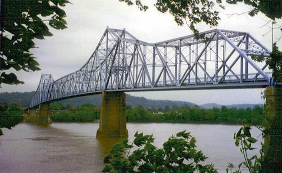
General Information
| Completion: | 1922 |
|---|---|
| Status: | demolished (2017) |
Project Type
| Function / usage: |
Road bridge |
|---|---|
| Material: |
Steel bridge |
| Structure: |
Cantilever truss bridge Through truss bridge |
| Material: |
Structurae Plus/Pro - Subscribe Now! |
Location
| Location: |
Ironton, Lawrence County, Ohio, USA Russell, Greenup County, Kentucky, USA |
|---|---|
| Crosses: |
|
| Will be replaced by: |
Oakley Clark Collins Memorial Bridge (2016)
|
| Coordinates: | 38° 31' 56" N 82° 41' 18" W |
Technical Information
Dimensions
| main span | 221.01 m | |
| total length | 731.82 m | |
| deck width | 6.40 m |
Materials
| piers |
reinforced concrete
|
|---|---|
| truss |
steel
|
Chronology
| 23 November 2016 | The bridge is closed to traffic for impending demolition. |
|---|
Participants
Contractor
Relevant Web Sites
- About this
data sheet - Structure-ID
20006345 - Published on:
17/10/2002 - Last updated on:
25/10/2017


