
General Information
| Completion: | 1879 |
|---|---|
| Status: | in use |
Project Type
| Function / usage: |
Pedestrian bridge (footbridge) |
|---|---|
| Material: |
Reinforced concrete bridge Structurae Plus/Pro - Subscribe Now! |
| Structure: |
original configuration: Arch bridge |
Location
| Location: |
Northmoor, Oxfordshire, South East England, England, United Kingdom |
|---|---|
| Crosses: |
|
| Coordinates: | 51° 42' 23.76" N 1° 23' 36.05" W |
Technical Information
Materials
| piers |
reinforced concrete
|
|---|---|
| arch |
reinforced concrete
|
Excerpt from Wikipedia
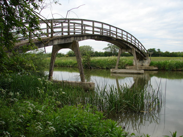
Hart's Weir Footbridge is a single-span concrete footbridge across the River Thames in Oxfordshire, England. Locally, it is also known as Rainbow Bridge, due to its rainbow-arc appearance as seen from the horizon. It is situated on the reach above Northmoor Lock, the nearest village being Appleton, Oxfordshire to the east.
The bridge was built in 1879 on the site of a weir that was removed a year later. Then known as Hart’s Weir, it had previously been Ridge’s, Langley’s, Cock’s, Rudge’s, and Butler’s Weir. Sixteen years later Northmoor Lock was built downstream.
Text imported from Wikipedia article "Hart''s Weir Footbridge" and modified on July 23, 2019 according to the CC-BY-SA 4.0 International license.
Participants
Currently there is no information available about persons or companies having participated in this project.
Relevant Web Sites

- About this
data sheet - Structure-ID
20011320 - Published on:
04/01/2004 - Last updated on:
09/10/2016


