
General Information
| Other name(s): | Glen Canyon Dam Bridge |
|---|---|
| Beginning of works: | February 1957 |
| Completion: | January 1959 |
| Status: | in use |
Project Type
| Structure: |
Truss arch bridge |
|---|---|
| Function / usage: |
Road bridge |
| Material: |
Steel bridge |
| Structure: |
Deck truss bridge |
| Plan view: |
Structurae Plus/Pro - Subscribe Now! |
| Support conditions: |
for registered users |
Awards and Distinctions
| 1959 |
award winner
for registered users |
|---|
Location
| Location: |
Page, Coconino County, Arizona, USA |
|---|---|
| Crosses: |
|
| Next to: |
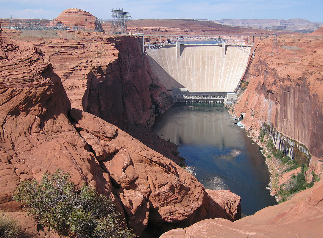
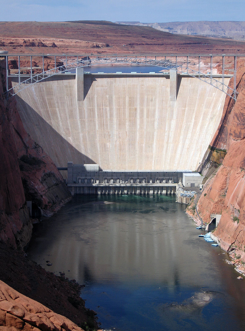
Glen Canyon Dam (1964)
|
| Coordinates: | 36° 56' 8" N 111° 29' 0" W |
Technical Information
Dimensions
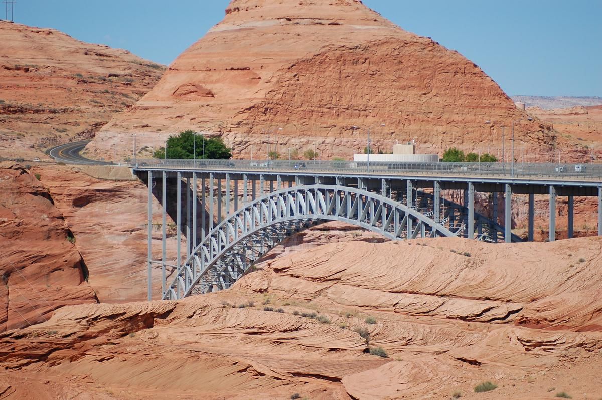
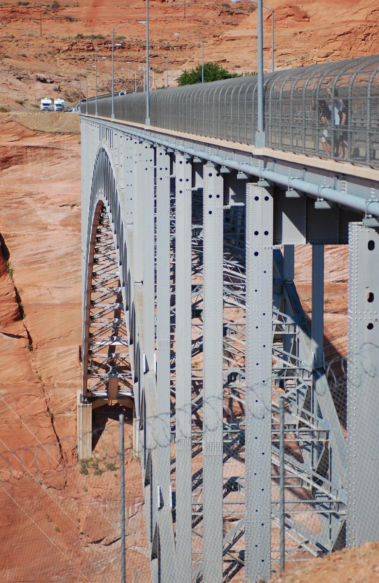
| main span | 313.3 m | |
| width | 9 m | |
| rise | 50.3 m | |
| total length | 387.4 m | |
| height above valley floor or water | 213 m |
Materials
| arch |
steel
|
|---|---|
| piers on arch |
steel
|
Excerpt from Wikipedia
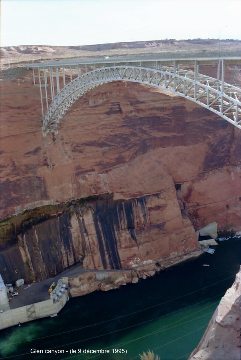
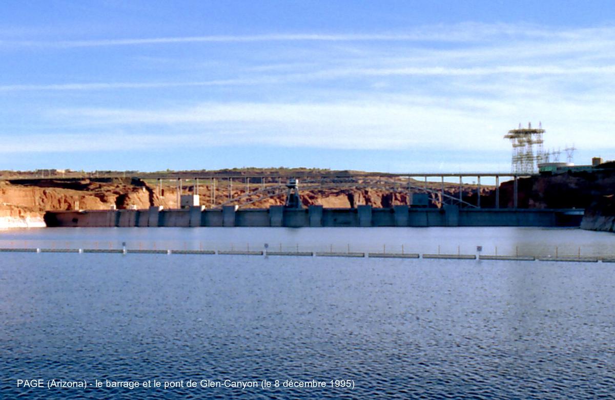
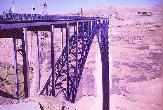
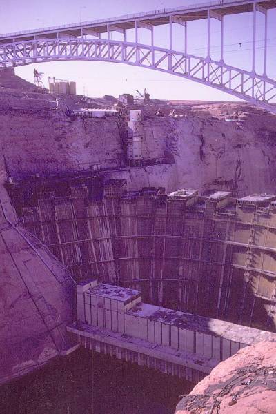
The Glen Canyon Bridge or Glen Canyon Dam Bridge is a steel arch bridge in Coconino County, Arizona, carrying U.S. Route 89 across the Colorado River. The bridge was originally built by the United States Bureau of Reclamation to facilitate transportation of materials for the Glen Canyon Dam, which lies adjacent to the bridge just 865 feet (264 m) upstream. The two-lane bridge has an overall length of 1,271 feet (387 m) with a deck 700 feet (210 m) above the river, making it the one of the highest bridges in the United States. The bridge was the highest arch bridge in the world when completed in 1959.
Text imported from Wikipedia article "Glen Canyon Dam Bridge" and modified on May 5, 2021 according to the CC-BY-SA 4.0 International license.
Participants

Relevant Web Sites

Relevant Publications
- (1984): Buiding bridges. History, Technology, Construction. Beton-Verlag, Düsseldorf (Germany).
- (1960): Colorado River Bridge at Glen Canyon Dam, Arizona U.S.A.. Presented at: Sixième Congrès de l'AIPC = Sixth Congress of IABSE = Sechster Kongress der IVBH, Stockholm, 27 juin-1er juillet 1960.
- About this
data sheet - Structure-ID
20000553 - Published on:
21/11/1999 - Last updated on:
29/04/2021
Structurae cooperates with


