
General Information
| Other name(s): | Pont gaulois de Sainte-Catherine |
|---|---|
| Beginning of works: | 3rd century |
| Completion: | 7th century |
| Status: | out of service |
Project Type
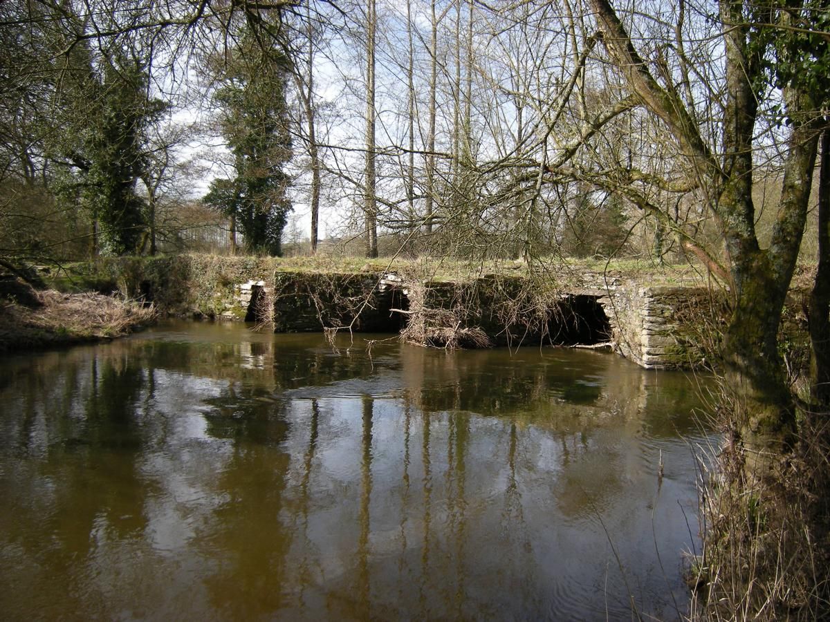
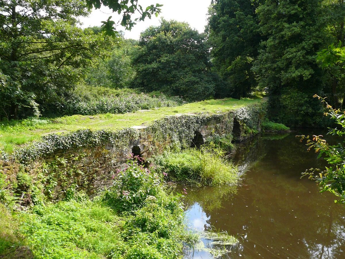
| Structure: |
Corbel arch bridge |
|---|---|
| Function / usage: |
Road bridge |
| Material: |
Masonry bridge Structurae Plus/Pro - Subscribe Now! |
Location
| Location: |
Treffrin, Côtes-d'Armor (22), Bretagne, France Plounévezel, Finistère (29), Bretagne, France |
|---|---|
| Crosses: |
|
| Coordinates: | 48° 17' 58.45" N 3° 33' 8.05" W |
Technical Information
Dimensions
| total length | ca. 60 m | |
| span lengths | 2.20 - 2.70 m |
Materials
| piers |
stone
|
|---|---|
| arches |
stone
|
Participants
Currently there is no information available about persons or companies having participated in this project.
Relevant Web Sites
There currently are no relevant websites listed.
Relevant Publications
- (2001): Les plus beaux ponts de France. Bonneton, Paris (France), pp. 20.
- (1984): Ponts de France. Presses Ponts et chaussées, Paris (France), pp. 284.
- (1988): Les ponts monuments historiques. Inventaire - description - histoire. Editions Brissaud, Poitiers (France), pp. 144-145.
- About this
data sheet - Structure-ID
20002161 - Published on:
20/10/2001 - Last updated on:
28/05/2021
Structurae cooperates with


