

General Information
Project Type
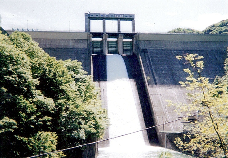
| Structure: |
Gravity dam |
|---|---|
| Function / usage: |
Flood-control dam Hydroelectric dam / plant |
| Material: |
Concrete dam |
Location
Technical Information
Dimensions
| height | 95.0 m | |
| retained water volume | 52 490 000 m³ | |
| crest length | 230.0 m | |
| dam volume | 415 000 m³ |
Excerpt from Wikipedia
Fujiwara Dam (藤原ダム) is a gravity dam on a Tone River tributary in Gunma Prefecture of Japan. It is located 14 km (9 mi) north of Minakami. It was constructed between 1951 and 1957. The dam itself supports a single Francis turbine hydroelectric generator with a 23 MW capacity which was commissioned in 1957. The reservoir created by the dam serves as the lower reservoir for the 1,200 Tamahara Pumped Storage Power Station which was commissioned in 1986. The dam is 95 m (312 ft) high and withholds a reservoir with a 52,490,000 m³ (42,554 acre⋅ft) storage capacity.
Text imported from Wikipedia article "Fujiwara Dam" and modified on July 23, 2019 according to the CC-BY-SA 4.0 International license.
Participants
Currently there is no information available about persons or companies having participated in this project.
Relevant Web Sites

- About this
data sheet - Structure-ID
20041427 - Published on:
18/12/2008 - Last updated on:
04/06/2023


