
General Information
Project Type
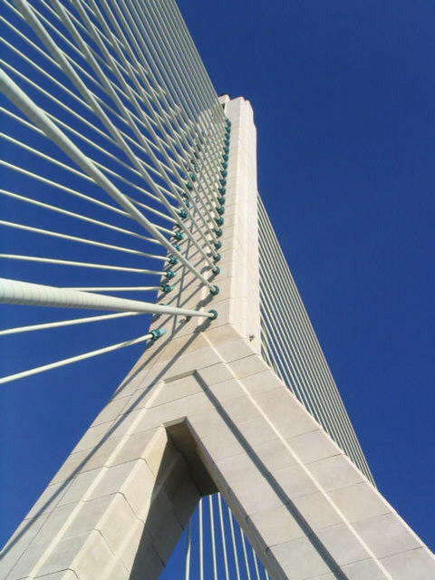
| Structure: |
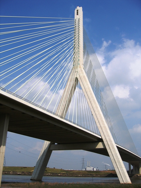
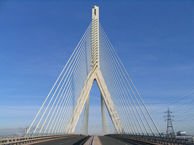
Cable-stayed bridge with fan system |
|---|---|
| Function / usage: |
Motorway bridge / freeway bridge |
| Material: |
Reinforced concrete bridge |
| Structure: |
Two-span cable-stayed bridge |
| Plan view: |
Structurae Plus/Pro - Subscribe Now! |
| Secondary structure(s): |
Structurae Plus/Pro - Subscribe Now! |
| Material: |
Structurae Plus/Pro - Subscribe Now! |
| Secondary structure(s): |
Structurae Plus/Pro - Subscribe Now! |
Location
| Location: |
Shotton, Flintshire, Wales, United Kingdom Connah's Quay, Flintshire, Wales, United Kingdom |
|---|---|
| Crosses: |
|
| Coordinates: | 53° 13' 45.85" N 3° 4' 1" W |
Technical Information
Dimensions
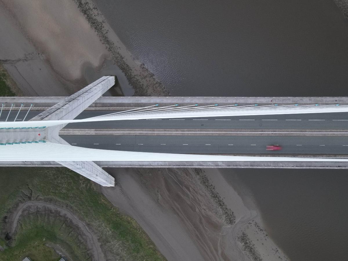
| total length | 954 m | |
| deck | width | 28 m |
| main bridge | ||
|---|---|---|
| total length | 294 m | |
| span lengths | 100 m - 194 m | |
| number of spans | 2 | |
| pylon | pylon height | 118 m |
Cost
| cost of construction | Pound sterling 55 000 000 |
Materials
| pylon |
reinforced concrete
|
|---|---|
| deck |
concrete
|
Excerpt from Wikipedia
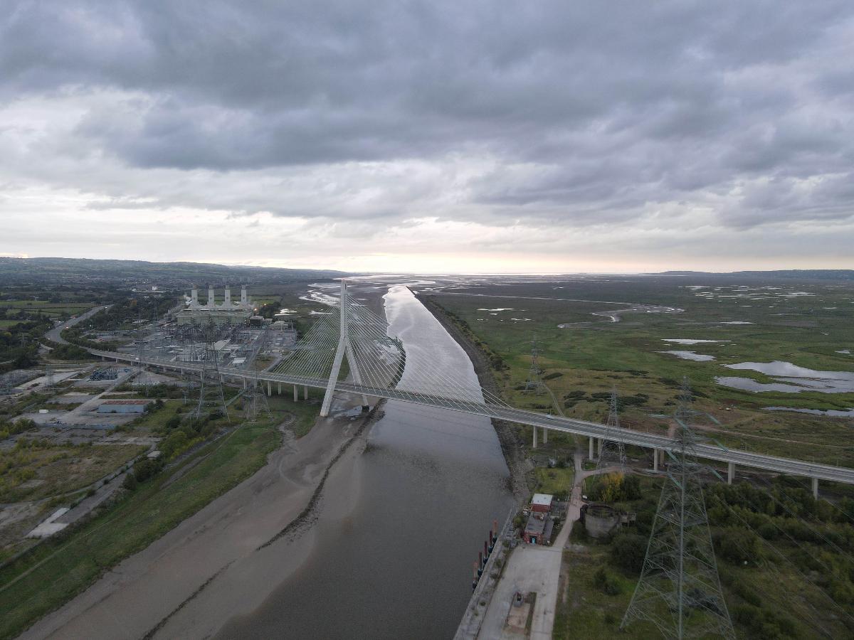
The Flintshire Bridge is a cable-stayed bridge spanning the Dee Estuary in North Wales. The bridge links Flint and Connah's Quay to the shore north of the River Dee at the southern end of the Wirral Peninsula. The bridge cost £55million to construct. This cost was met by the then Welsh Office and in the future, maintenance costs are expected to be the responsibility of the local authority Flintshire County Council.
The bridge was officially opened in 1998 by Queen Elizabeth II. It carries part of the A548 road and has been nicknamed 'the bridge to nowhere' as it doesn't link up with the A55 Expressway.
It is the largest asymmetric cable-stayed bridge in the whole of Britain.
Text imported from Wikipedia article "Flintshire Bridge" and modified on February 10, 2023 according to the CC-BY-SA 4.0 International license.
Participants
- Tony Gee and Partners LLP (foundations)

Relevant Web Sites

Relevant Publications
- (1999): The Dee Estuary Bridge — control of geometry during construction. In: Proceedings of the Institution of Civil Engineers - Civil Engineering, v. 132, n. 1 (February 1999), pp. 31-39.
- (1999): Design and Monitoring of the Flintshire Bridge, UK. In: Structural Engineering International, v. 9, n. 3 (August 1999), pp. 225-228.
- (2002): Foundation geology of the River Dee estuary cable-stayed bridge, Flintshire, North Wales. In: Engineering Geology, v. 63, n. 1-2 (January 2002), pp. 131-139.
- Freyssinet cable-stayed structures. Freyssinet International, Vélizy-Villacoublay (France), 2004, pp. 22.
- About this
data sheet - Structure-ID
20000580 - Published on:
28/12/1999 - Last updated on:
31/01/2023


