
General Information
Project Type
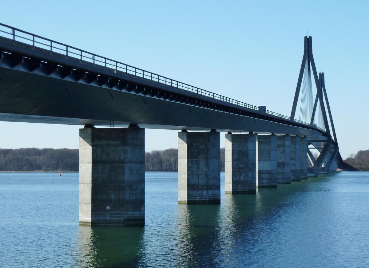
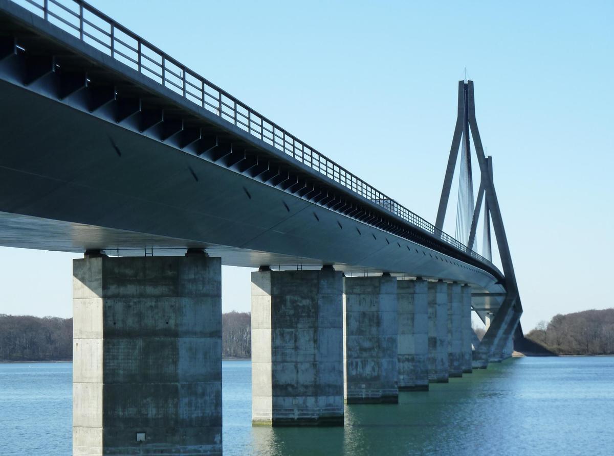
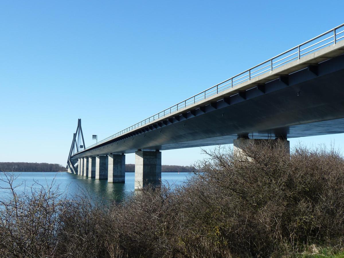
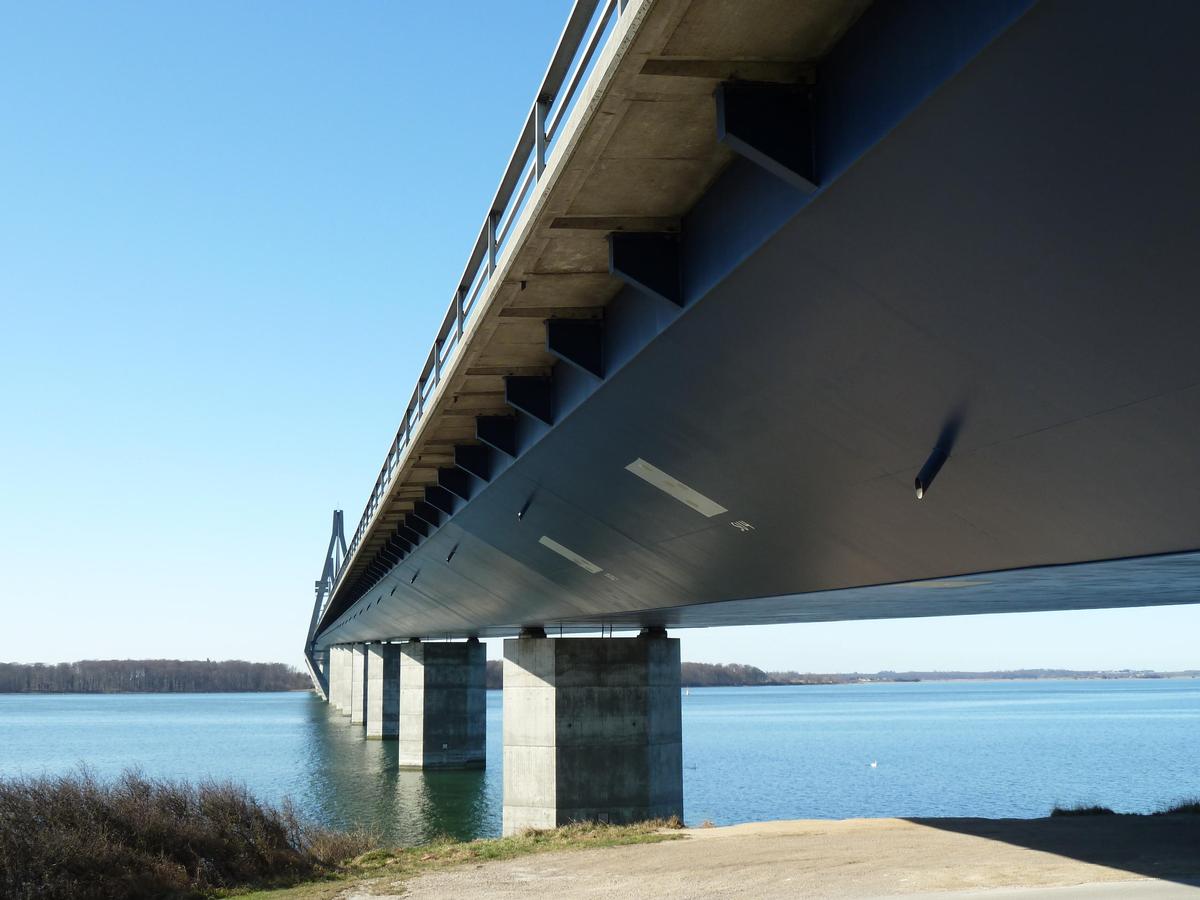
| Structure: |
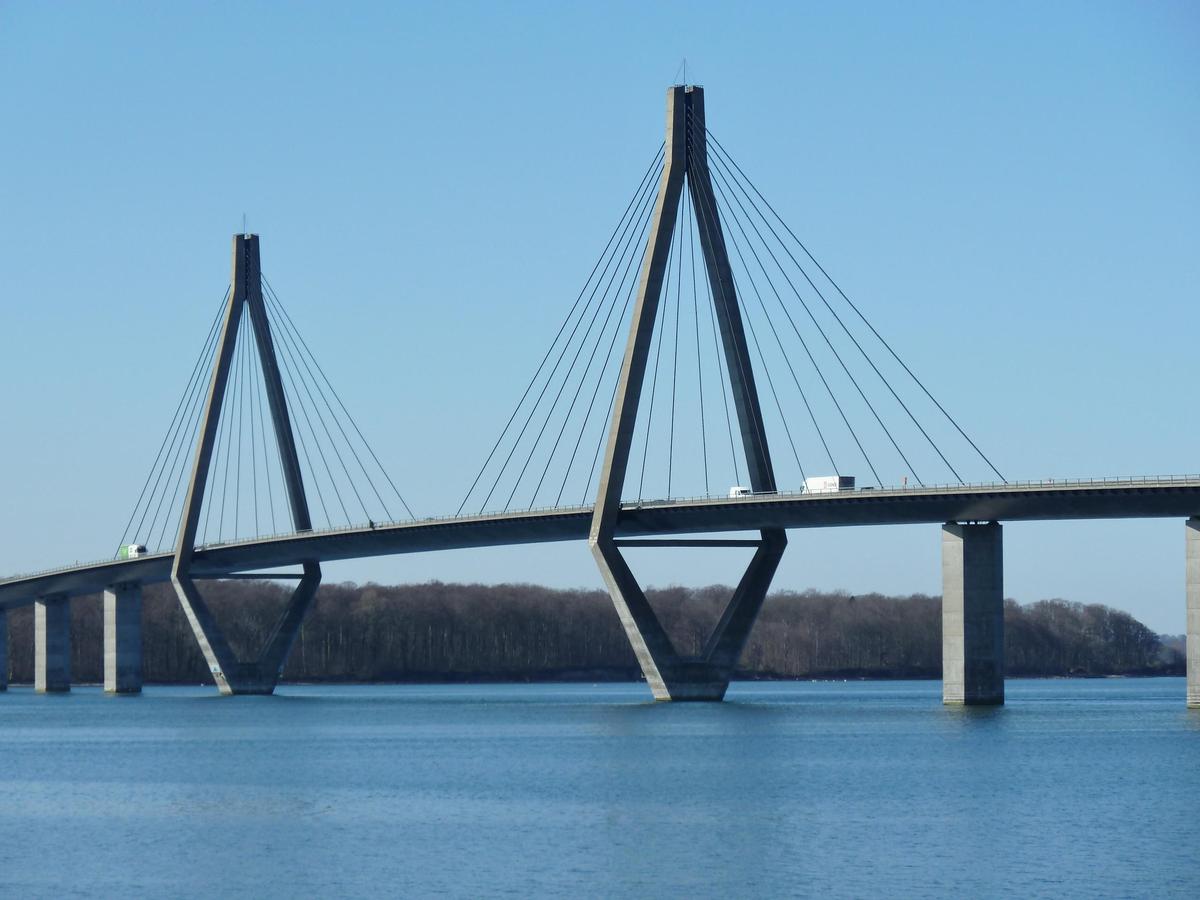
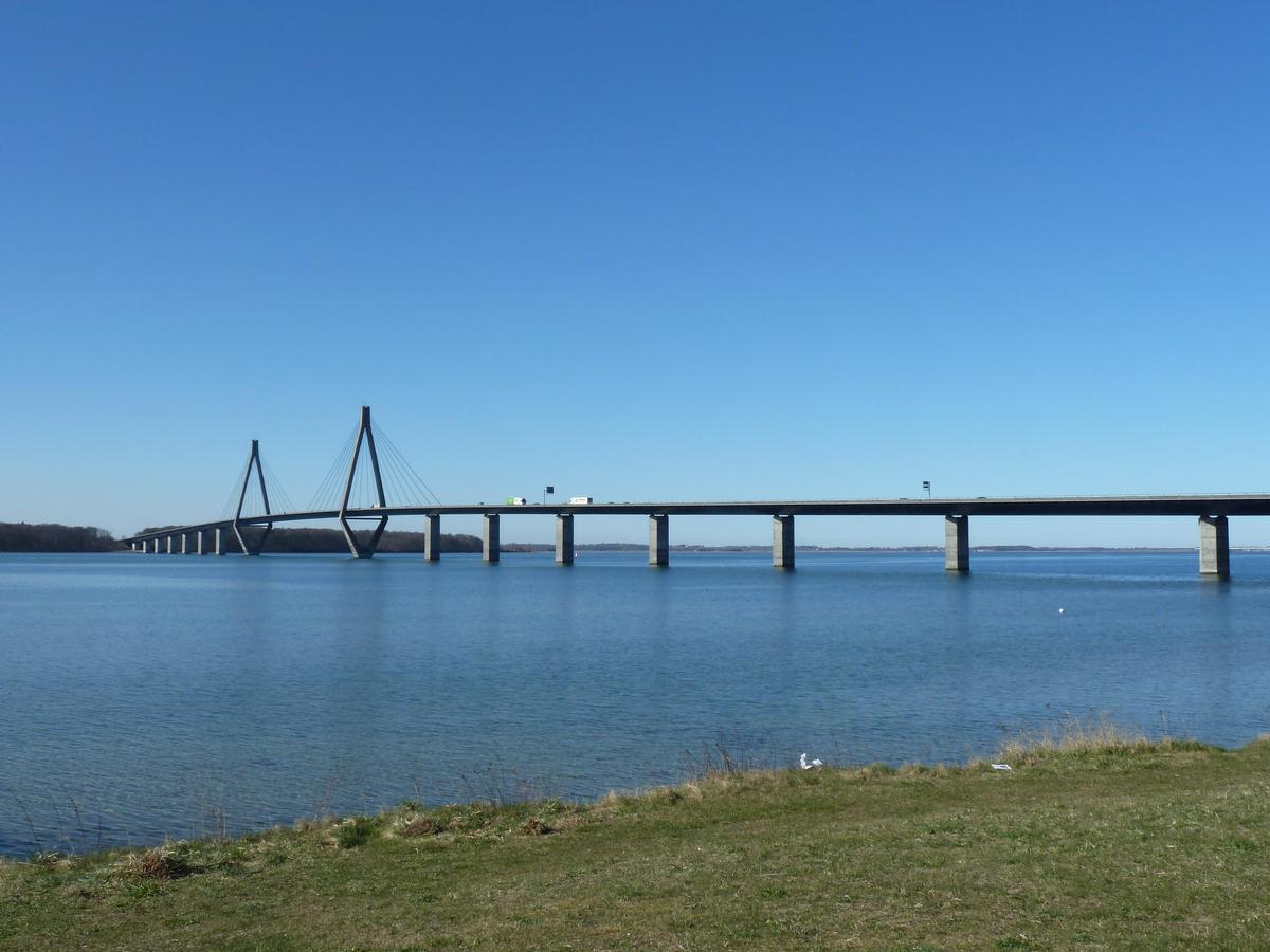
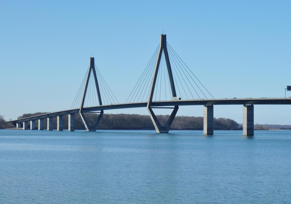
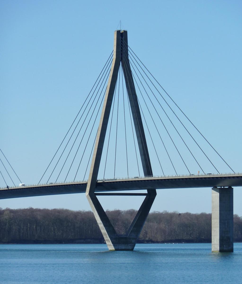
Three-span cable-stayed bridge |
|---|---|
| Function / usage: |
Motorway bridge / freeway bridge |
| Material: |
Structurae Plus/Pro - Subscribe Now! |
| Secondary structure(s): |
Structurae Plus/Pro - Subscribe Now! |
| Material: |
Structurae Plus/Pro - Subscribe Now! |
Location
| Location: |
Vordingborg, Zealand, Denmark |
|---|---|
| Crosses: |
|
| Near: |
Farö North Bridge (1985)
|
| Coordinates: | 54° 56' 37.31" N 11° 58' 29.65" E |
Technical Information
Dimensions
| main span | 290.00 m | |
| length of side spans | 2 x 80.00 m - 2 × 120.00 m | |
| deck | deck depth | 3.50 m |
| deck width | 22.40 m | |
| pylon | pylon height | 95.10 m |
Materials
| cables |
steel
|
|---|---|
| piers |
reinforced concrete
|
| pylons |
reinforced concrete
|
Chronology
| 1976 | Danish Parliament decides to build a motorway section between Ronnede and Sakskøbing passing east of the city of Vordingborg. The highway required two large bridges: the north bridge connecting the island of Zealand to the island of Farö and the south bridge linking Farö to the island of Falster. The north bridge was executed as a 1.5-km long continuous girder bridge and the south bridge as a 1.7-km-viaduct with a cable-stayed main span. |
|---|
Participants

Relevant Web Sites
There currently are no relevant websites listed.
Relevant Publications
- (2002): Bridges - Ponts - Brücken. Atrium, Mexico City (Mexico), pp. 132-135.
- (2007): Design for movements in bridges. Presented at: IABSE Symposium: Improving Infrastructure Worldwide, Weimar, Germany, 19-21 September 2007, pp. 24-27.
- (1999): The Faroe cable-stayed bridge - Maintenance experience with major components. Presented at: IABSE Conference: Cable-Stayed Bridges - Past, Present and Future, Malmö, Sweden, 2-4 June 1999, pp. 688-697.
- Die Farø-Brücken der Südautobahn in Dänemark. In: Schweizer Ingenieur und Architekt, v. 102, n. 20 (10 May 1984).
- (1983): Les fondations du pont de Farö au Danemark. In: Travaux, n. 582 (November 1983), pp. 33-36.
- About this
data sheet - Structure-ID
20000646 - Published on:
01/04/2000 - Last updated on:
21/04/2016
Structurae cooperates with


