


General Information
| Other name(s): | South Fork Malheur River Bridge |
|---|---|
| Completion: | 1964 |
| Status: | demolished (1996) |
Project Type
| Structure: |
Kingpost truss bridge |
|---|---|
| Function / usage: |
Road bridge |
| Material: |
Timber bridge Structurae Plus/Pro - Subscribe Now! |
Location
| Location: |
Harney County, Oregon, USA |
|---|---|
| Address: | Crane-Venator Road |
| Crosses: |
|
| Coordinates: | 43° 24' 29.34" N 118° 16' 59.48" W |
Technical Information
Dimensions
| main span | 11.88 m | |
| total length | 19.50 m | |
| deck width | 6.62 m |
Materials
| deck |
wood
|
|---|---|
| piers |
concrete
|
| diagonals (truss) |
wood
|
| verticals (truss) |
steel
|
Significance
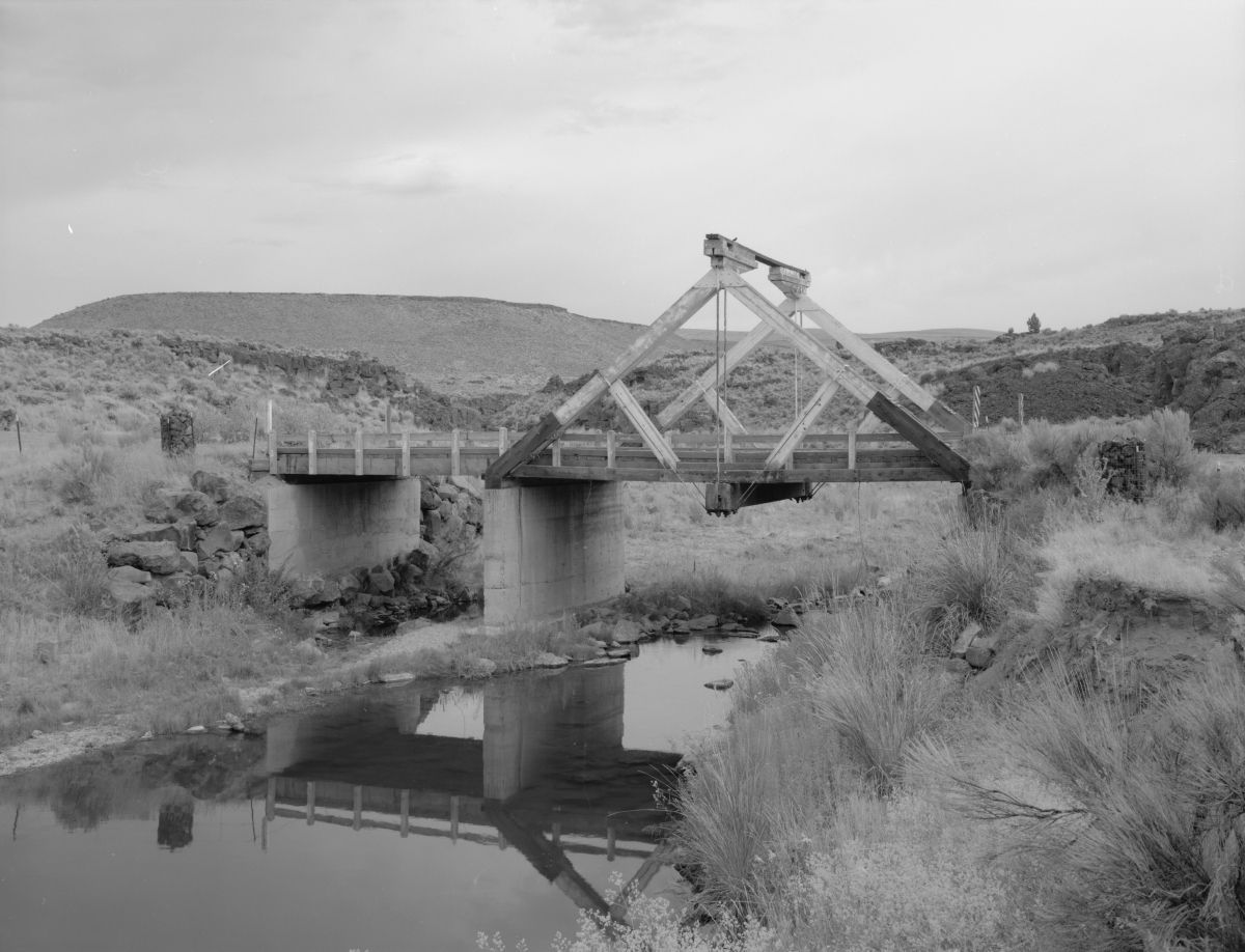
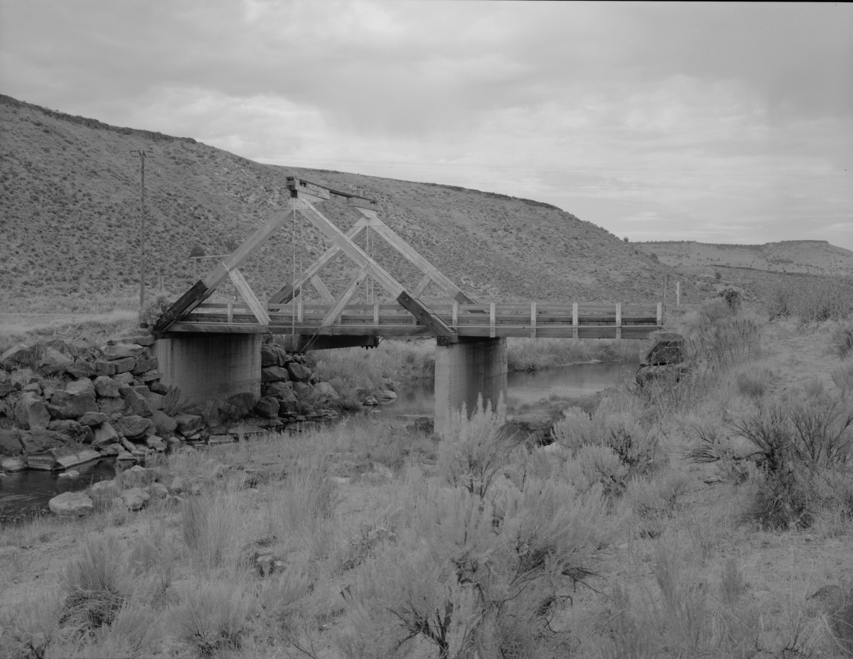
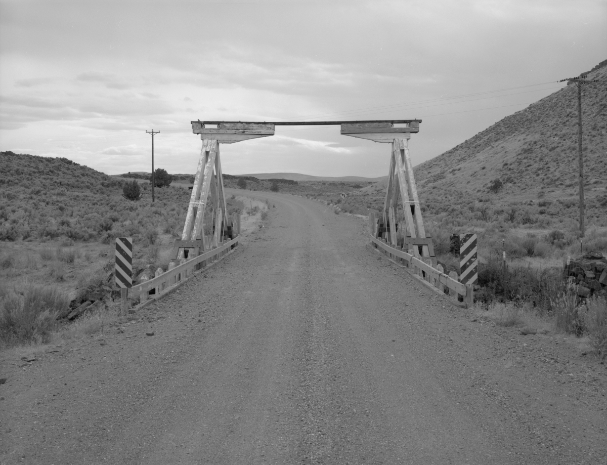
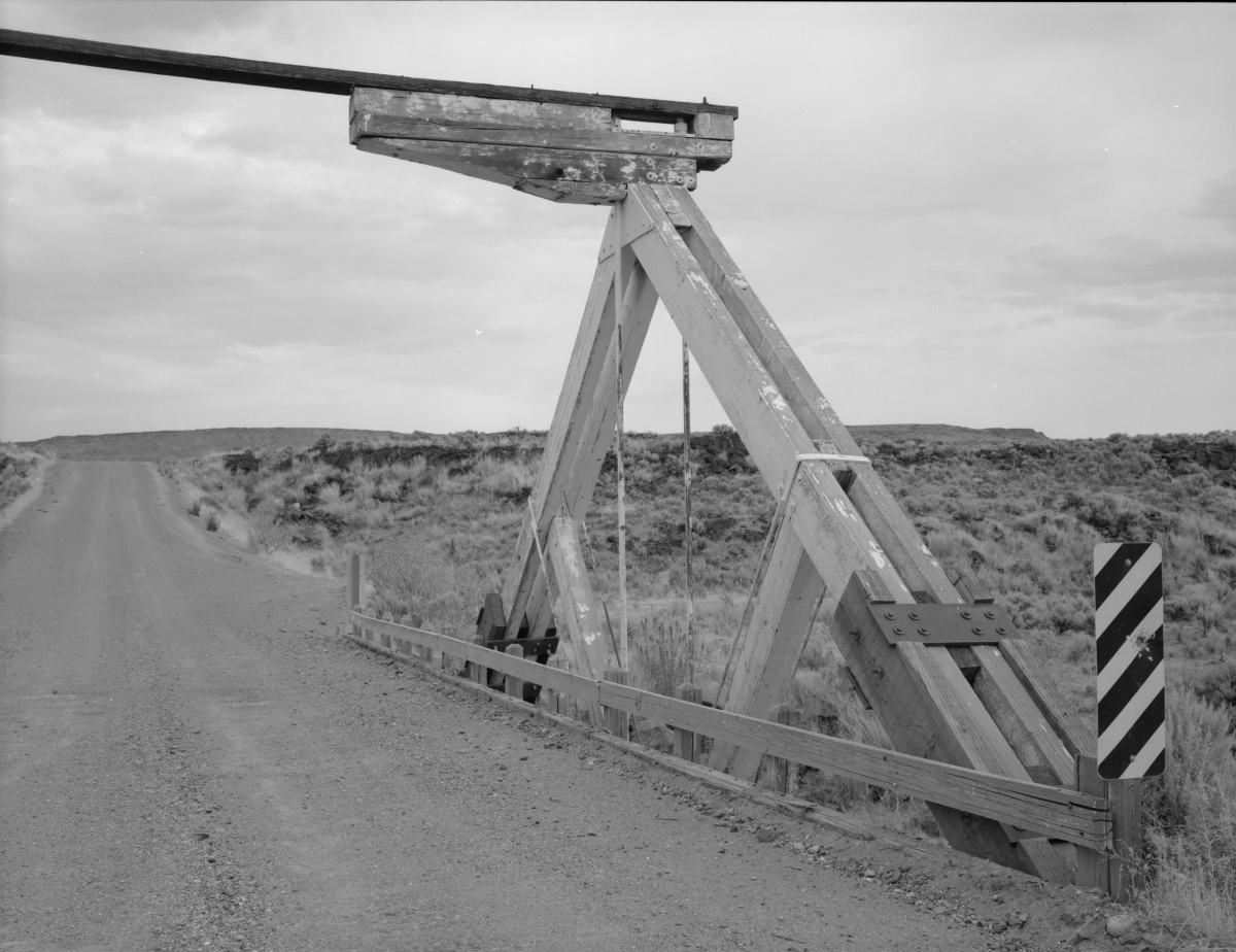
The bridge is a very rare example of timber king post truss bridges in Oregon. In the context of Eastern Oregon, it is the only example of its type. Simple designed, the resource demonstrates the primary elements of a truss bridge. The heavy timber frame is reinforced with knee braces and with riveted metal gussets on both the interior and exterior of the king posts. The floor beam is supported by steel tension rods, and the structure rests on concrete piers.
Historic American Engineering Record (HAER OR-88)
Description
Constructed in 1964, the bridge has an overall length of 64' (19.50m). The length of the main truss span is 39' (11.88) and bridge deck width is 21'9" (6.62m). The structure is located in an isolated agricultural area and is utilized about 40 times per day.
Participants
Currently there is no information available about persons or companies having participated in this project.
Relevant Web Sites

- About this
data sheet - Structure-ID
20005480 - Published on:
24/09/2002 - Last updated on:
20/05/2020


