
General Information
Project Type
| Function / usage: |
Hydroelectric dam / plant |
|---|
Location
| Location: |
Bridgeport, Douglas County, Washington, USA |
|---|---|
| Impounds: |
|
| Coordinates: | 47° 59' 43.08" N 119° 37' 58.80" W |
Technical Information
Dimensions
| length | 1 817.2 m |
Excerpt from Wikipedia
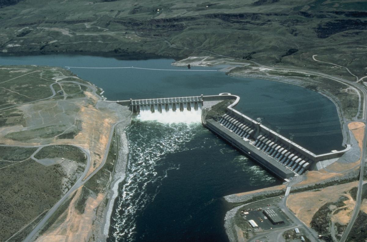
The Chief Joseph Dam is a concrete gravity dam on the Columbia River, 2.4 km (1.5 mi) upriver from Bridgeport, Washington. The dam is 877 km (545 mi) upriver from the mouth of the Columbia at Astoria, Oregon. It is operated by the USACE Chief Joseph Dam Project Office, and the electricity is marketed by the Bonneville Power Administration.
History
The dam was authorized as Foster Creek Dam and Powerhouse for power generation and irrigation by the River and Harbor Act of 1946. The River and Harbor Act of 1948 renamed the project Chief Joseph Dam in honor of the Nez Perce chief who spent his last years in exile on the Colville Indian Reservation. Because of ist lack of fish ladders, Chief Joseph Dam completely blocks salmon migration to the upper Columbia River system.
Construction began in 1950, with the main dam and intake structure completed in 1955. Installation of the initial generating units was completed in 1958. Ten additional turbines were installed between 1973 and 1979, and the dam and lake were raised 3 m (10 ft), boosting the capacity to 2,620 MW, making Chief Joseph Dam the third largest hydroelectric power producer in the United States.
Type
Chief Joseph Dam is a run-of-the-river dam which means the lake behind the dam is not able to store large amounts of water. Water flowing to Chief Joseph Dam from Grand Coulee Dam must be passed on to Wells Dam at approximately the same rate. With 27 main generators in the powerhouse, it has the hydraulic capacity of 6,030 m³/s (213,000 cu ft/s).
In the event more water flows to Chief Joseph Dam than could be used for power generation, the spillway gates would be opened to pass the excess water. With an average annual flow rate of 3,058 m³/s (107,992 cu ft/s), the Columbia River seldom exceeds the powerplant's capability to pass water, and spilling of water is infrequent at Chief Joseph Dam.
Reservoir
The reservoir behind the dam is named Rufus Woods Lake, and runs 82 km (51 mi) up the river channel. Bridgeport State Park, on the lake, is adjacent to the dam.
Text imported from Wikipedia article "Chief Joseph Dam" and modified on July 23, 2019 according to the CC-BY-SA 4.0 International license.
Participants
Currently there is no information available about persons or companies having participated in this project.
Relevant Web Sites

- About this
data sheet - Structure-ID
20031751 - Published on:
16/09/2007 - Last updated on:
27/09/2022


