
General Information
| Completion: | 1944 |
|---|---|
| Status: | in use |
Project Type
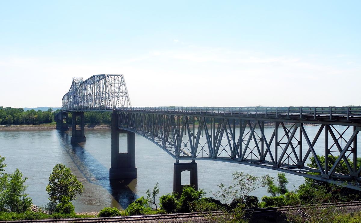
| Structure: |
Through truss bridge |
|---|---|
| Function / usage: |
Road bridge |
Location
| Location: |
Chester, Randolph County, Illinois, USA Claryville, Missouri, USA |
|---|---|
| Crosses: |
|
| Coordinates: | 37° 54' 8" N 89° 50' 14" W |
Technical Information
Dimensions
| main span | 204.16 m | |
| total length | 861.49 m | |
| deck | deck width | 6.71 m |
| number of lanes | 2 |
Chronology
| 23 August 1942 | Opened as a toll bridge. |
|---|---|
| 29 July 1944 | The main span is destroyed in a severe thunderstorm. |
| 24 August 1946 | The bridge is reopened. |
| 1 January 1989 | Tolls are removed. |
Excerpt from Wikipedia
The Chester Bridge is a continuous truss bridge connecting Missouri's Route 51 with Illinois Route 150 across the Mississippi River between Perryville, Missouri and Chester, Illinois. It is one of two motor-traffic bridges spanning the Mississippi River between St. Louis and Cape Girardeau, Missouri.
History
Located at river mile marker 109.5, the Chester Bridge is a two-lane traffic truss bridge which was constructed by Sverdrup and Parcel and Associates, Inc. of St. Louis, Missouri. Construction began in 1941 and was finished in 1942 at a cost of $1,385,000 (1942 dollars). The bridge opened on August 23, 1942 and operated as a toll bridge until January 1, 1989. The main span was destroyed by a severe tornadic force thunderstorm on July 29, 1944, and reconstructed 2 years later. The bridge serves about 6,400 vehicles per day.
Chester Welcome Center
The Chester Welcome Center is located in Segar Park next to the Chester Bridge and overlooks the Mississippi River. The park was dedicated to E. C. Segar who was born on December 8, 1894, in Chester, Illinois. Segar is most noted for his cartoon comic "Popeye” which he created in 1929 from his recollections of a local scrapper on the Mississippi River. A six-foot “life-size” bronze statue of Popeye stands near the bridge.
Text imported from Wikipedia article "Chester Bridge" and modified on July 23, 2019 according to the CC-BY-SA 4.0 International license.
Participants
Currently there is no information available about persons or companies having participated in this project.
Relevant Web Sites

- About this
data sheet - Structure-ID
20016440 - Published on:
25/05/2005 - Last updated on:
05/02/2016


