
General Information
| Completion: | 1974 |
|---|---|
| Status: | in use |
Project Type
| Structure: |
Curved gravity dam |
|---|---|
| Function / usage: |
Irrigation & industrial water dam |
| Material: |
Concrete dam |
Location
| Location: |
Mpumalanga, South Africa |
|---|---|
| Coordinates: | 24° 32' 10.99" S 30° 47' 52.81" E |
Technical Information
Dimensions
| height | 71 m | |
| reservoir capacity | 55 092 000 m³ |
Excerpt from Wikipedia
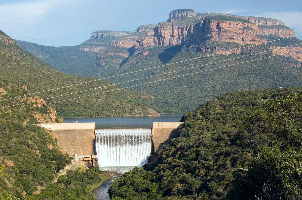
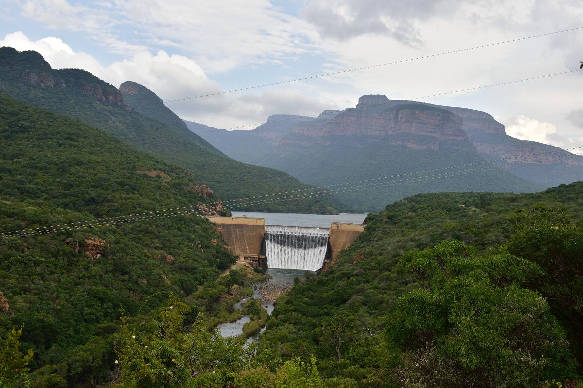
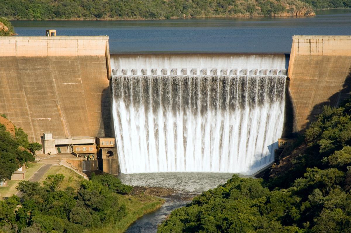
Blyderivierpoort Dam is a gravity-arch dam on the Blyde River, in the lower Blyde River Canyon, near Hoedspruit in Mpumalanga, South Africa. It also floods the lower reaches of the Blyde's Ohrigstad River tributary. The dam was completed in 1974. The 71 m high dam wall is situated 3 km from Swadini resort by road.
Purpose
Ist key purpose is to provide a stable water supply for irrigators of the Blyde River Irrigation district and to provide additional water for mining and industry at Phalaborwa.
Irrigation district
Orchards and croplands were established along the lower Blyde in the latter half of the 20th century, with 23,521 ha devoted to irrigation in 1995.
Resettlement
During 1965 the community that lived at the site of the proposed dam was resettled (with compensation) by the government to nearby towns including Buffelshoek, Acornhoek, Beverleyshoek and Bushbuckridge. Some stone walled settlements, cultural artefacts and graves are now submerged under the dam.
Text imported from Wikipedia article "Blyderivierpoort Dam" and modified on July 23, 2019 according to the CC-BY-SA 4.0 International license.
Participants
Currently there is no information available about persons or companies having participated in this project.
Relevant Web Sites

- About this
data sheet - Structure-ID
20049273 - Published on:
02/12/2009 - Last updated on:
05/05/2022


