0
  • DE
  • EN
  • FR
  • International Database and Gallery of Structures

Advertisement

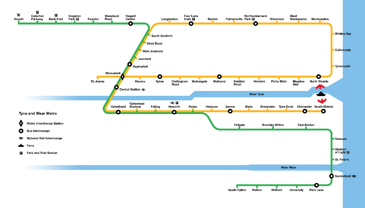
Transitatipn map of the Tyne and Wear Metro, a light rail network serving Newcastle upon Tyne and Sunderland

Based on the official Metro map -

Media-ID: 431059
Created in/on: 12 June 2020
Author:

Commuto / Wikimedia Commons

Copyright notice / License:

This creative work has been published under the Creative Commons Attribution-ShareAlike 4.0 International (CC-BY-SA 4.0) license which allows copying, and redistribution as well as adaptation of the original work provided appropriate credit is given and the same license is used as for the original work (the above link must be included). Any alterations to the original must also be mentioned.

Published on:
Last updated on: 08/01/2024

More media of this structure

United Kingdom (1980)

Other similar media files