
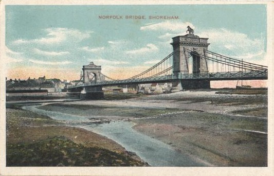
General Information
| Completion: | 1833 |
|---|---|
| Status: | demolished |
Project Type
| Structure: |
Chain suspension bridge |
|---|---|
| Function / usage: |
Road bridge |
| Material: |
Structurae Plus/Pro - Subscribe Now! |
Location
| Location: |
Shoreham-by-Sea, West Sussex, South East England, England, United Kingdom |
|---|---|
| Crossed: |
|
| Coordinates: | 50° 49' 55.28" N 0° 16' 46.86" W |
Technical Information
There currently is no technical data available.
Participants
Construction
- William Tierney Clark (builder)
Relevant Web Sites
There currently are no relevant websites listed.
- About this
data sheet - Structure-ID
20008012 - Published on:
08/02/2003 - Last updated on:
24/06/2022
Structurae cooperates with


