
General Information
| Completion: | 14 May 1939 |
|---|---|
| Status: | in use |
Project Type
| Structure: |
Roller drum gate barrage Tainter gate barrage |
|---|---|
| Function / usage: |
Lock |
Location
| Location: |
New Boston, Mercer County, Illinois, USA Louisa County, Iowa, USA |
|---|---|
| Impounds: |
|
| Coordinates: | 41° 11' 26.88" N 91° 3' 36.53" W |
Technical Information
Dimensions
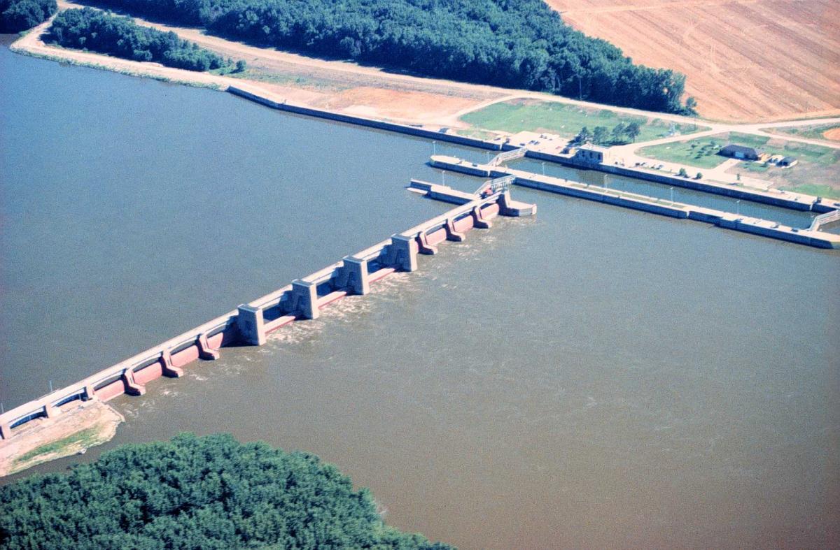
| length of movable section | 341.7 m | |
| lock | width | 33.5 m |
| length | 182.9 m |
Excerpt from Wikipedia
Lock and Dam No. 17 is a lock and dam located near New Boston, Illinois on the Upper Mississippi River near river mile 437. Its main lock is 110 feet (33.5 m) wide and 600 feet (182.9 m) long with its bottom at an elevation of 518 feet (157.9 m). Normal pool elevation behind the dam is 536 feet (163.4 m). The movable portion of the dam is 1,121 feet (341.7 m) long and consists of 3 roller gates and 8 tainter gates. In 2004, the facility was listed in the National Register of Historic Places as Lock and Dam No. 17 Historic District, #04000177 covering 869 acres (3.5 km²), 1 building, 3 structures and 2 objects.
Text imported from Wikipedia article "Lock and Dam No. 17" and modified on 23 July 2019 under the CC-BY-SA 3.0 license.
Participants
Currently there is no information available about persons or companies having participated in this project.
Relevant Web Sites

- About this
data sheet - Structure-ID
20030594 - Published on:
24/08/2007 - Last updated on:
29/01/2022
Structurae cooperates with


